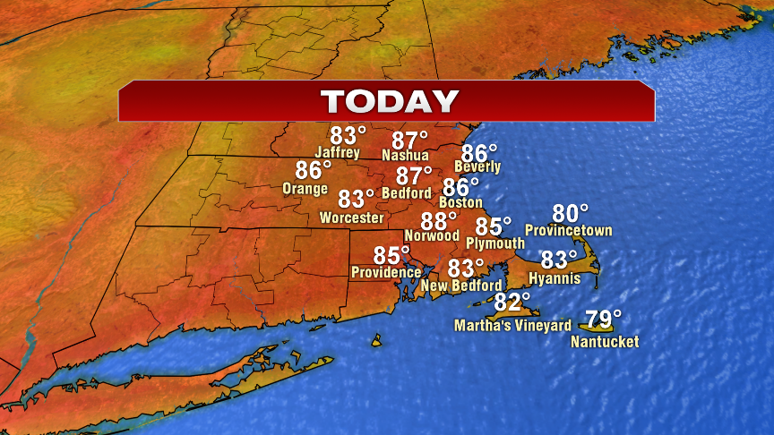
As a warm summer weekend wrapped up, the humidity started to drop off. This morning, we start off with that lower humidity and will enjoy a nice day with a lot of sunshine and warm temperatures. Highs top off in the mid to upper 80s, allowing for a top notch summer weather day.
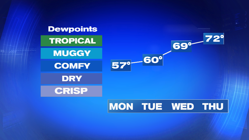
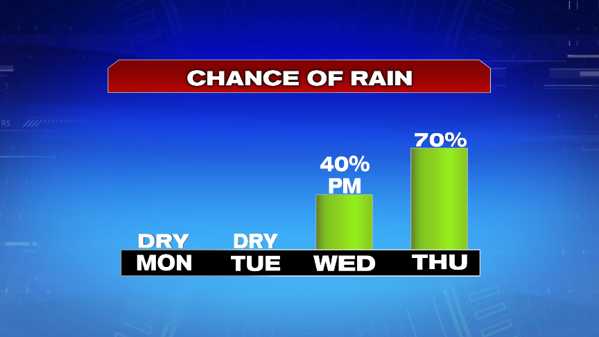
The heat and humidity will build this over the next few days, as temps crack 90 by Wednesday. By Wednesday afternoon, we’ll also track the potential of scattered storms to develop and as a cold front cross Wednesday night/early Thursday, scattered showers and storms will be prevalent. Embedded with the showers and storms will be localized downpours thanks to some tropical moisture that’s kicked in thanks to the remnants of Barry.
Clouds and showers part ways early Friday morning, then it’s all about the heat Friday afternoon, right through the weekend. Highs topple 90 degrees for many, and likely peak in the mid to upper 90s Saturday!