

Heat continued to build yesterday as temps soared into the low 90s for many spots away from the coastline. At the coast, a bit of a sea breeze held numbers down a touch, but offered a great beach day overall with clouds parting ways for some sun. The humidity was sky high too.
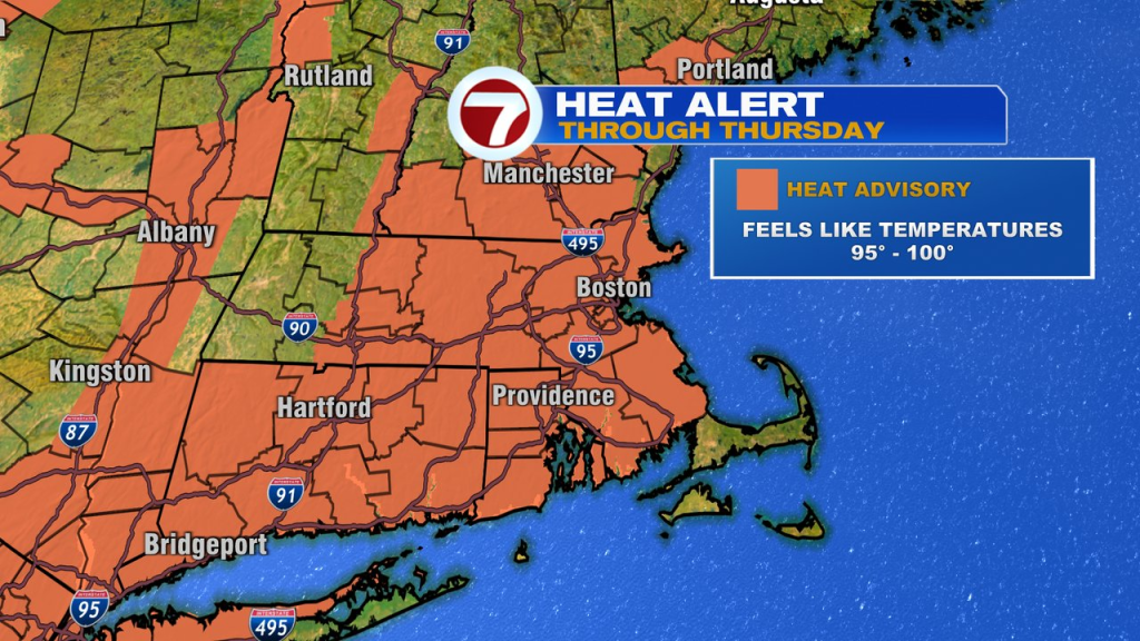
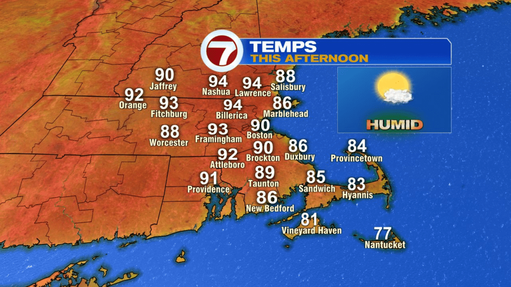
Today, we’ll do it all over again, and even add a couple degrees. As the heat peaks today with highs in the low to mid 90s, the dew points run in the 70s. That’ll push the heat index up to near 100. The risk of pop-up showers and storms looks low, so if pool side or to the beach you go, the forecast looks good for that. If you have to work outside, staying hydrated is key on a day like today.
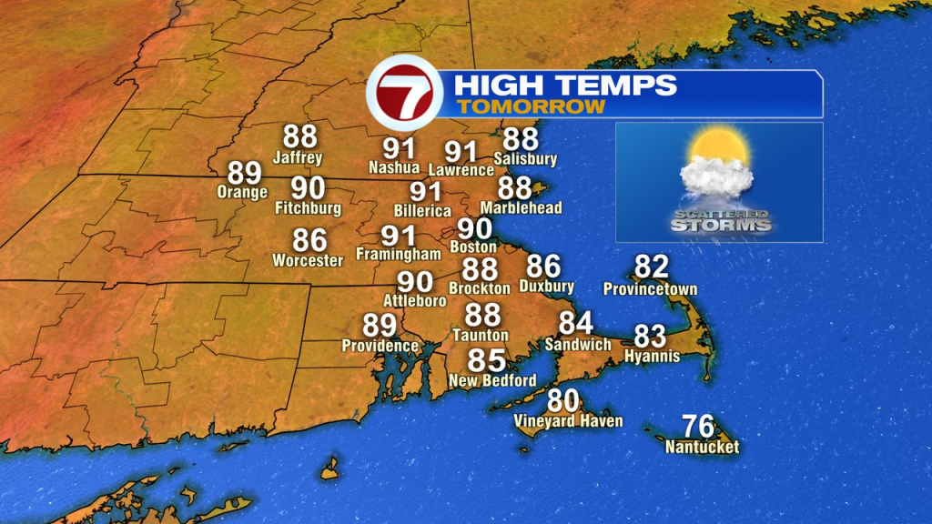
It’ll be hot and humid again tomorrow with more clouds in the mix and a few scattered storms to track. Highs still near 90.
Looking for relief? We’ll find it Friday. High humidity gets flushed out with a cold front slipping through in the morning. While dews start near 70 predawn, the numbers fall into the 50s by midday. The lowering humidity, combined with temps back into the low to mid 80s, will make for a very pleasant afternoon. The evening looks great for those fire pits too.
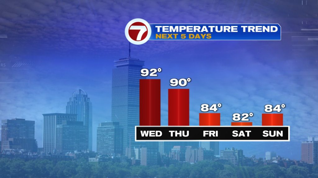
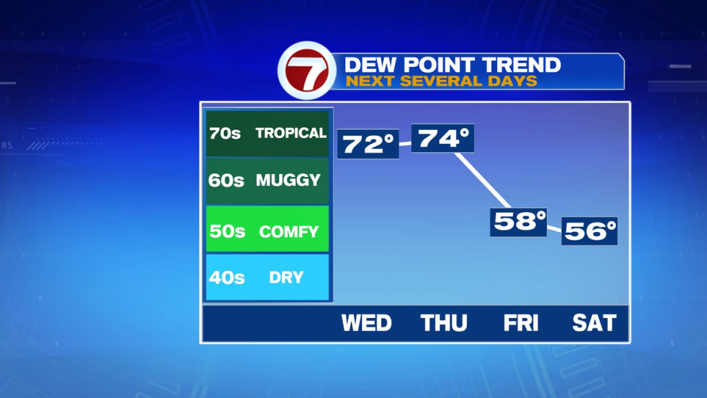
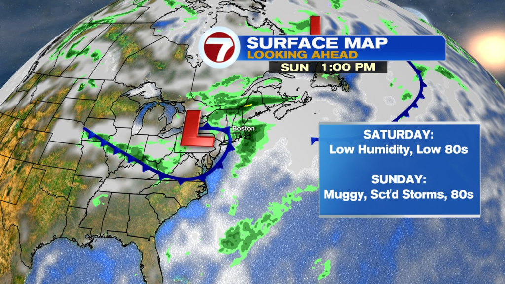
Saturday, we pick up where we left off. That means low humidity and temps in the low 80s.
Sunday brings back some mugginess and the chance for scattered storms.
Monday and Tuesday, we’re back to comfy air.