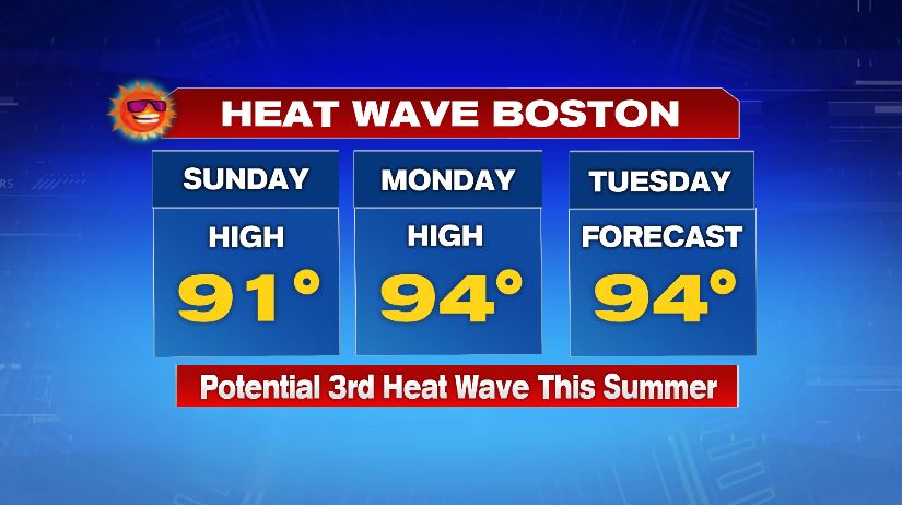
Another hot day is on the way for today! For Boston it will mark our third official heatwave of 2020.
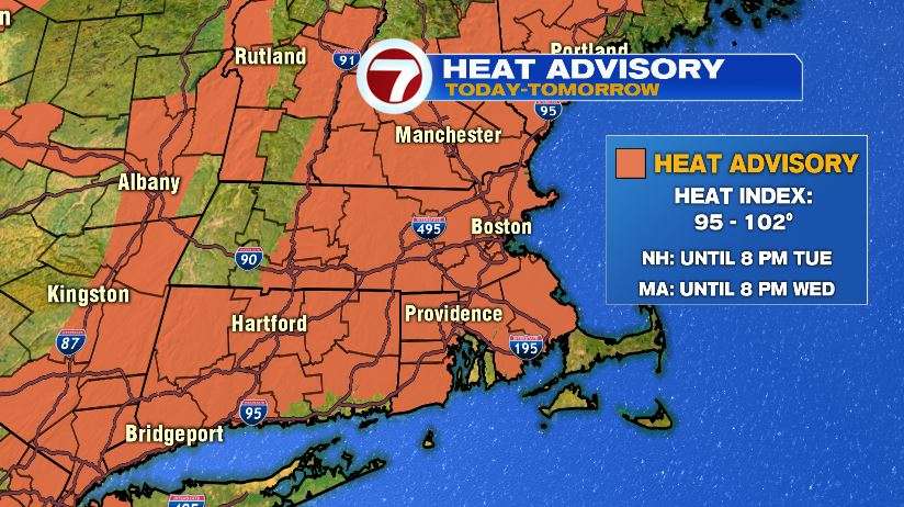
A heat advisory is again in effect for the entire area. It has been expanded and extended from yesterday and now includes southern New Hampshire. The entire area is line to see feels like temperatures push, if not exceed, the 100° mark this afternoon. It has also been extended for Massachusetts to include the day on Wednesday with temperatures back in the 90s and an increase in the humidity.
Air temperatures today will hit the low to mid 90s with feels like temperatures near 100° as we said. Try your best to stay cool, whether that’s in the A/C or pool side somewhere. Just keep the sunscreen handy. UV index climbs to a 9, so sunburn can occur in just 20 minutes. If you are outside just remember to be safe. Slow down, drink water, and leave the kids and pets at home if you’re running errands.

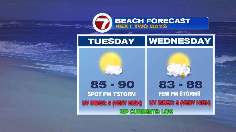
Much like yesterday, a spot storm is possible but most will stay dry. Yesterday that 10% chance popped up in Worcester county. Today that same 10% chance still exists so just watch for a quick darkening sky if you’re out near some water. It would be nice to see some extra rain as our drought continues across New England.

If you are heading to the beach, the weather looks great, just watch for that spot storm chance.
Yesterday’s high in Boston pushed our 90 degree tally to 12 with 13 on the way for today. Many inland areas are well beyond that number. With the 90° readings yesterday, some inland spots have hit 20 days of 90°. We’ll tack one on today, another one Wednesday, and perhaps even some inland spots on Thursday. Boston will not hit 90 on Thursday with a sea breeze cooling the coast.

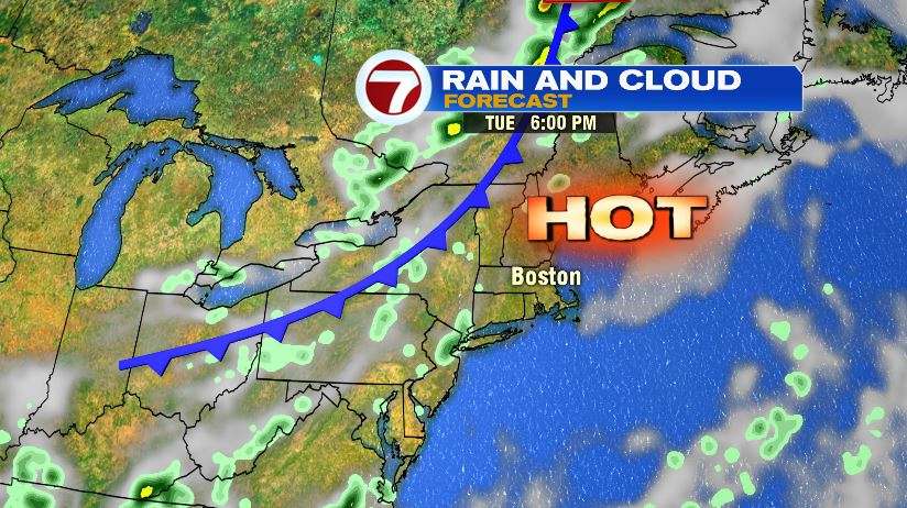
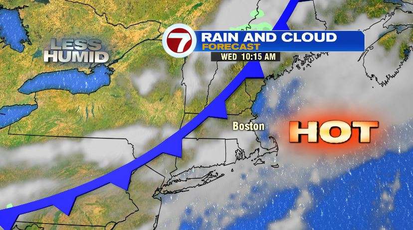
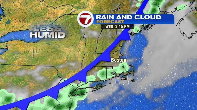
There is relief on the horizon but it will take some time to get here. There’s a very slow moving cold front bringing cooler and drier air for the end of the week and the weekend. We’re hot today and we’ll get a quick shot of the heat tomorrow morning and early afternoon before the cold front arrives. As it does, it will spark a few scattered storms Wednesday afternoon/evening. It won’t give everybody showers and storms but more of us will see that much needed rain. Unfortunately, this looks to be our best chance in the 7 day forecast. Once that front passes, the humidity will drop for Thursday. A southeast wind will cool the coast on Thursday, but a few inland towns could actually hit 90 again on Thursday. The true relief comes Friday, Saturday, and Sunday.
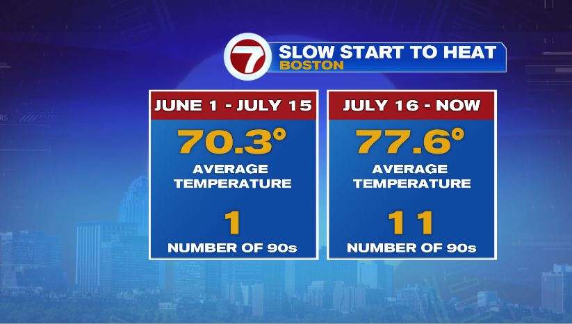
Does it seem like the past few weeks have been miserably hot? Well you’re not wrong. The first half of summer (June 1st – July 15th), the average temperature in Boston was about 70°. During that same period of time, Logan Airport saw just one day hit 90°. The second half of summer (which goes until the end of August) has averaged over seven degrees warmer and recorded 11 days hitting 90°! That does not include today or tomorrow. And there’s still 2 weeks to go!
And for the sake of an accurate title, here’s your song of the day… Love Potion #9.