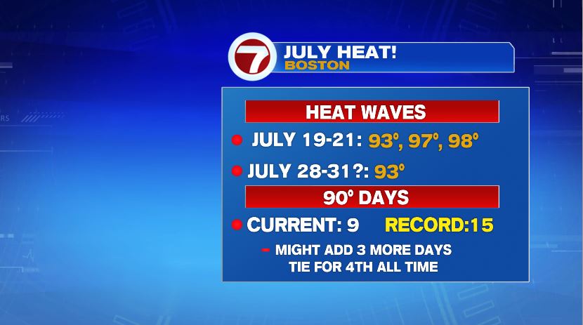
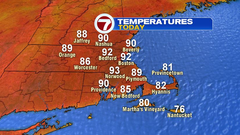
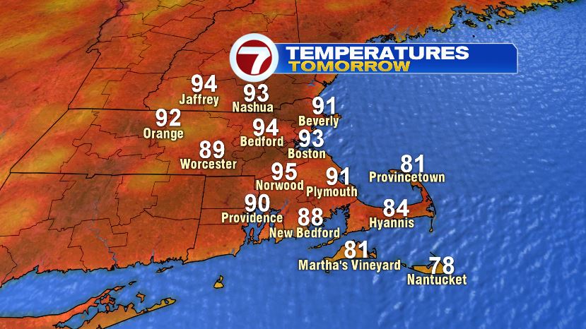
July has been a hot month, and with only a few days left, why change it now? In fact, to end the month, we’ll likely see our second heat wave of the year and also the month. Yesterday was our first day with Boston Logan hitting 93°. Today we’ll be there again, and Tuesday, and possibly even Wednesday before the heat breaks with evening storms.

With the heat and humidity the next few days, the heat index values will push the triple digits for a lot of us which prompted the National Weather Service to issue a heat advisory for both today and tomorrow. It does not include Worcester county, not that it will be a lot cooler there. Heat indexes will still likely hit the low 90s.
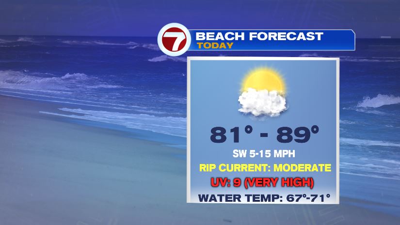
You won’t find much relief on the coast in terms of a “cooler coast” scenario. The heat pushes right out to the coast. It will be slightly cooler if you’re on the beach… like literally standing on the sand. There, temperatures will climb to the 80s with water temperatures in the upper 60s to low 70s. Winds will be a little strong today so watch out for an increased rip current risk, especially on the exposed beaches.