Wow, what a day yesterday as temps warmed into the 70s and lower 80s as low humidity held on strong as sunshine won out. Today, we’ll keep the sunshine and low humidity around, however, it’ll warm up a lot this afternoon.
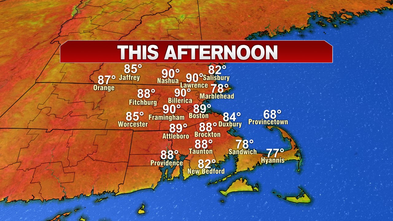
This morning’s weather is comfortable for any Memorial Day parades and services, and this afternoon will be a beauty for the pools and beaches. Highs reach the mid 80s to low 90s across much of the region, albeit cooler for the Cape and Cape Ann. The beach forecast looks good with temps in the 70s/80s there. Seas run around 3 feet with ocean temps in the low to mid 50s. Chilly water for sure!
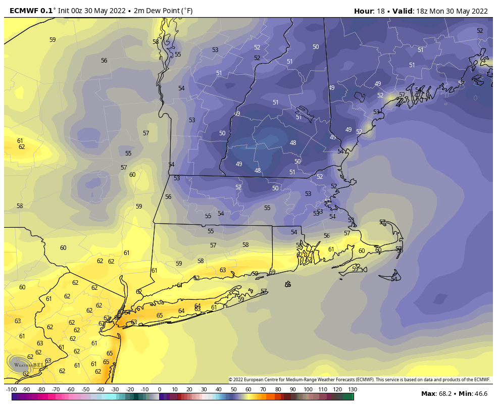
Dew points stay in the 50s today, so despite the temps heating up, the humidity stays in check.
The humidity does come up a bit this evening and tonight as mild and muggy air holds on. Temps tonight hover around 70, providing a much warmer overnight than what we experienced last night.
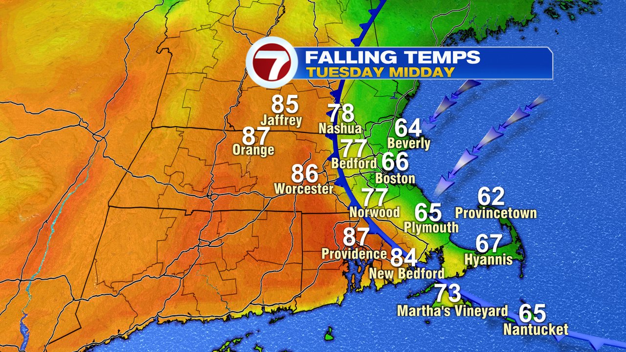
With such a warm start to the day Tuesday, temps quickly warm into the 80s by mid to late morning. Then comes the crash back. As a cold from slides in from our northeast, temps drop off dramatically from east to west. By noon, coastal temps are back into the 60s, while temps are mid to upper 80s still west of 495. By mid afternoon, even in Worcester County, it’ll be substantially cooler. The best chance for scattered showers/storm will be late afternoon or early in the evening.
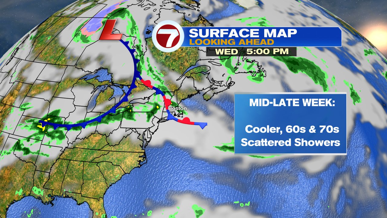
The pattern stays cooler mid to late week with scattered showers possible at times. Highs from Wednesday, through next weekend, will run in the 60s and 70s.