
7Weather – Another messy storm is here! Our second one this week. This one gave us more of a break around the evening commute as drier air moved in with it. Any snow showers that initially developed will transition to rain. Heavy rain and wind tonight with the potential for flooding.
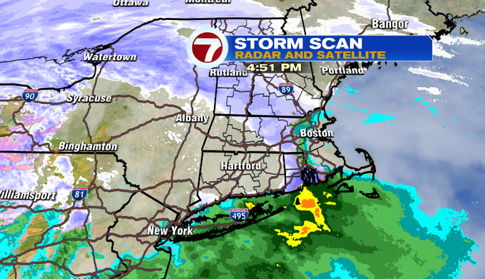
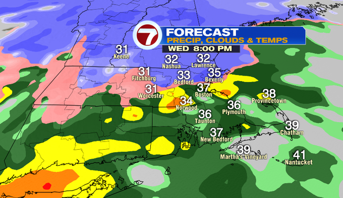
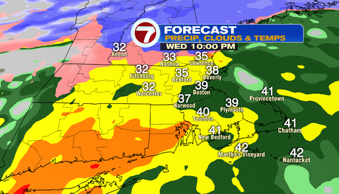
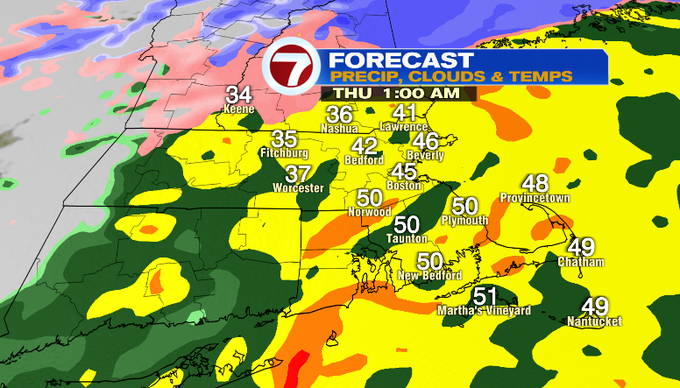
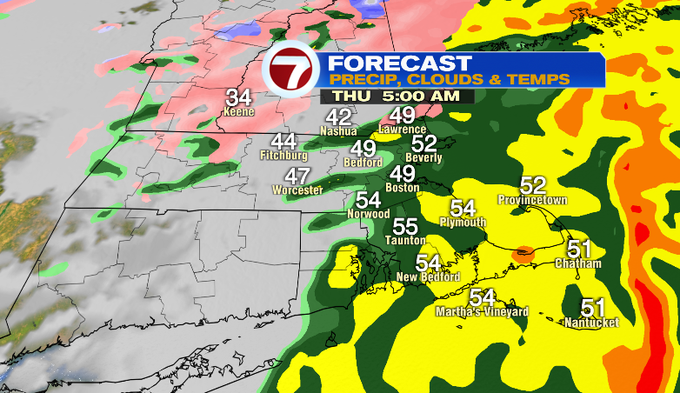
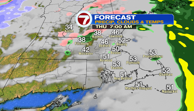
TIMING: We’ve seen a narrow band of snow showers and flurries working through Worcester County and Rhode Island this afternoon. Snow showers could still fill in more before 9pm. Beyond that, warmer air will overspread the region and begin to flip any snow showers to rain. By 10pm, most everyone will be under heavy rain. Southern New Hampshire and the Merrimack Valley will be on the edge of the rain/snow line. Overnight, everyone will get heavy rain with some downpours. You can see that with the yellow and pockets of orange shading enveloping pretty much everyone across Mass and southern New Hampshire. Between 5-7 am, the rain tapers west to east. Most of us should be clearing out by late morning.
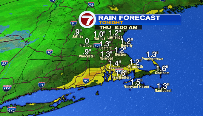
RAIN TOTALS: Rain will come down hard tonight. Heavy rain with some downpours will add up to 1-2″ before it comes to end tomorrow morning.
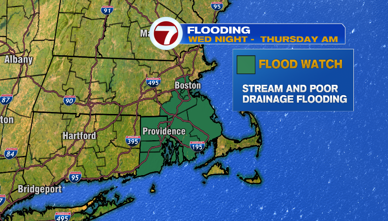
FLOODING: That heavy rain along with this week’s early snowmelt could lead to flooding around SE Mass. There’s a Flood Watch in place tonight through tomorrow morning. Excessive runoff could lead to flooding near streams, low-lying and flood-prone areas and around poor drainage and urban areas.
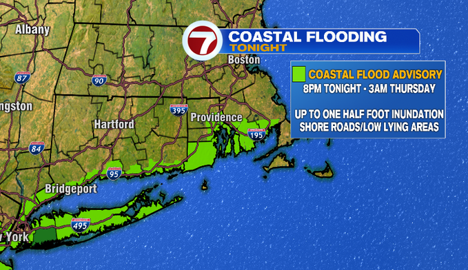
Along with that there is a Coastal Flood Advisory tonight through the early morning high tide. This is mainly for areas around the South Coast and Narragansett Bay. Expect splashover to minor coastal flooding around shore roads and low-lying areas.
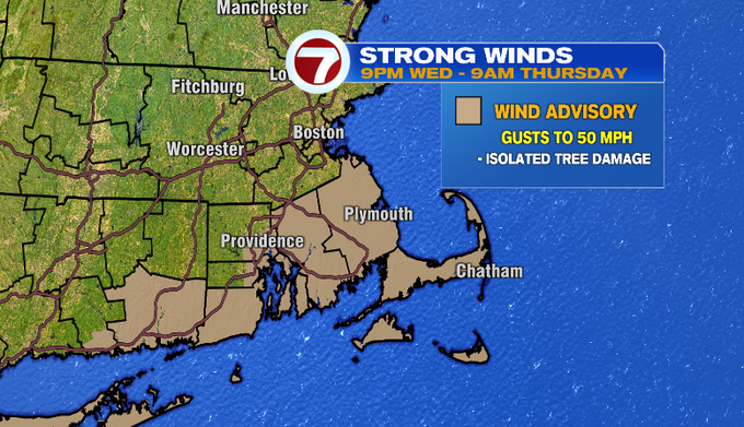
WIND: The storm will come with a gusty southerly wind tonight and into tomorrow morning. The strongest wind will be overnight with gusts near 50 mph across SE Mass. Gusts in this range will be enough to cause isolated tree damage and the potential for power outages.
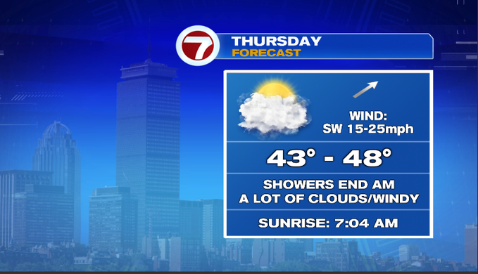
LOOKING AHEAD: Rain tapers tomorrow morning. Expect some puddles on the road for the morning commute, but otherwise the morning drive should be ok. Temperatures overnight rise into the upper 40s/low 50s, so it’ll feel mild to start your day. A SW wind will be gusty tomorrow. Temperatures will cool slightly into the afternoon into the low/mid 40s, and we’ll see mostly clouds.
Looking ahead, there’s a hint we could get some rain late Sunday into Monday. We’re watching the chance for another rain/snow storm late Wednesday into Thursday.
Meteorologist Melanie Black