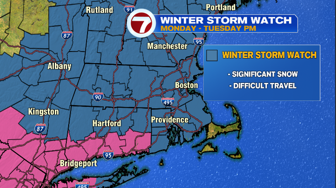
We’re keeping an eye on the developments of a nor’easter that swings into southern New England as early as Monday.
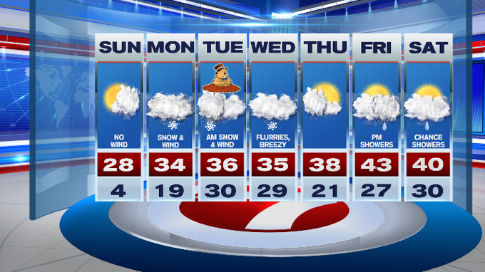
Today is the calm before the storm with increasing cloud cover through the afternoon. Speaking of calm, we’ll see light and variable winds today (a stark difference compared to the winds over the last several days that sent wind chills tumbling below zero). Highs today will stretch into the upper 20s.
Tonight, under mainly cloudy skies, temperatures only dip to around 20°.
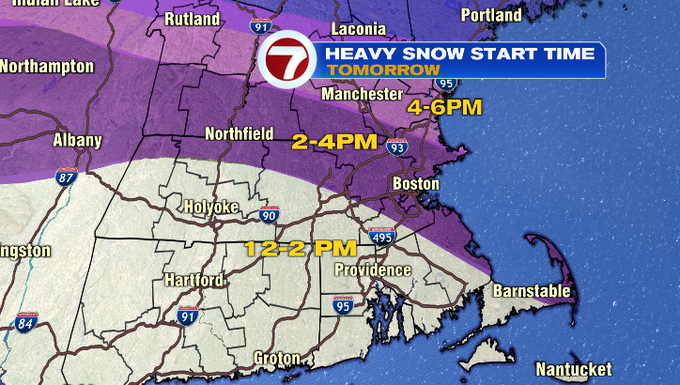
Monday starts off dry, then we could see a few snowflakes flying in the morning associated with some ocean-effect showers, while the leading edge of moderate snowfall holds off until the afternoon.
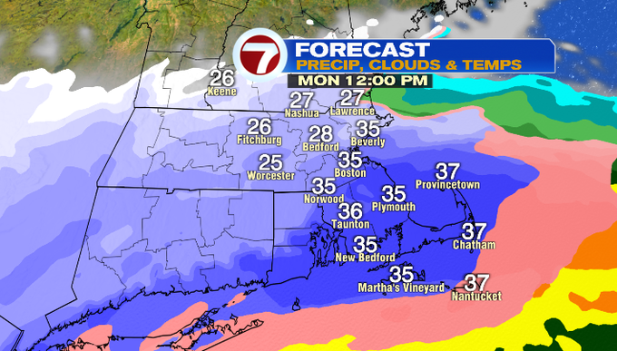
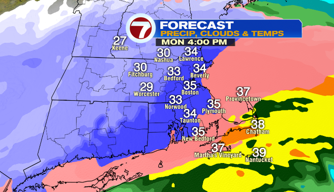
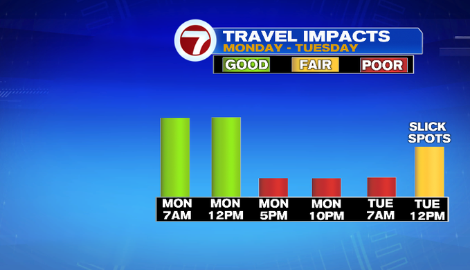
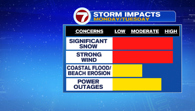
We will likely see a thump of snow late afternoon into the evening commute, making for tough travel conditions with low visibility with 1-2″ per hour snowfall rates and accumulating heavy wet snow on the roads.
A Winter Storm Watch has been issued across most of the region, which will likely become a Winter Storm Warning later today.
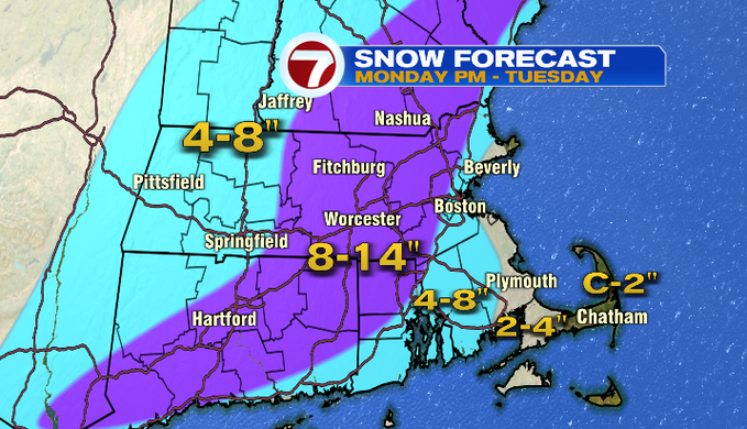
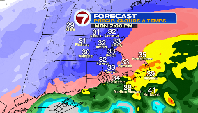
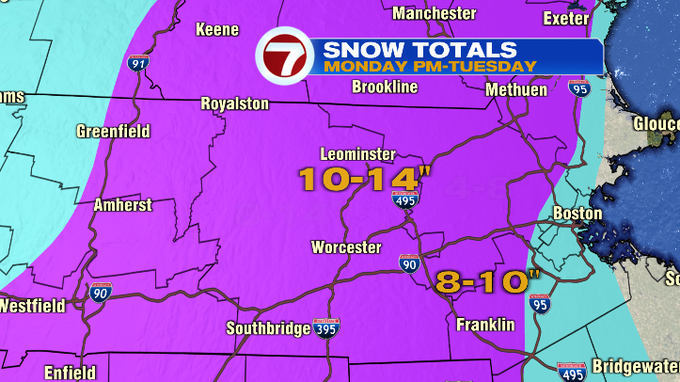
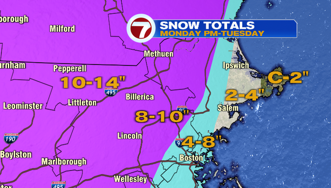
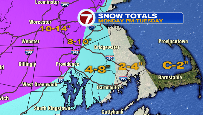
The rain/snow line will play a factor into the lesser snowfall amounts from Cape Ann/Gloucester to the South Shore and the Cape and Islands. However, areas inland, especially west of the 95-corridor, that’s where the jackpot area is where 8-14″ of snow is possible, with the higher end of those totals for areas farther west.

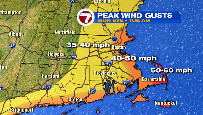
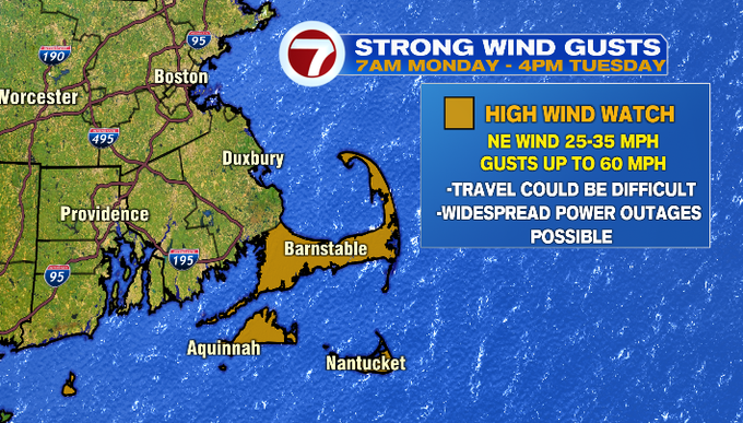
Now the Cape and Islands are not expected to get much snow, but they will be getting the brunt of the wind gusts. A High Wind Watch has been issued for the Cape and the Islands for gusts up to 60 MPH. Widespread power outages of possible with that caliber of gusts. For gusts along the coast, we’re looking at 40-50 MPH, and areas inland 35-40 MPH.
Coastal flooding and beach erosion is another concern with this storm. Thankfully the tides are astronomically low with the timing of this storm, but some minor coastal flooding with the battering surf is still possible Monday and Tuesday.
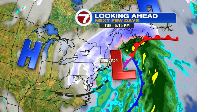
For early Tuesday morning, we’re still tracking some lingering snow showers before the system lifts out to our north and we’ll see improving conditions from south to north by midday Tuesday.
Wednesday brings a few flurries, otherwise mainly cloudy and breezy. By the end of the week, a warm-up is in the forecast with Friday’s high in the low 40s, which sticks around into early next weekend.