As of the 11am update Saturday from the National Hurricane Center, Henri has reached hurricane status. It is now a Cat. 1 hurricane with sustained winds of 75 mph and gusts up to 90 mph. Plus, with that 11am update, Tropical Storm Warnings have expanded to include the Cape & Nantucket with the Hurricane Warning expanding east to include southern RI.
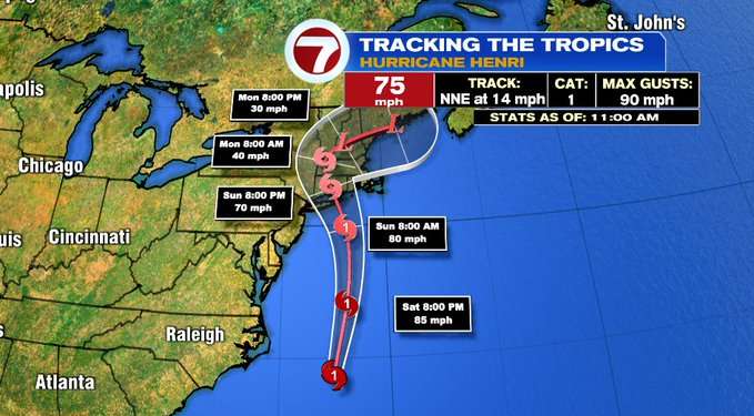

Henri will continue it’s northern track through today and into tomorrow morning as a hurricane as it approaches the southern New England coastline. The path has shifted just a little bit east compared to the 5am update. Coastal regions from Long Island to Ct and RI are still in the cone of potential areas where Henri could make landfall as a strong tropical storm Sunday late afternoon.
Today is the calm before the storm to prepare. With damaging gusts and more rain on the way, power outages are expected due to the water logged ground and the fully leafed trees, it won’t take much wind to down trees and power lines. Make sure your phone is charged and you have flashlights nearby.

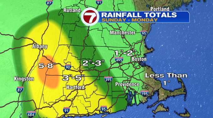
With Henri’s forecasted path, the heaviest rain will fall in western and central MA, with the stronger gusts from RI to the South Coast, Upper Cape, and the Islands.
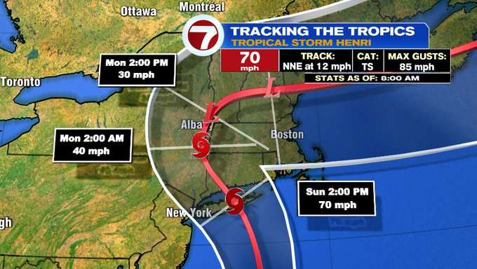
For the gusts, we’re looking at anywhere from 50-60 mph closest to the eye of the storm (where it makes landfall) which could be from Long Island to the CT coastline to Block Island, which is where a Hurricane Warning has been issued. A Tropical Storm Warning has been issued for southern RI, the South Coast and Martha’s Vineyard. Widespread 30-40 mph gusts are expected across much of the Bay State, 40-50 mph for portions of SE MA, the Cape and Nantucket.
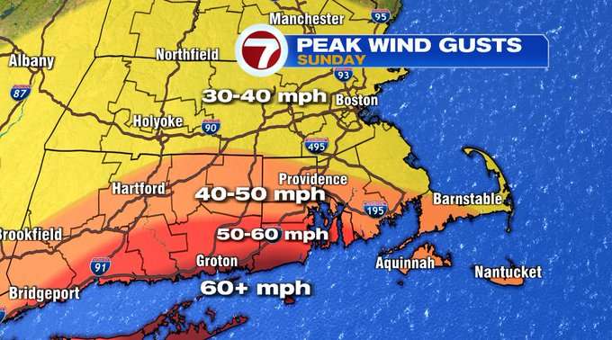
When we’re talking gusts that strong, expect some tree damage and power disruption tomorrow.

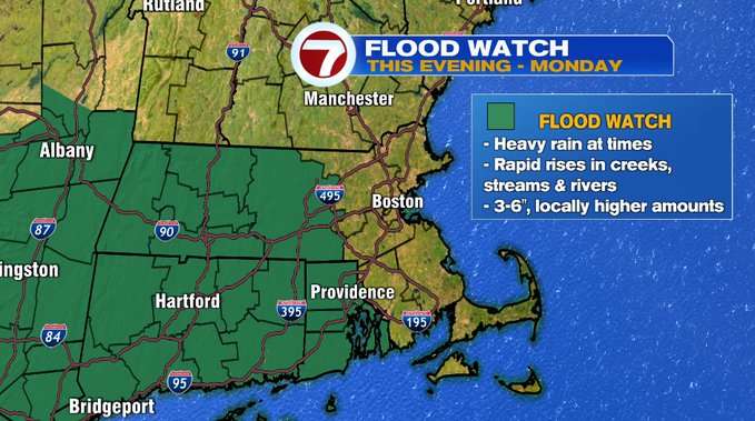
Flooding rain is possible considering just how soaked the ground already is, and adding tropical downpours will only make for a better chance for flooding. Higher rainfall totals are expected for western MA, however we could see some flooding for central MA where we could get several inches of rainfall. This is where a Flood Watch has been issued from this evening through Monday.
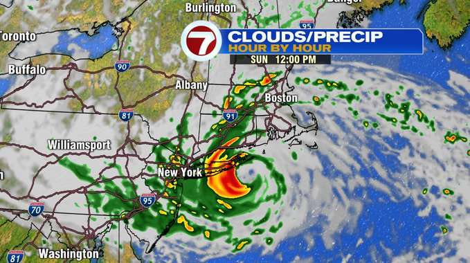
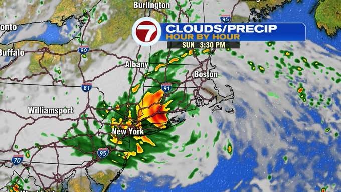
The leading edge of the rain bands on the outer fringes of Henri will reach southern New England as early as Sunday morning (ahead of daybreak), and will move from south to north through the morning hours. These bands feather out from the center of the storm which will be nearing the southern coastline of New England by mid-afternoon, resulting in on and off rain through the day, with embedded downpours and we can’t rule out the possibility of severe weather including tornadoes.


For the South Coast, the Cape and Islands, especially the southern facing coastlines, storm surge is yet another aspect of this storm. Winds will be streaming in from the east-southeast, the wind drives the ocean waters onto land, creating storm surge that could reach a peak of 3-5 ft, depending on if the storm surge pairs up with the timing of our astronomical high tides Sunday.

As the remnants of Henri spins out of New England, we could still see a few downpours into Monday, with drier conditions arriving Tuesday.
Stay tuned for the latest updates from 7News on the air and online over the next 24 hours to 48 hours.
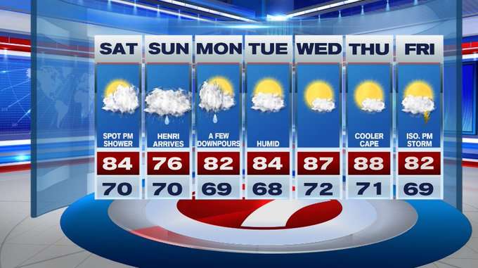
Looking ahead towards the second half of the 7-day forecast, a warm-up with highs into the mid to upper 80s arrives by midweek.