The snow returns (or continues) through the overnight tonight. Areas out west got dumped on last night and saw on-and-off light snow through the day today. Coastal areas saw significantly less snow last night and saw light rain and snow today but not adding to the snow totals. That will change tonight. A winter storm warning has been posted for areas inside of 495 for that snow arriving early tomorrow morning.

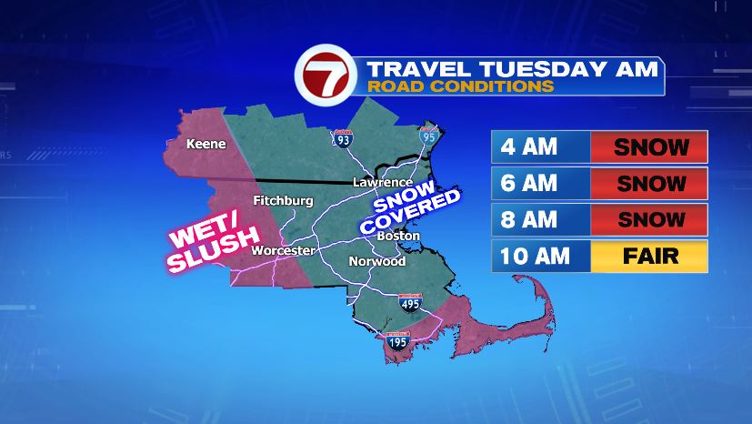
Travel for many of us will be worse for your Tuesday morning commute than either of the commutes on Monday. Snow to the northwest with gradually push down into Boston and southeastern Mass and change the rain back over to snow. Travel tonight will go downhill fast as roads become snow-covered for everyone.

Tomorrow morning will be terrible for drivers. Snow covered roads will take over eastern Massachusetts until 10 AM. Snow will begin to taper at that point which will give road crews the opportunity to catch up to the snow and make for a better evening commute *fingers crossed*.
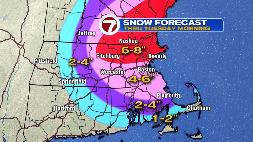
Here’s what we’re expecting for ADDITIONAL snowfall between now and tomorrow morning when it wraps up. Remember, this has nothing to do with what fell last night. It’s brand new stuff!

The snow will be heavy and wet so aside from rough travel, there is the possibility of power outages as that heavy, wet snow weighs down tree limbs and power lines.

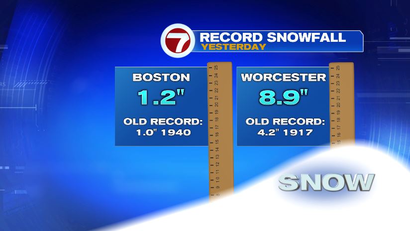
And what about last night’s snow? Well it was record-setting for both Boston and Worcester! The total for Worcester overnight was 10″ but 8.9″ of that falling before midnight and thus counting toward the daily record.
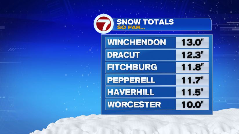
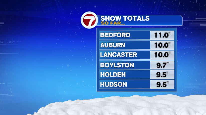
And there was plenty more significant snow reports from across the area: