New year, new pattern! December was anything but winter for southern New England. Less than 1″ of snow for Boston (normal is 9″) as well as the 15th warmest December on record! That’s about to change over the next several days.
It looks like we will receive our first significant snow of the season for most of the region with many cities and towns needing to shovel and plow. First things first…Thursday. A quiet, dry day to run through the storm checklist (IE…where are the shovels?! Will the snow blower work this year?!).
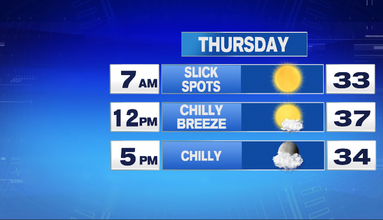
Seasonably chilly but overall, a decent winter day. Watch out for some slick spots early Thursday morning from any leftover moisture still lingering on untreated surfaces.
On to the storm! Here are the storm deets and impacts:
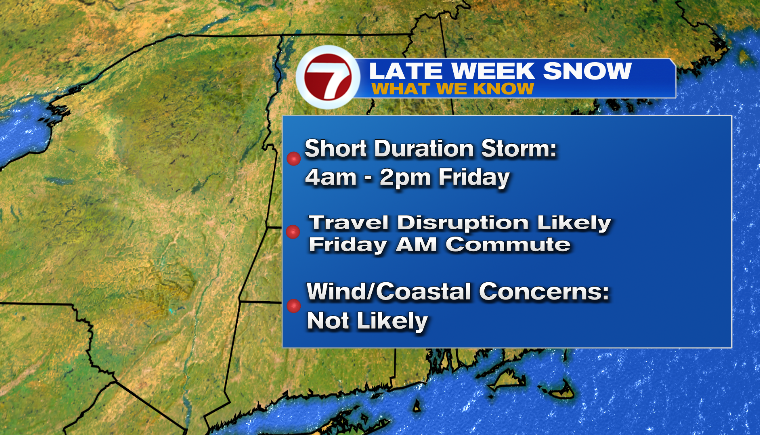
While a significant snow on the way, far from a *blockbuster* (personally, I think of a blockbuster as everyone is getting 12+” of snow..this is not that storm). The storm is:
*Quick hitting with first flakes by 4am Friday.
*Heaviest from 5-9am Friday
*Tapering to flurries between 1-3pm Friday
*Poor travel likely for the Friday AM commute but improving throughout the afternoon. Could be some flight delays/cancelations for Friday AM flights
*Fast moving storm means no coastal flooding or damaging wind
Another way to view storm Impacts is here…
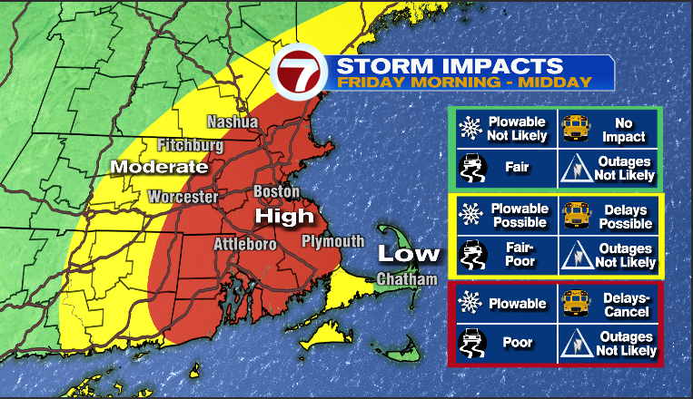
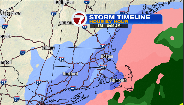
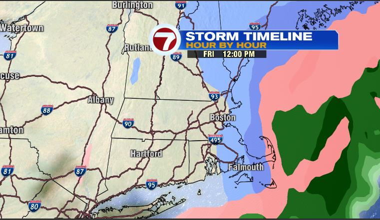
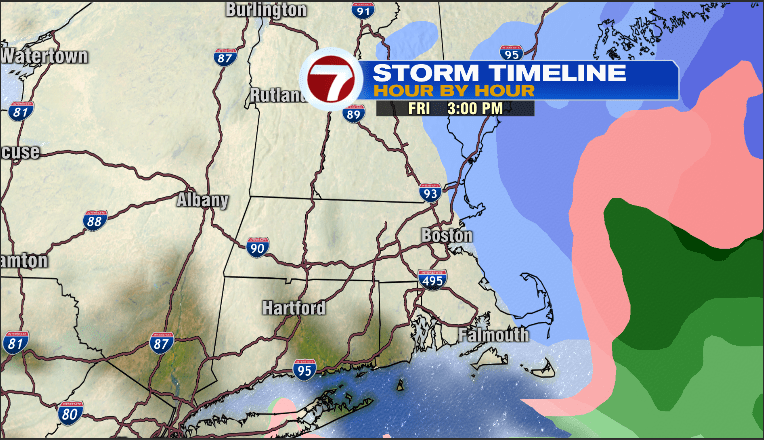
I’ll grant ya, it’s a busy map but should work. In terms of a visual timeline, let’s step through the day on Friday.
First up, 8am
Next, midday…
and finally, mid afternoon Friday..
and of course, all this lead up to the Holy Grail…the snow map…
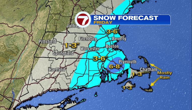
Some thoughts on that map..
*It’s still Wednesday, the colored blobs may still drift a bit between now and Friday
*Cities/Towns around the metro and south are more likely to reach 6″ versus west and north of town.
*Worcester-Fitchburg-Nashua are closer to 3″ than 6″ as well as places on immediate South Shore (along and east of Rt.3/3A)
*It’s also possible that there is a small area in Plymouth-Bristol counties that end up with a bit more than 6″…we shall see
Post storm weather?
Sunny and cold for Saturday and likely a Bitter Blast of cold air arriving Monday and lasting through Wednesday of next week. Sandwiched in-between is a weak weather system with rain showers and temps near 40.
More on the storm the rest of the week!
~JR