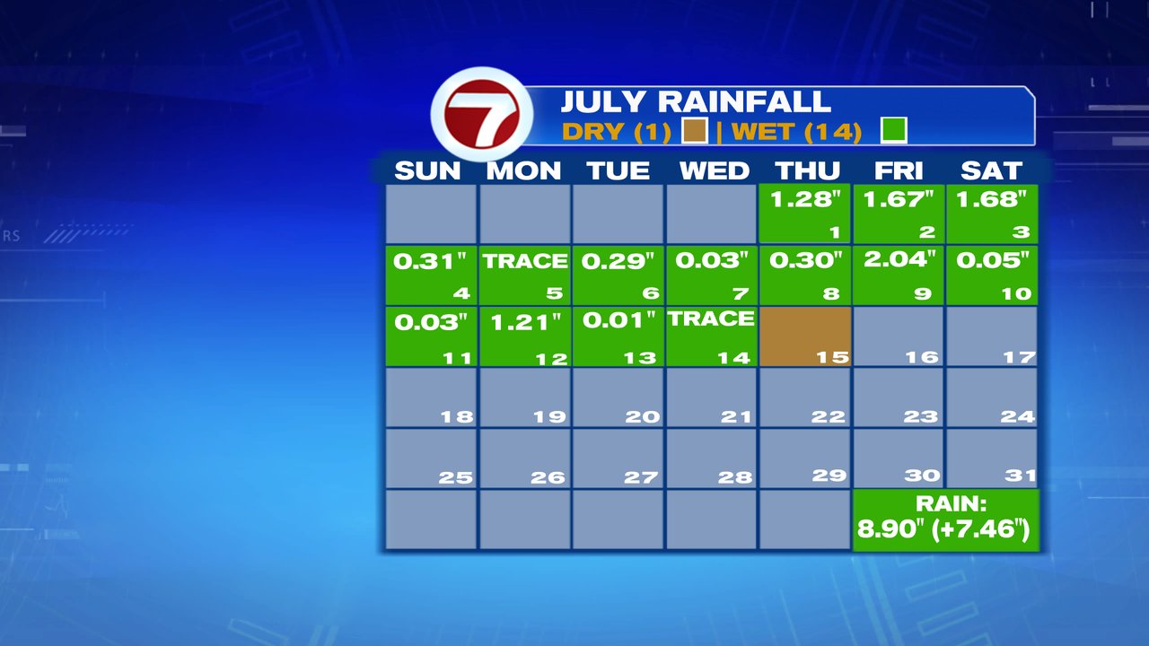
How about yesterday?! Not only did many locations away from the coast head up toward 90 degrees, we also had a completely dry day for much of the area. Boston recorded it’s first dry day in 17 days, breaking the wet weather streak at 16 days. Currently, we’re only halfway through the month and stand as the 3rd wettest July on record with the 2nd half of the month to go.
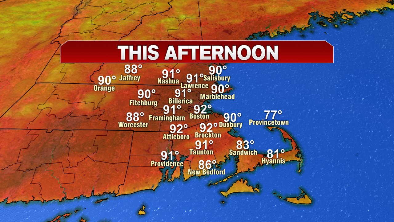
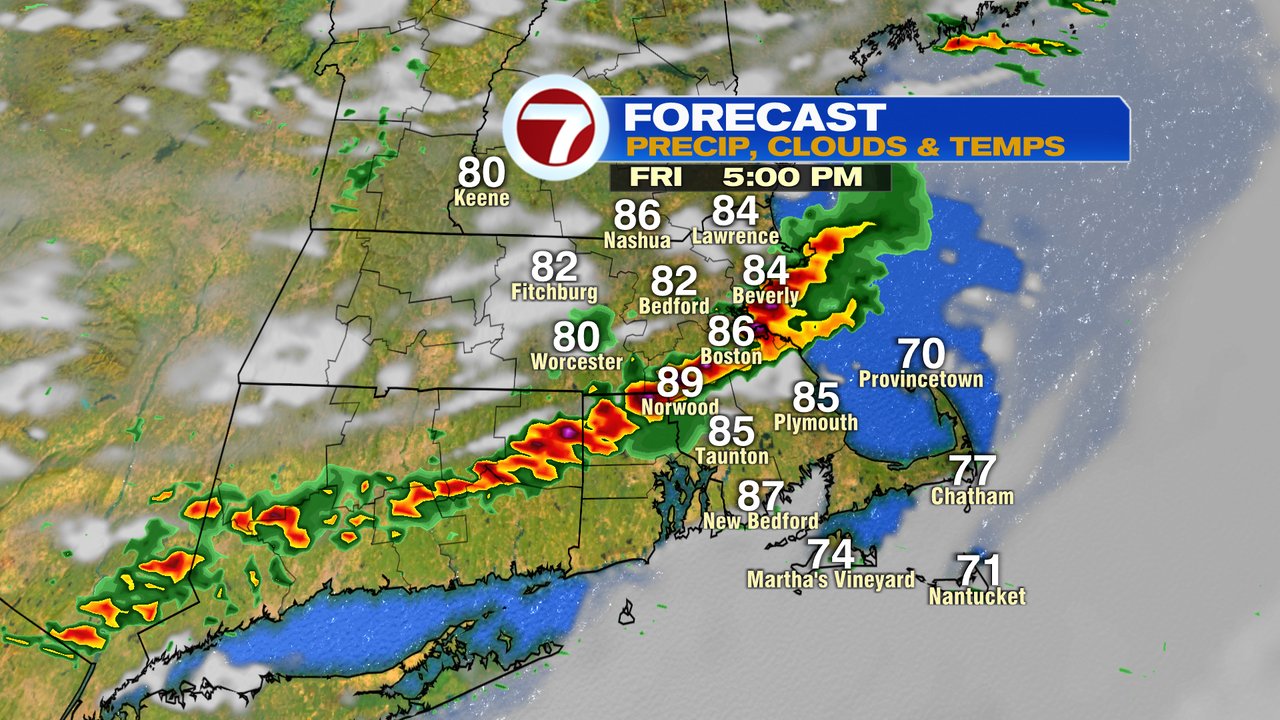
High heat is with us today as temps crack 90 for many locations away from the south coast. That includes the city of Boston as winds are out of the southwest. Heading to the beach or pool today? While coastal fog won’t be an issue near and north of Boston like it was yesterday, we do run the risk for some mid to afternoon storms to pop up. Keep an eye to the sky for those. Localized torrential rain, street flooding, lightning and gusty winds are the main threats.
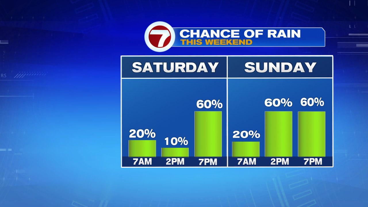
Heading into the weekend, it won’t be as hot, but it will be humid still. In addition, unfortunately it’ll be unsettled at times too. Showers and storms are limited tomorrow morning, through midday but do increase in the afternoon. Localized downpours are possible late tomorrow, especially tomorrow night into predawn Sunday. More showers crop up midday-afternoon Sunday. Temps run in the mid 70s to near 80 both days.