The trend to the upside today will finally peak as the combination of air temps in the lower to middle 90s and dew points in the 60s to near 70, will send the heat index into the 95-100 range. That has prompted a heat advisory for inland locations today.
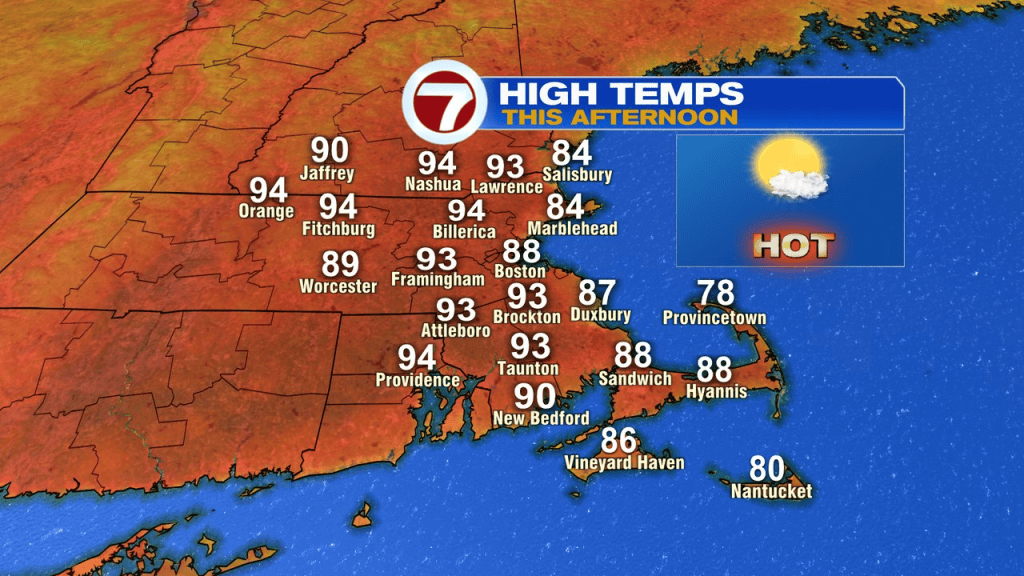
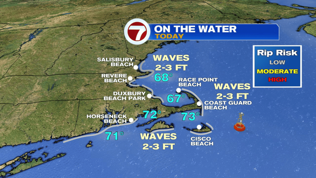
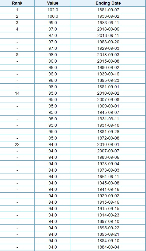
At the coast, a sea breeze will kick in, allowing temps to fall just shy of 90. While we’ll be close a record high in Worcester, in Boston it wont be close to the 102, set back in 1881.
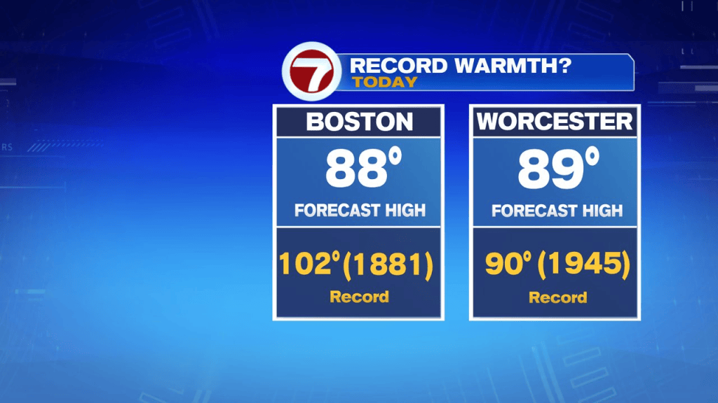
The forecasted high today in Boston is 88, although if we do sneak up to 90, it would be the 130th time Boston has done it on or past September 1st. Below are some of the hottest September days on record for Boston.
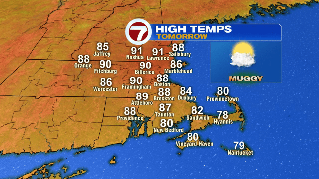
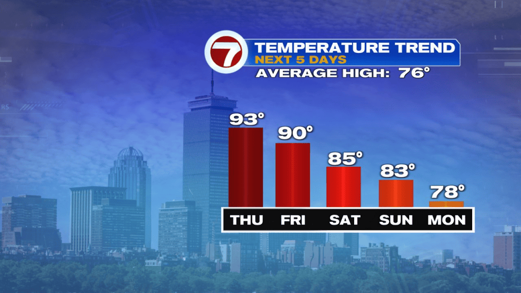
It’s another hot one tomorrow, although the temps won’t be quite as high with temps running near 90. The humidity stays high too.
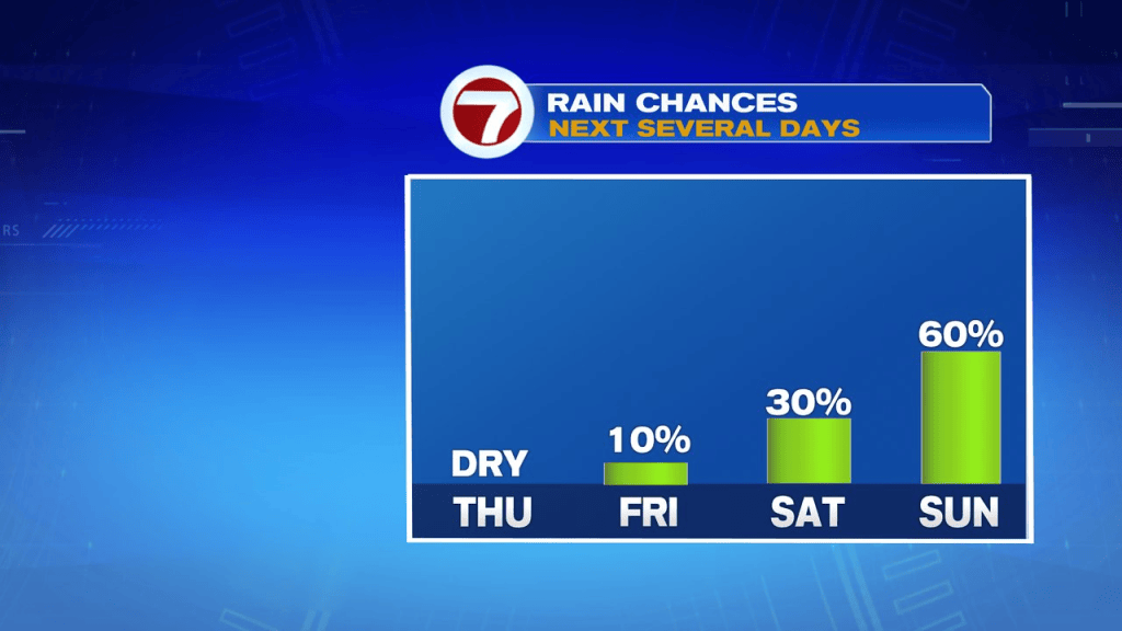
The showers and storm risk increases this weekend, with them more widespread Sunday vs. Saturday. It’ll likely remain unsettled into early next week.
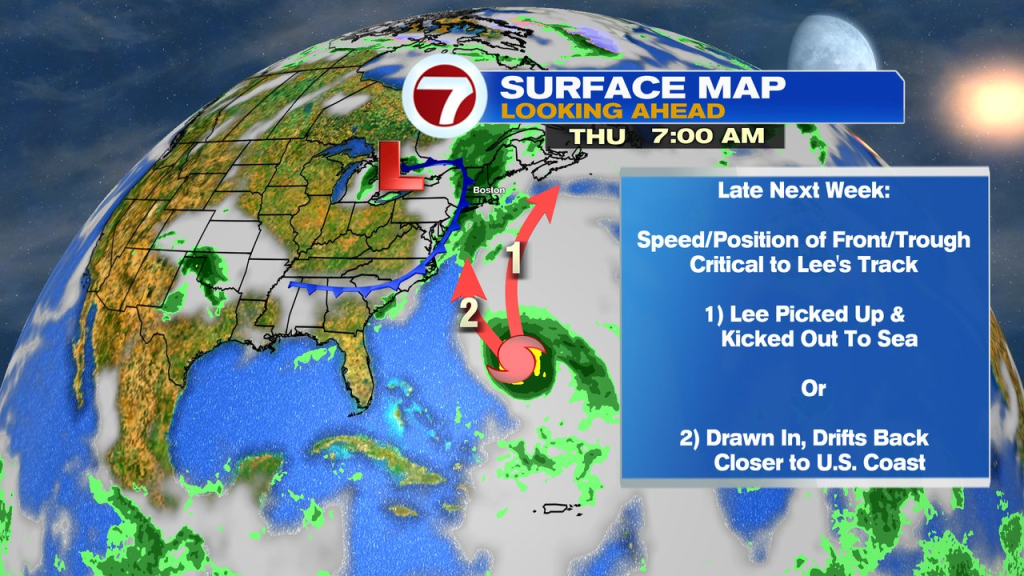
Meantime in the tropics, Lee is a hurricane and one we’ll keep an eye on closely. It’s expected to become a category 4 by this weekend and will track more north by mid-week. The question becomes, how close is that track to the U.S. coast?