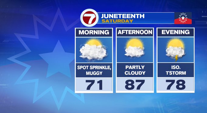
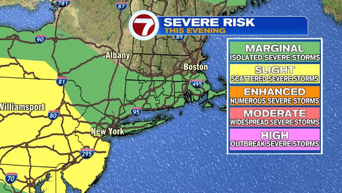
We saw a few sprinkles pop up earlier this morning associated with a passing warm front, but now we wait for the cold front that swings in later this evening, bringing a threat for isolated thunderstorms along and south of the Pike closer to sunset.
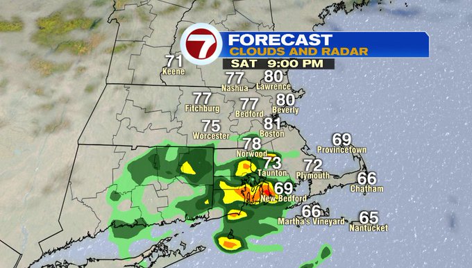
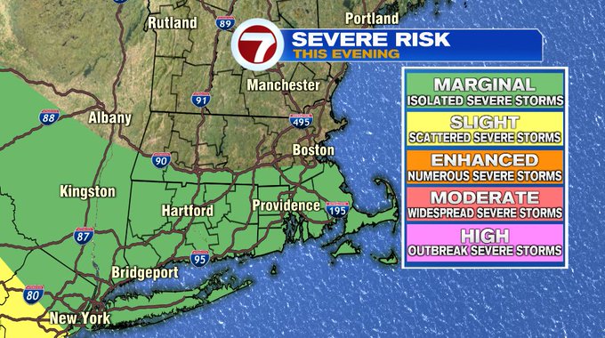
Some of these storms this evening could be strong, with damaging gusts being the main threat, which is why the Storm Prediction Center has put areas along and south of the Pike under a marginal risk.
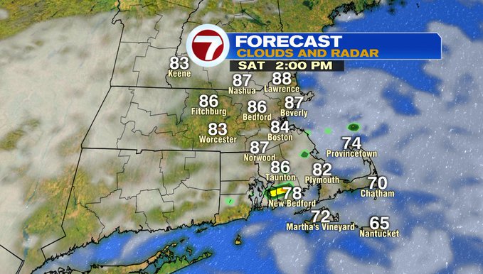
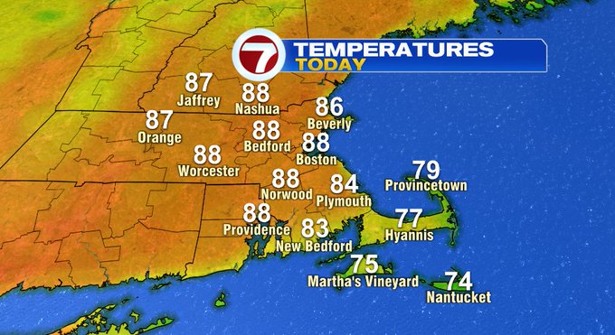
Today, it is also noticeably more muggy compared to the last several days, and we have the southwesterly breeze picking up to 10 to 15 mph, dipping temperatures along the South Coast and the Cape / Islands due to the cooler ocean waters, while farther inland we’re looking at highs well into the mid to upper 80s.
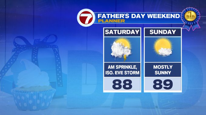
With the forecast soaring into the 80s, if you’re heading to the beach, we’ll see some peeks of sun this afternoon, with more sunshine for Father’s Day tomorrow.

Tonight, overnight lows only slip into the 60s with a chance for an isolated thunderstorm for SE MA early, then a gradual clearing of the skies late as the cold front slides out.
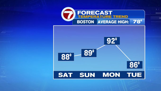
Father’s Day is another hot one, nearing 90° under mostly sunny skies.
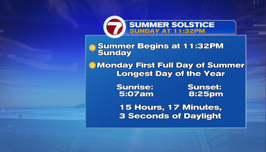
The summer solstice is Sunday night at 11:32PM, making Monday the first full day of summer and it will certainly feel like it. Highs on Monday stretch into the low 90s. It will be breezy and humid under mostly sunny skies.
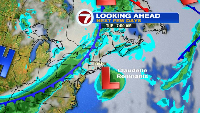
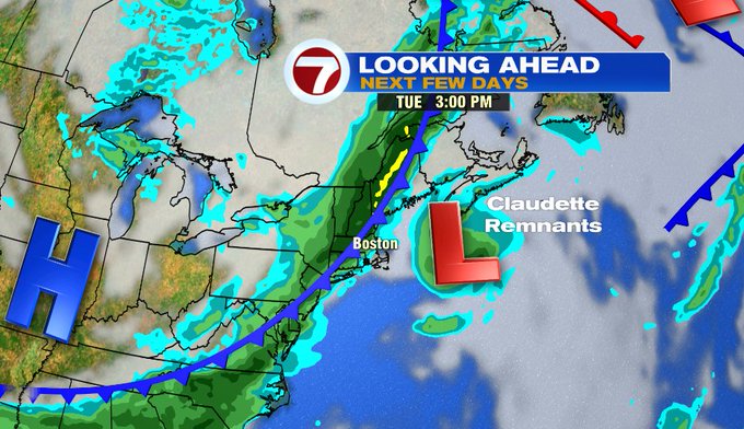
For Tuesday, we have an approaching cold front to our northwest and the remnants of Claudette to our southeast. The remnants of Claudette could bring some much needed rain to the Outer Cape on Tuesday before it continues it’s path out to sea, while the cold front that moves in for the afternoon brings widespread thunderstorms.
Refreshing air dives in for midweek with both Wednesday and Thursday into the upper 70s under mostly sunny skies.
