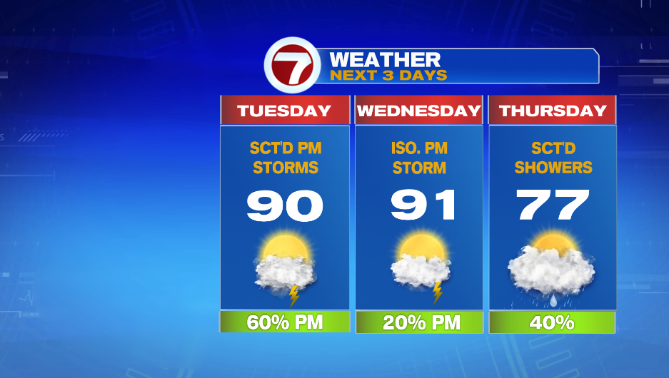
We go back to hot an humid weather tomorrow. A disturbance moves through in the afternoon, firing up thunderstorms. A few of those storms could be strong to severe.
Temperatures will be rising overnight, and we end up in the low and mid 70s by 7 AM Tuesday. There will be lots of clouds early in the day, but then it clears up a bit by mid-morning. This sunshine will allow temperatures to jump into the low 90s. The heat and the humidity will make the atmosphere unstable, and then a disturbance will give us the lift we need to see clusters of storms.
The main window for strong to severe storms is from 2-8 PM, and the main concern is strong wind (damaging wind gusts associated with the thunderstorms).


Wednesday will also be hot and humid. We go from a 60% chance of storms on Tuesday to a 20% chance on Wednesday. This means it will be isolated where only 2 to 3 cities get hit with a storm. There could be spotty showers Thursday morning, but the better chance of rain is in the afternoon. Highs only make it into the mid 70s.
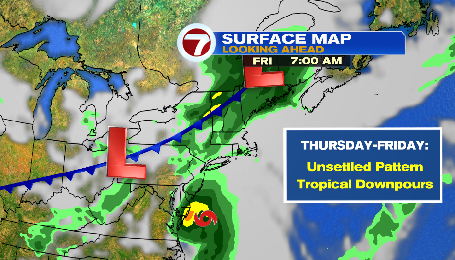
The week ends with unsettled weather once again. Elsa is expected to be a post-tropical storm as it nears the coast of southern New England. There could be some gusty winds on the Cape, but the main concern will be the potential for flooding from tropical downpours. Mainly because of all the rain we’ve seen in the last 5 days.