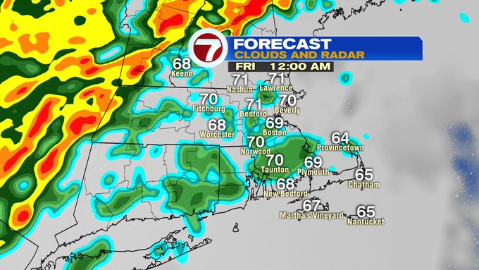
We’re looking at a wet, windy, but humid Halloween for southern New England. We’re talking temperatures in the upper 60s, along with wind gusts between 40-50 mph in spots.
Why so windy? We have a system moving in from the west, a strong southwest wind along with a potent cold front. The cold front – the leading edge of colder air, doesn’t move through until at least Friday morning, so the warmest air will be felt just ahead of this front.
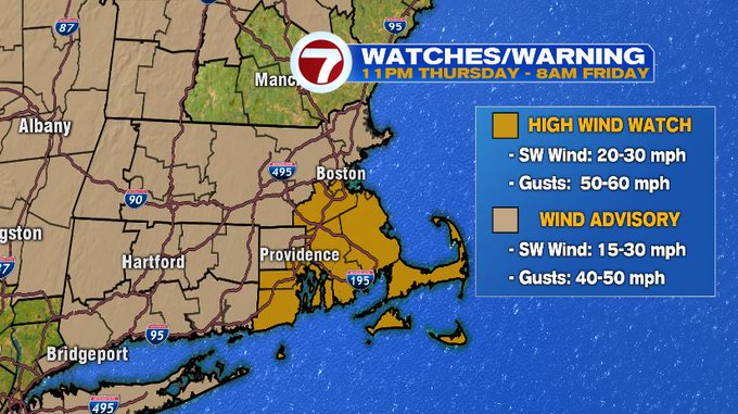
A High Wind Watch has been issued for SE MA, including the South Shore, the Cape and Islands from 11PM Thursday through 8AM Friday for gusts up to 60 mph. A Wind Advisory has been issued for spots inland across the Bay State where gusts could reach between 40-50 mph. The scattered showers and the howling winds has caused trick or treating to be rescheduled to another day.

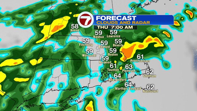
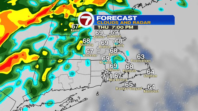
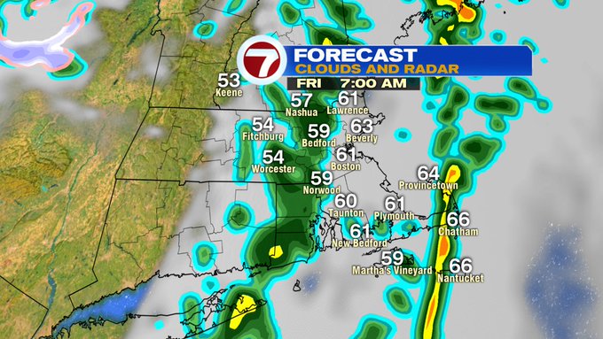
As far as the timing of the rain, for the morning commute, we’re looking at light rain showers scattered across the region.
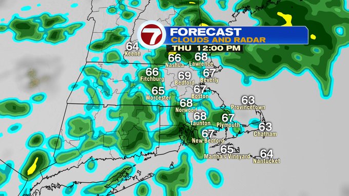
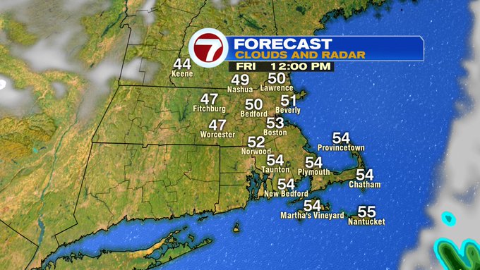
These showers break apart around lunchtime, but be sure to still have the rain gear on hand.
The heaviest downpours look to remain well off to our northwest into Thursday night, but the winds ahead of this line will start to pick up.

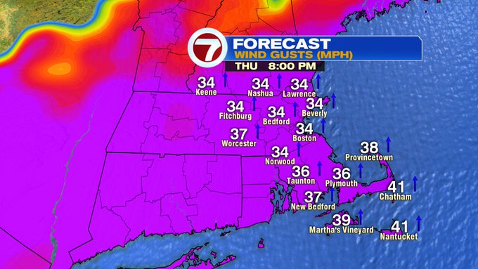
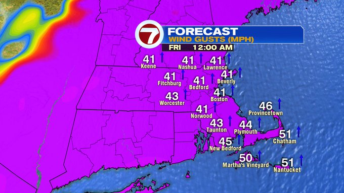
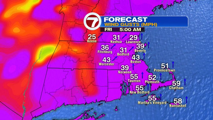
The strongest winds will likely be into early Friday morning. It will not be a total washout for trick-or-treaters, but it also won’t be the nicest of Halloween evenings. It will be mild and windy.
We still have lingering showers and wind into Friday morning before the front finally clears the area. Once the front moves out to sea, much more seasonable conditions slide in for Friday afternoon- dropping those temperatures through the day.
For those towns that have rescheduled trick or treating to Saturday, it will be a beautiful day for it with sun-filled skies and highs into the 50s.