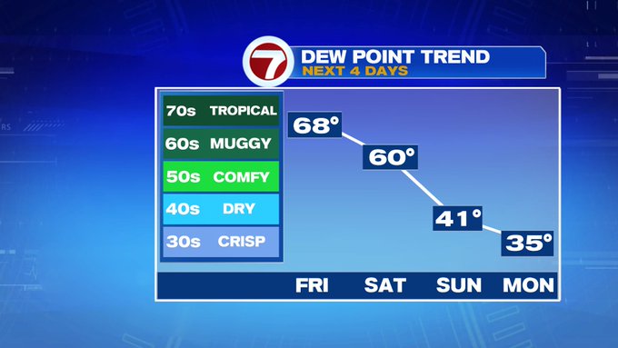
The tropical-like humidity has returned to southern New England to wrap up the work week.
Today we’ll see dewpoints into the upper 60s to near 70 with temperatures into the low 80s, especially along and north of the Pike, making it feel even warmer. We’ll see some sunny breaks into mid-afternoon, otherwise we’re tracking mainly cloudy skies. Highs will be slightly cooler for the South Coast and the Cape and Islands due to the southerly breeze off the cooler ocean waters.


Tonight, another warm night with a few showers into early Saturday morning. Overnight lows only slip into the mid 60s.
Tomorrow features a few showers/downpours by midday, but these slide out quickly, allowing for less humid air and a gradual clearing of the skies by mid-afternoon Saturday.


Overall, Sunday is the pick of the weekend with highs into the low 70s, less humid and sunfilled skies.

Cooler to start the work week with highs into the mid 60s, then we flip back into the 70s through the end of the 7-day. The next best chance for rain showers returns Wednesday.
