With today’s high stretching into the upper 80s under partly sunny skies, it is the warmest day so far this year for much of southern New England.
This evening, we’ll see increasing clouds ahead of our next chance for rain that arrives overnight into early Friday morning.


Not much relief from the heat overnight as temperatures only slip into the 60s.

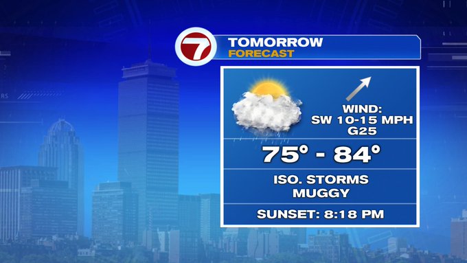
Friday is bookended by showers which could feature some downpours while a few rumbles of thunder cannot be ruled out.

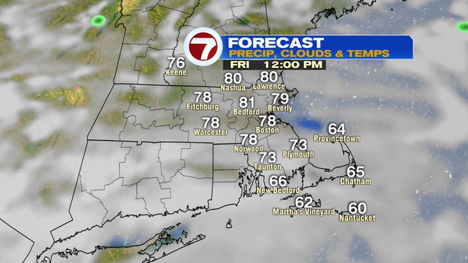

There will be some dry times midday (between 11am – 2pm) before showers and storms start to bubble up by dinner time (between 4pm – 7pm).


Be weather aware for your late afternoon and early evening plans Friday.
A few showers could linger into early Saturday, otherwise the rest of the weekend is looking mainly dry (especially during the daytime hours).

Cooler and less humid by Sunday with highs around 70, then it’s back to near 80 through the rest of the 7-day forecast.

A quick tropical update: Our third named storm, Cristobal, a tropical depression, is expected to strengthen back to a tropical storm over the warm waters of the Gulf of Mexico over the next few days while moving northward towards the Gulf Coast of Louisiana.
