With a coating to an inch of snow and sleet on the ground, then a glaze of freezing rain on top, it’s the perfect mixture of ingredients to cause widespread issues for the morning commute. Spin outs and accidents have been numerous this morning as slick travel is an issue, especially away from the coast. Temps gradually moderate from southeast to northwest, to above the freezing mark, through the morning.
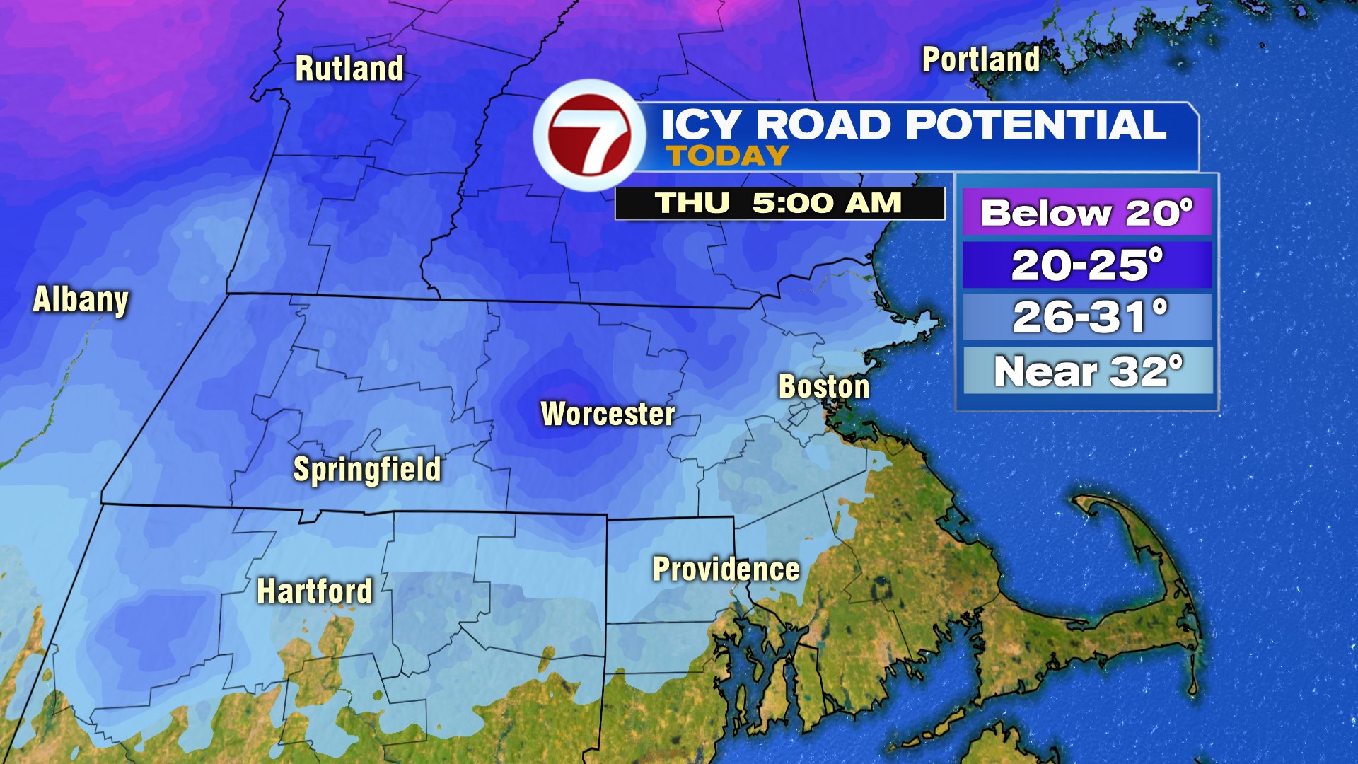

By 10am, temps inside 495 are above freezing, but will linger near freezing until early afternoon in the Worcester Hills.


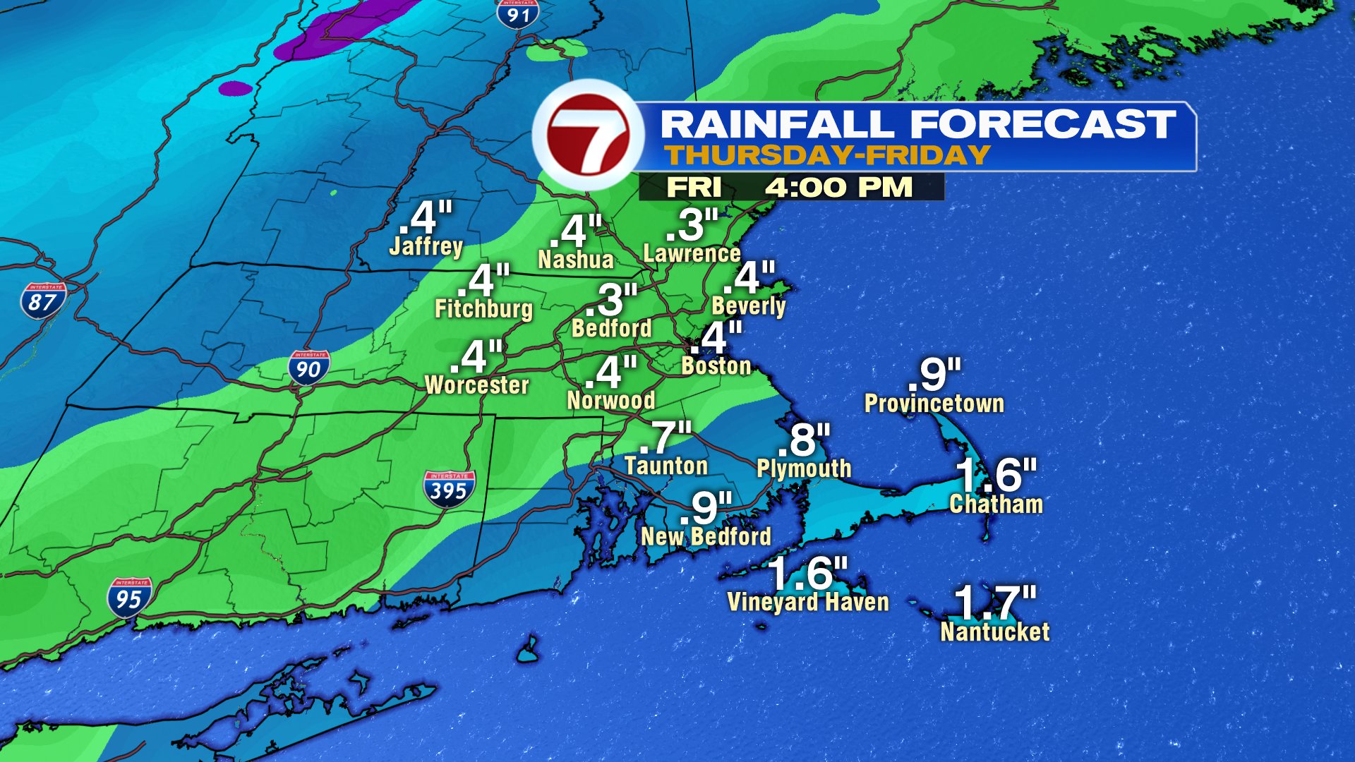
Spotty light showers and drizzle continue this afternoon, before a renewed chance of steadier rain tonight. Showers linger through Friday, and by Friday afternoon, the temp range across the area is quite large. Temps tomorrow afternoon run mid 30s across northern Mass and southern NH to mid 50s across SE Mass. This storm wraps up tomorrow evening and allows for a chilly but quiet weekend. A few snow showers are possible Sunday afternoon, but it’s not a big storm for us.

Ski conditions look good this weekend up north as an icy mix tonight turns to heavy snow tomorrow.

