This morning’s heavy downpours (along with some rumbles of thunder and flashes of lightning) was much-needed since it has been a dry start to 2021.
Ahead of this morning’s rain, we were almost an inch below normal for January.
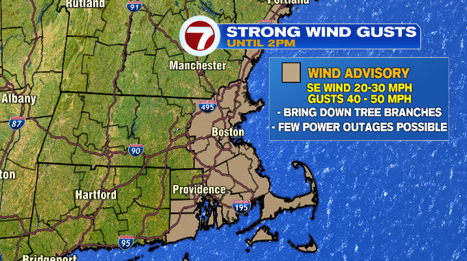
Not only did we see the heavy, soaking rain this morning, we also saw gusty winds. A Wind Advisory remains in effect through 2PM this afternoon within the 495-corridor, NH seacoast, SE MA, and the Cape and Islands for gusts up 40-50 MPH.
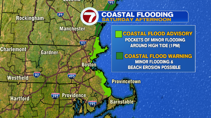
Speaking of the coastline, a Coastal Flood Advisory remains in effect until 3PM for the North Shore, Boston Harbor, and the South Shore due to pockets of minor flooding possible around high tide (1PM). A Coastal Flood Warning has been issued for the NH seacoast due to minor flooding and beach erosion possible around high tide.
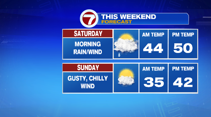
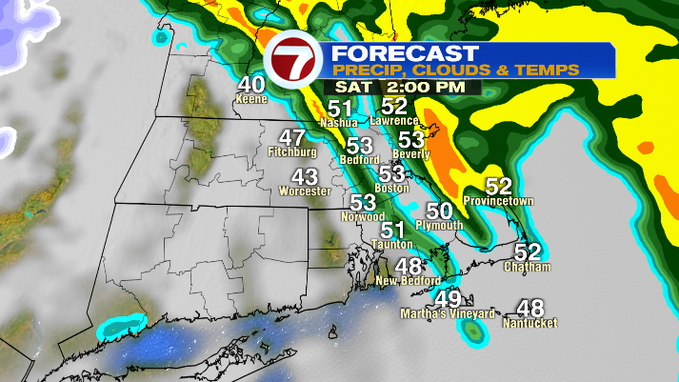
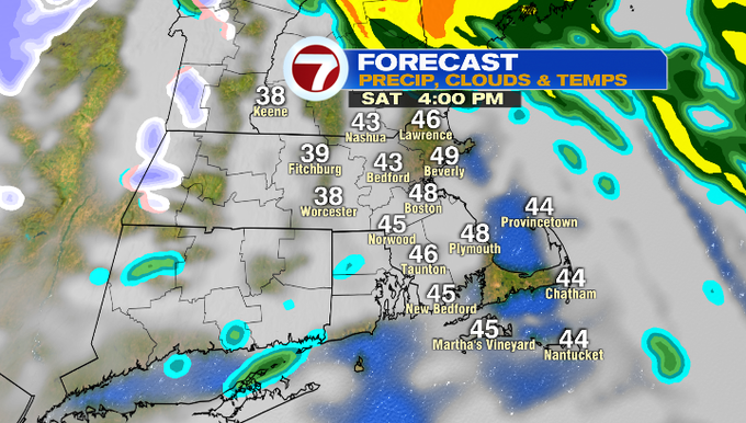
The heaviest rain pushes off the coast by midday, with a few lingering showers through 2PM. Expect improving conditions, although the clouds will linger through most of the afternoon. It will still be unseasonably warm with temperatures around 50°.
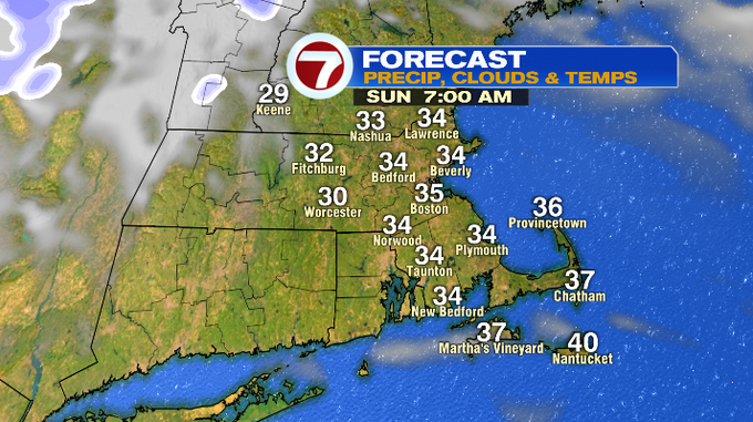
Tonight, a partial clearing of the skies with temperatures sliding back into the mid 30s.
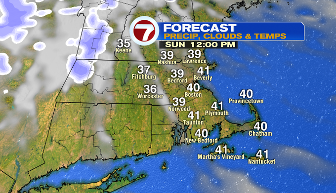
Sunday is the better half of the weekend with highs into the 40s under partly sunny skies. A gusty breeze will also be with us, too.
For Martin Luther King Jr. Day, highs will be around 40° with a chilly breeze under partly sunny skies.
Seasonable conditions return for the middle of the week with highs in the 30s. Wednesday brings a chance for flurries while Thursday night into Friday hints at some rain/snow showers. We will continue to keep an eye on that as we get closer.
