We saw a mixture of sun and clouds today across southern New England with highs well into the upper 70s inland, slightly cooler at the coast due to a persistent onshore breeze off the cooler ocean waters.
Tonight, we’ll see increasing clouds and higher dewpoints, with areas of patchy fog developing through the overnight (especially at the coast).

While we enjoyed another dry day here, severe thunderstorms traversed portions of the midwest and the Great Lakes Region which was under a moderate threat for severe storms today.

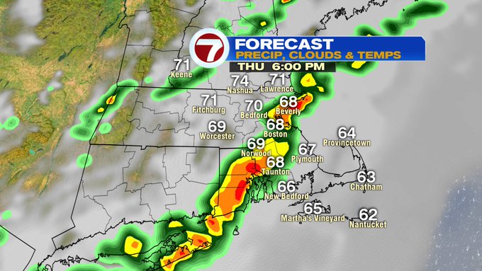
That vast system along with a cold front will sweep into New England Thursday afternoon with strong winds the main threat.

As for the timing of Thursday’s storm threat, it’s mainly in the afternoon and early evening (between 2pm – 7pm). There should be some dry times during the morning commute.


Temperatures warm-up to round out the week with highs on Friday into the upper 80s. 70s return this weekend with slightly cooler conditions at the coast.


