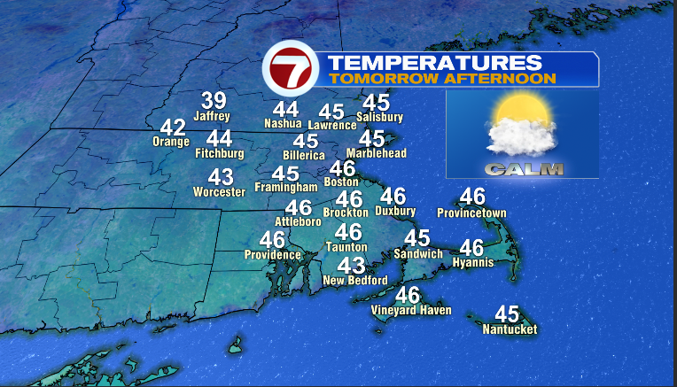
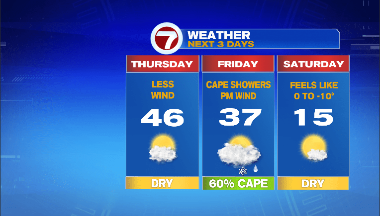
January Thaw inbound for tomorrow and after the Bitter Blast on Tuesday (as well as this morning), I’ll take it! After the cold start, temps on Wednesday afternoon did manage to reach the upper 30s and lower 40s (42 Boston). Now, 42 all by itself is fantastic after wind chills below zero but in order to get that milder air into New England, we had to endure more wind. Such is the life of a New Englander this time of year. Warming temps up either requires a jet stream pattern like we saw in December, a storm or, like today, a healthy southwest wind. We get a bonus mild day tomorrow AND we get it without any wind! I’ll take it!
Make it count as the arctic air is poised to return by late Friday night and more so Saturday. Here is Friday’s weather map…
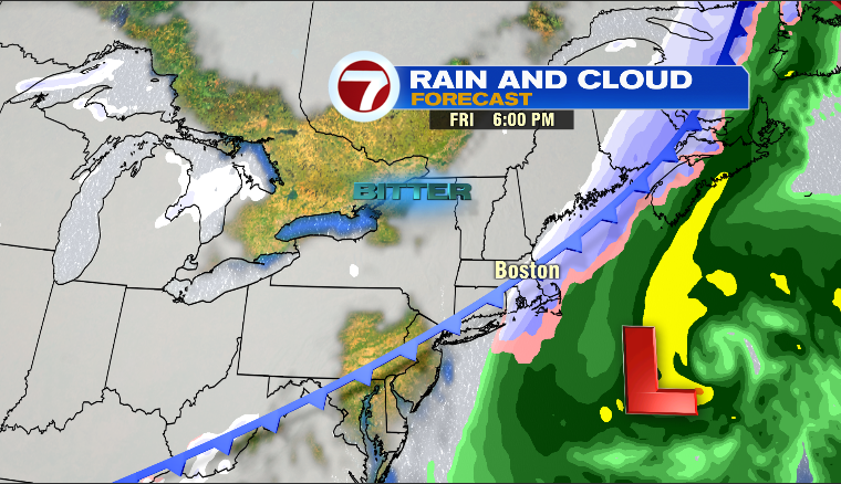
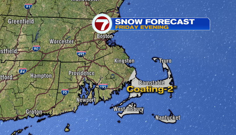
Busy. I spy an ocean storm and an arctic front. That ocean storm will spend most of its energy out over…..the ocean but I do think it will be able to produce some rain and then snow showers especially across the Cape/Islands. Shouldn’t be too much in the way of accumulating snow as temps will be falling out of the 40s and into the 30s (not conducive to quickly accumulating snows) but here is a snow potential map for Friday evening…
I think the greater effect from the ocean storm is the strong north wind developing Friday afternoon and lasting into early Saturday morning. map shows wind gust potential in that timeframe…
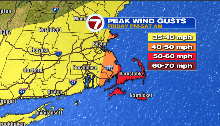
Some power disruption possible on the Cape/Islands with those type of wind gusts. After that, we re-focus are another chunk of artic air coming out of Canada for Saturday. I think it’s similar to what we experienced Tuesday…morning temps in the single numbers, afternoon temps in the teens with wind chills all day below zero
Enjoy that Thaw tomorrow!
~JR