After a gray, gloomy, misty and foggy start this morning we certainly saw some improvement this afternoon. For some sooner than others. Central Mass saw sunshine by early afternoon but it took until almost 5pm for Boston and the coastline. That return of the sun boosted temperatures to the 80s for many of us today!

The sun, the warmth, and the humidity is priming the atmosphere for strong to severe storms later today. The humidity was no joke today. Dew points climbed into the 70s which is well into the tropical range of things. It was thick outside. Unfortunately that’s not going anywhere anytime soon. We’ll keep the humidity around all the way through the weekend.

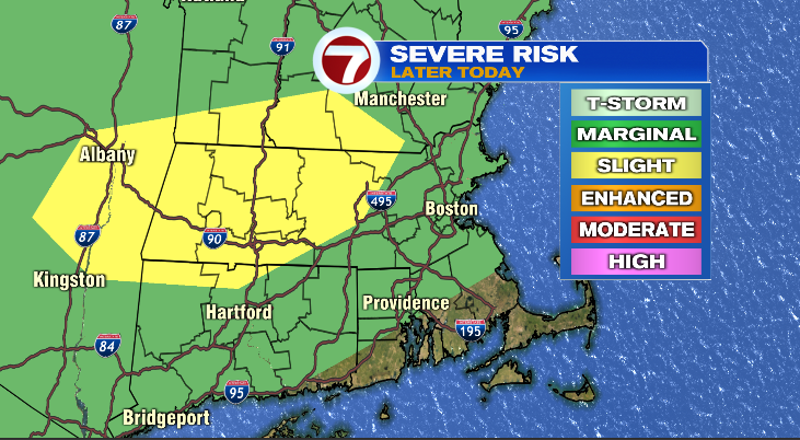
The greatest risk of severe weather tonight is for areas outside of 495 — the yellow shaded area below. The risk is less for the green shaded area but we’re not ruling out a strong to severe storm in those areas either this evening. The greatest risk for storms tonight will be gusty and potentially damaging winds.

These storms will move through Worcester County between 6-8pm and Metro West to Boston 8-10pm. For many of us these will be near or after dark so don’t let your guard down for storms later this evening. Below is a rough timeline.


On the backside of this, we have a glorious end of the week — which we are WELL OVERDUE for. Thursday will be the sunnier of the days though Friday will still feature sunshine. I think the difference is those building cumulus clouds on Friday. Some of which could even end up producing an isolated thunderstorm. Either day will be fantastic to get outside and finally enjoy the sun!
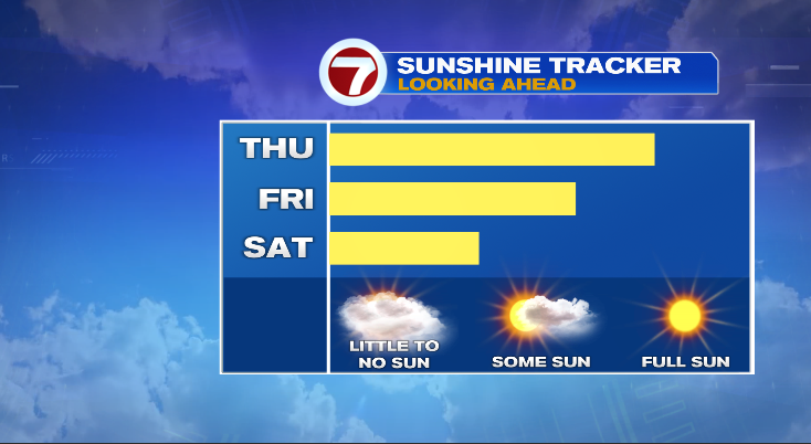
Friday though will be the warmer day. But just barely. We will have a sea breeze on Thursday which will keep the coastline in the 70s, but still a couple of great beach days to close out the week.