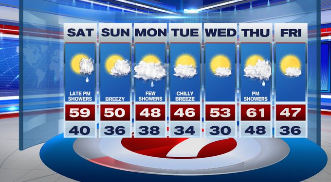
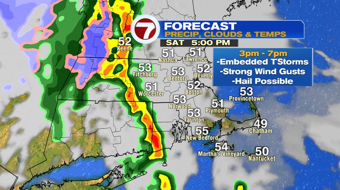
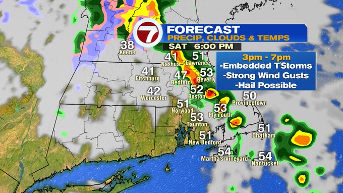
The bulk of our Saturday is dry, however, we will have a line of showers with embedded thunderstorms marching across the Bay State around sunset. Some of these storms could be on the strong to severe side with gusty to damaging wind gusts and hail possible. The timing will be from 3pm to 7pm Saturday.
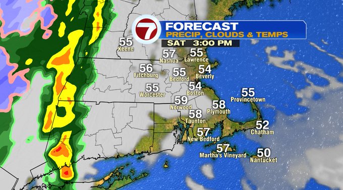
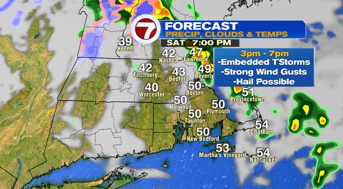
Ahead of the line of showers/storms, it will be a great time to clean-up after yesterday’s wild weather that brought damaging winds, power outages, and some flooding for portions of southern New England. Highs today will stretch into the upper 50s to low 60s this afternoon.
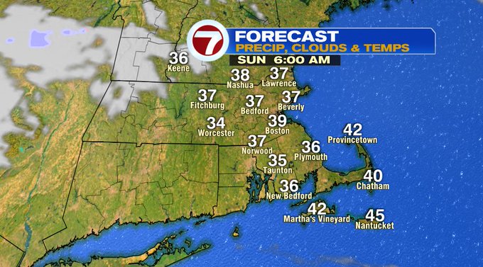
Tonight, a few showers linger around 8pm, otherwise we’ll see a gradual clearing of the skies allowing temperatures to dip into the 30s to low 40s.
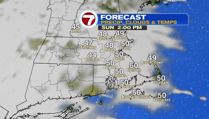
We start off with sunshine Sunday and then we’ll see increasing clouds Sunday afternoon. It will be cooler tomorrow with highs into the upper 40s to low 50s.
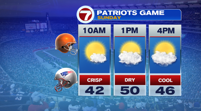
For the Pats game at Gillette, temperatures will be around 50 for kickoff and then fall back into the 40s by the end of the game.
We have another system approaching the region late Sunday night into Monday. That will squeeze out a few showers for us in the form of rain, some high elevation snow will be possible for the Berkshires and southern VT.
It’s a cooler start to the work week with highs into the 40s, but we see those temperatures warm-up Wednesday and Thursday with highs into the 60s Thursday.