The last few days have featured the heat coupled up with the humidity and thankfully, the humidity is the one that will be pushed out to end the week on a much more comfortable note.
This evening, a few lingering showers associated with a passing cold front will continue to move out, creating a drier Wednesday evening for your outdoor plans.

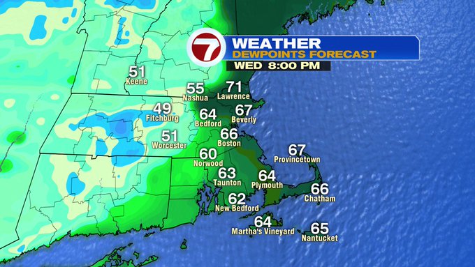
Tonight, it will be much more comfortable than last night as dewpoints will drastically drop.

Between 8PM Wednesday to 8AM Thursday, dewpoints will go from the mid to upper 60s to low to mid 50s.

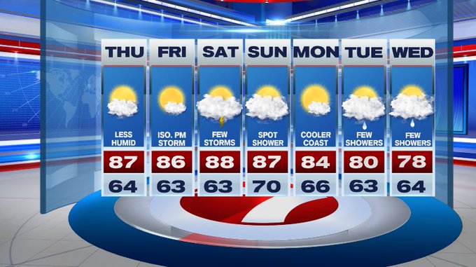
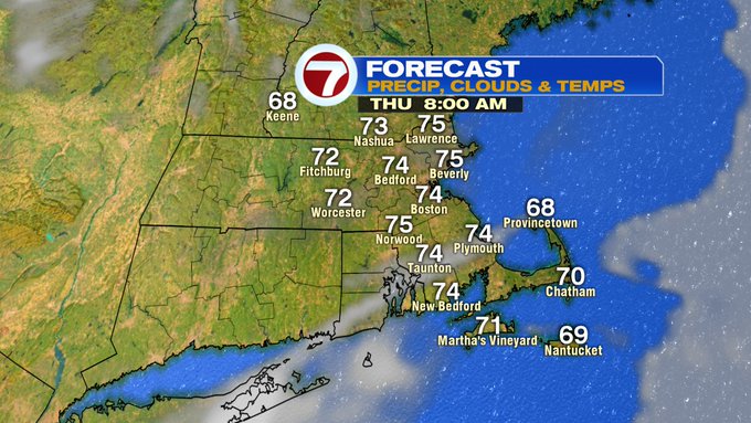
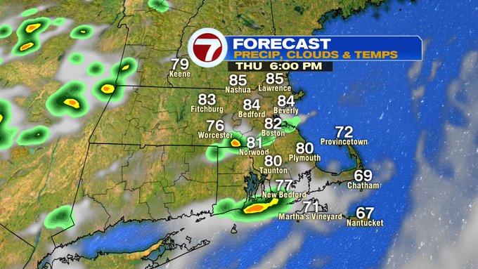
Thursday brings mainly sunny skies with highs into the low to mid 80s (away from the Cape where temperatures will be in the upper 60s to low 70s).

Although Thursday’s highs are very similar to today, it won’t feel as unbearable due to much lower dewpoints.

A passing shower cannot be ruled out Thursday late afternoon/early evening, but mainly south.

As for the weekend, another front swings in Saturday afternoon, sparking off some thunderstorms. We’re not tracking a washout, but just be weather aware for your outdoor plans. A spot shower is possible Sunday (mainly in the morning), otherwise, the second half of the weekend is looking dry.
Next week starts off dry, then some shower chances return along with a slight cool down Tuesday and Wednesday.