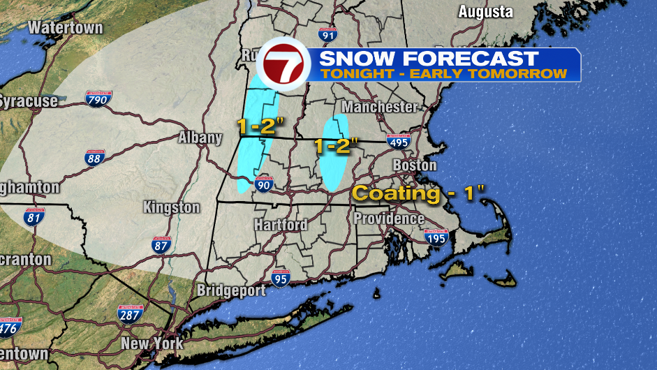
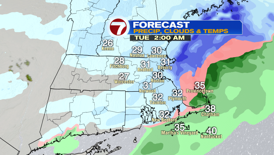
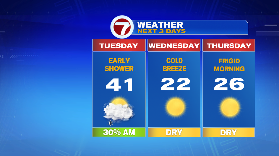
7Weather- A weak system brings light snow tonight with some lingering showers early Tuesday morning.
Expect flakes to start between 9-11 PM tonight. We’ll have some light snow around until 1-2AM, and then this system starts to move out. I think a majority of us will get a coating from this with an isolated 1″ possible.
Roads will need to be treated for tonight. Untreated surfaces will be slick tonight-early tomorrow morning.
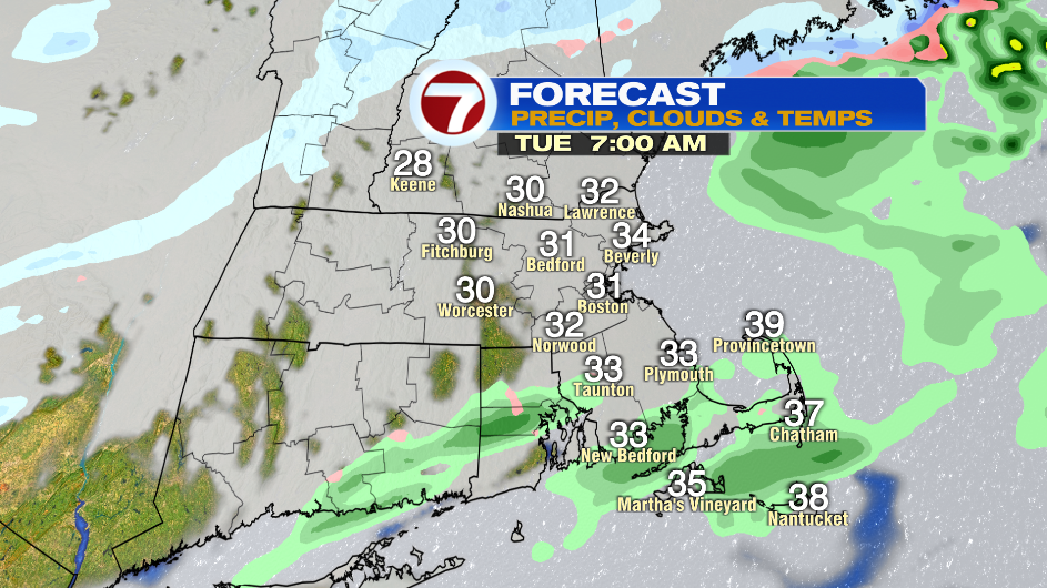
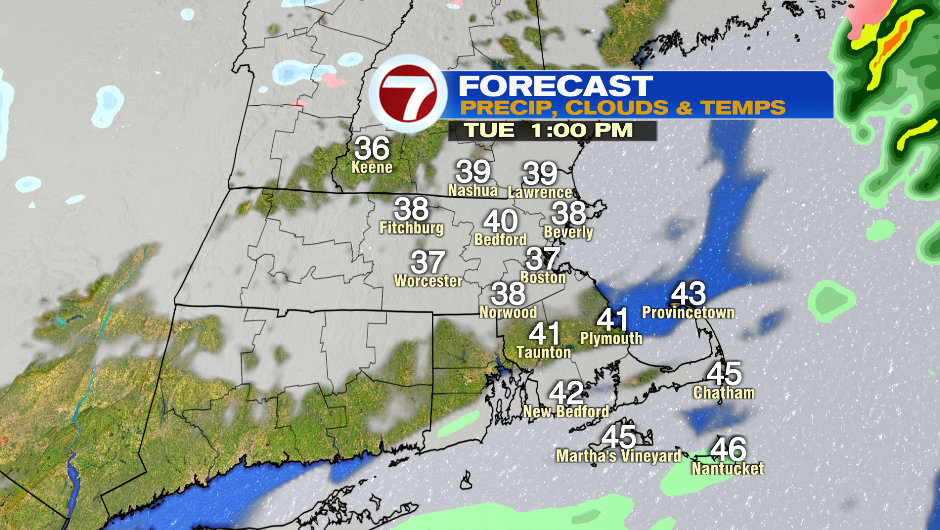
Skies gradually clear throughout the day so we will have a mix of clouds and sun. Highs reach into the upper 30s and low 40s before cold air arrive Tuesday night into Wednesday.
Temperatures will be in the mid and upper teens Wednesday morning, and we don’t move much with highs in the low 20s. A cold breeze will make it feel like the teens in the afternoon.
There won’t be much wind around Thursday morning, but even just a very light breeze will make it feel frigid. The day starts in the single digits, but we rebound into the mid 20s in the afternoon.
We’ll see a few, light snow showers Friday as a cold front moves through the region.
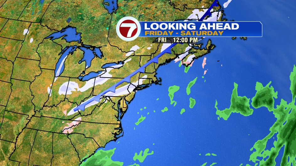
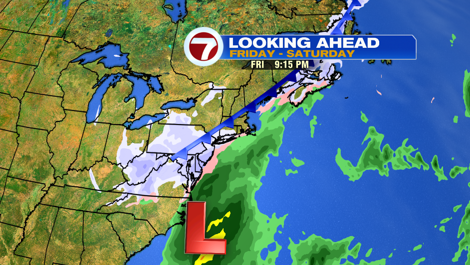
A low pressure system is expected to develop off the coast of the Carolinas on Friday. It’s too early to talk about snow amounts, but we do know it is a strong low pressure that could bring heavy snow, wind and coastal flooding to New England Friday night into Saturday.
The track (location of the low) will determine the impacts of this storm. If it hugs the coast then we will have moderate to high impacts, if it is further offshore then there will be minimal impacts from this system. Stay tuned!