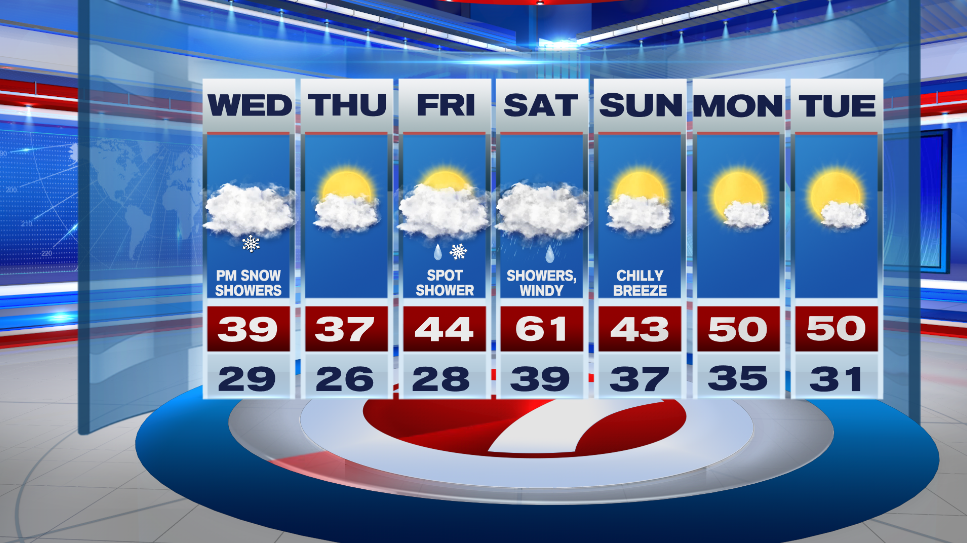
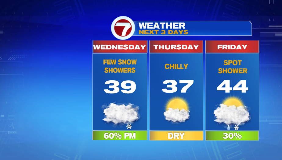
7Weather- Chilly air arrived last night, and now we’ll see snow showers as our next weather maker moves in tomorrow.
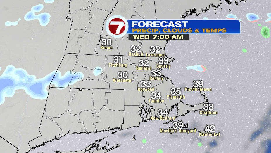
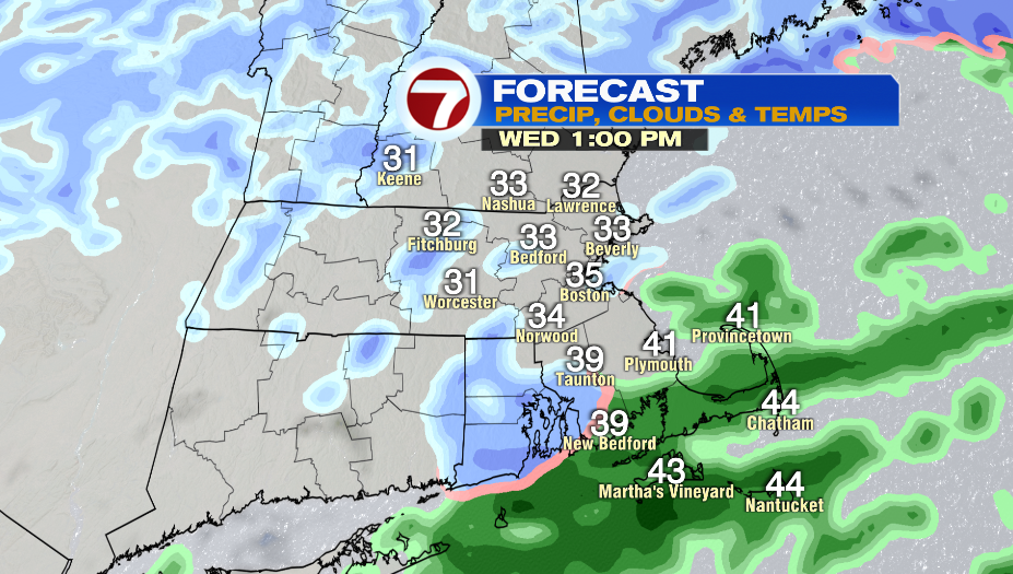
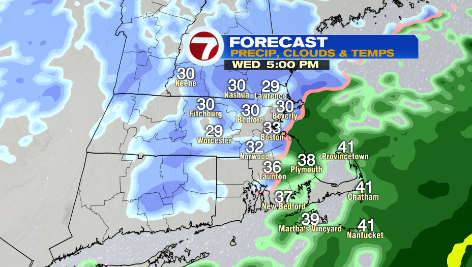
Temperatures will be right around freezing tomorrow morning. It will be cloudy and you might see a few flakes. Patchy, light snow starts in the early afternoon and becomes steady closer to sunset and after sunset.
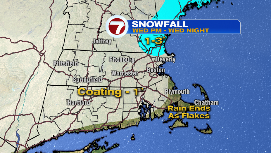
Temperatures will be above freezing for southern Bristol and Plymouth Counties and the Cape & the Islands throughout most of the event so rain ends as a few flakes in these areas with no accumulation expected.
Most of us will see a coating to 1″ of snow. There is a small area in the North Shore and the Seacoast into New Hampshire that could get a little more snow with the forecast between 1-3″.
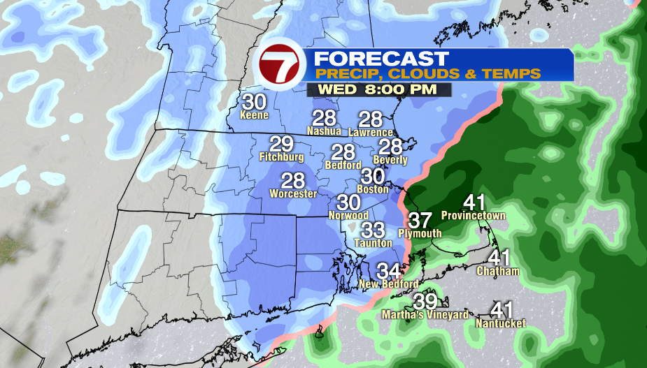
The steadies snow will fall from 6-10PM. Expect slow downs for the evening commute with isolated slick spots.
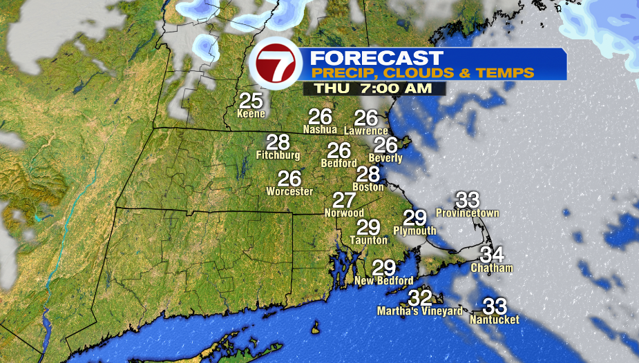
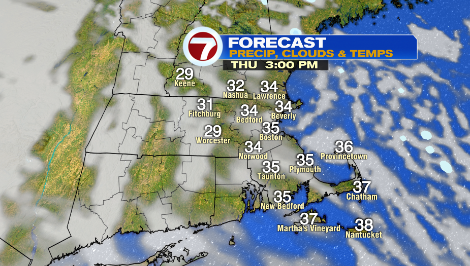
This system clears out on Thursday, and it looks like we’ll have sunshine and in the morning. It will be a cold start to the day with temperatures in the mid and upper 20s. The afternoon is partly sunny and chilly with highs in the mid 30s
You could run into a few sprinkles or flurries on Friday. The week ends mainly cloudy with highs near normal in the low and mid 40s.
Saturday is a warm day in the 60s. Just like Monday’s weather, we’ll have rain and wind along with the warmth. A cold front comes rushing in Saturday night dropping temperatures into the 40s Sunday. Monday and Tuesday look pleasant with sunshine and highs near 50º.