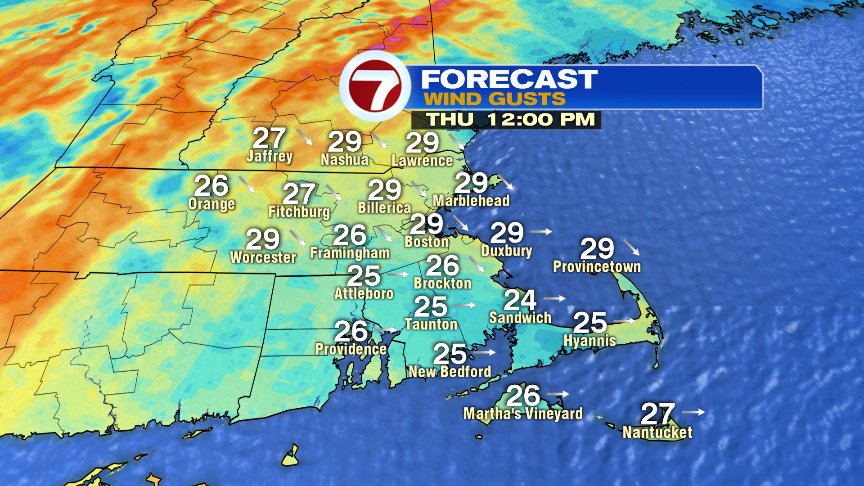
Patchy flurries and light snow showers kick off this Thursday morning as colder air starts to work into New England. In fact, temperatures won’t move much through the day, with highs averaging the mid to upper 30s. Factor in a wind that gusts 20-30mph, and wind chills will hold in the 20s.

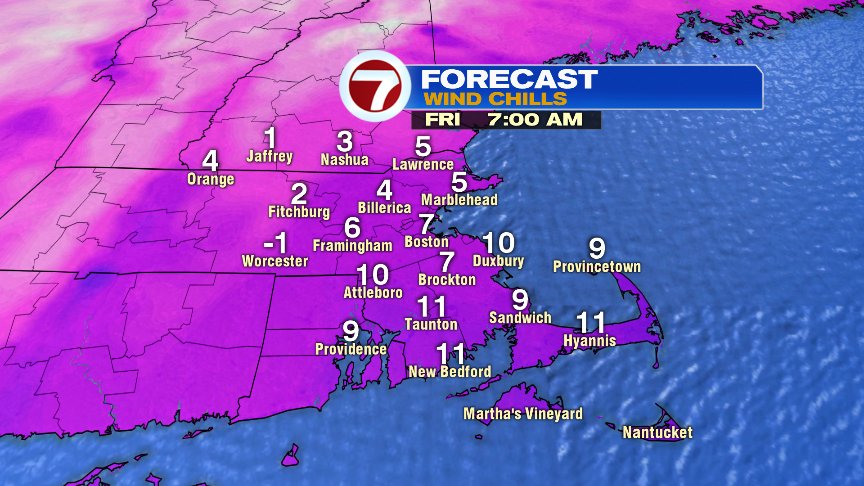
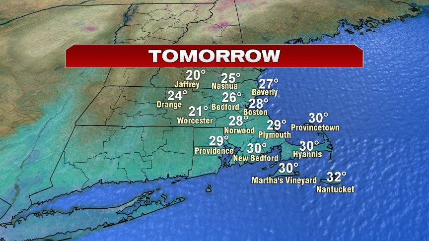
Lows tonight drop back into the teens and low 20s, and combined with a busy breeze, will allow for wind chills to fall back into the single digits to near 0 degrees. So we start Friday off on the much colder side, and stay cold through the day as highs only recover into the mid to upper 20s and a gusty wind holds wind chills down into the upper single digits and lower teens. It’ll be dry though as mostly sunny skies prevail.
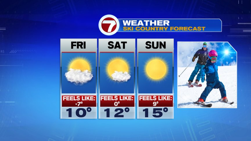
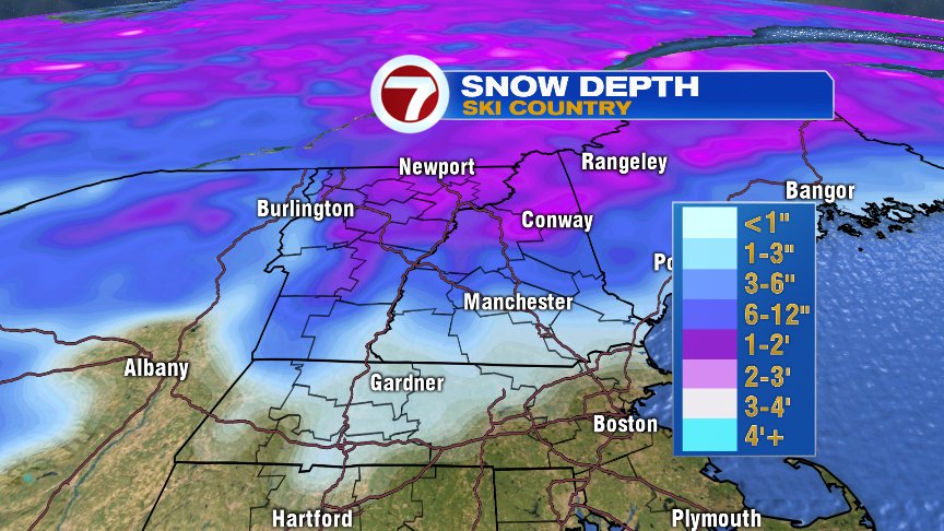
Despite the lack of snow pack over southern New England, Ski County has had a great week, with many ski resorts picking up a foot or more of snow over the last couple of days. Ski conditions up north should be great this weekend, just bring plenty of layers as the cold air will be there too. Nothing record breaking, but certainly a bit chilly to say the least.
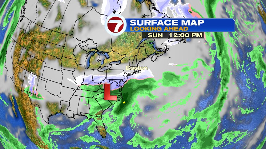
It’ll remain dry through the weekend across much of New England, aside from a few flurries or patchy light snow Sunday near the South Coast. Most of the snow from the storm to our south will be focused across the mid-Atlantic.
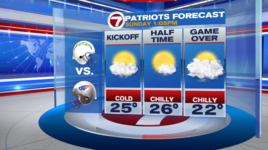
Kickoff temps at Gillette will run into the 20s and winds will be light. Sure, it’ll be cold, but nowhere near as cold as that game 15 years ago when the kickoff temp was 4 degrees and wind chills ran near -10.

Have a good day.
@clamberton7 https://twitter.com/clamberton7