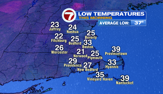
It was a cold start to our Saturday with temperatures dipping into the lower 20s for quite a few locations. For Boston, we dipped to 33° and we haven’t been that cold since early April.
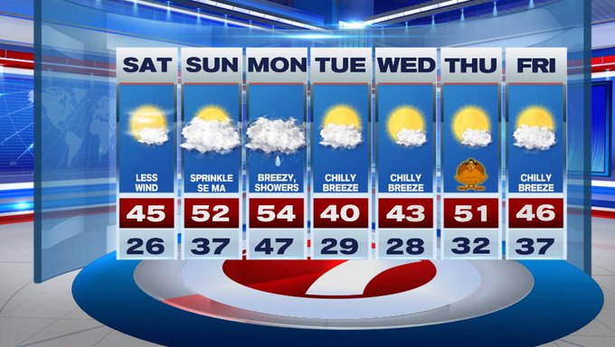
Today, temperatures bounce back into the mid 40s under mostly sunny skies.
Later this afternoon into the evening, we’ll see high clouds build in from the west, associated with our next front that will bring a few showers to the region late Sunday into Monday.
Tonight, under mainly cloudy skies, temperatures will not dip as low as earlier this morning. Expect lows to be in the 30s for much of the region.
Speaking of showers, a few sprinkles are possible for SE MA tomorrow, otherwise our scattered shower threat holds off until Sunday night (around 10pm).

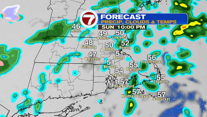
Those scattered showers linger into Monday, along with breezy conditions. The showers should push out in time for the Monday evening commute.

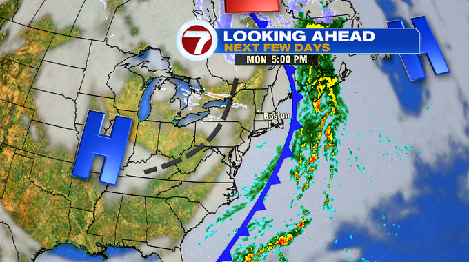
As the front clears the region, colder and drier air settles in for Tuesday and Wednesday — great for your holiday travel plans leading up to Thanksgiving.

By the time we reach Thursday, temperatures moderate back to seasonable conditions with highs around 50° for the holiday. We slide back into the 40s by Friday.