Overall, a nice September weekend on tap after a chilly start earlier this morning. Quite a few locations saw the coldest air since mid-June, that’s nearly 3 months.
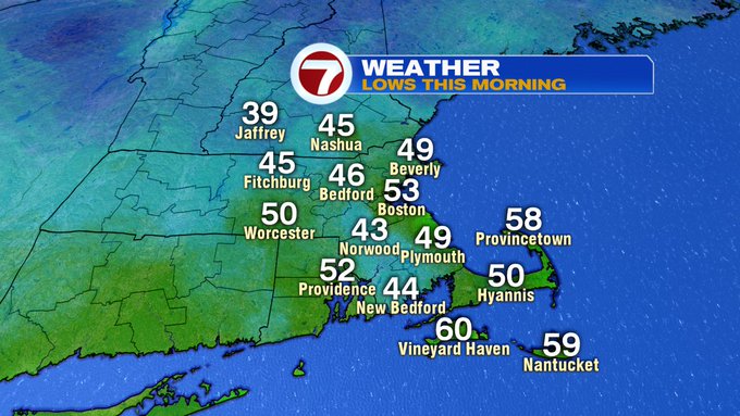
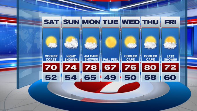
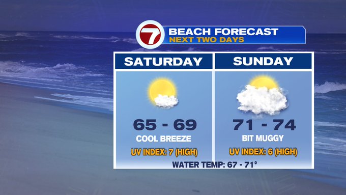
The chilly air coupled up with clear skies and low humidity gave it that fall-feel to our Saturday morning. With mainly sunny skies, temperatures will rebound to near 70 this afternoon inland, slightly cooler at the coast due to an onshore breeze.

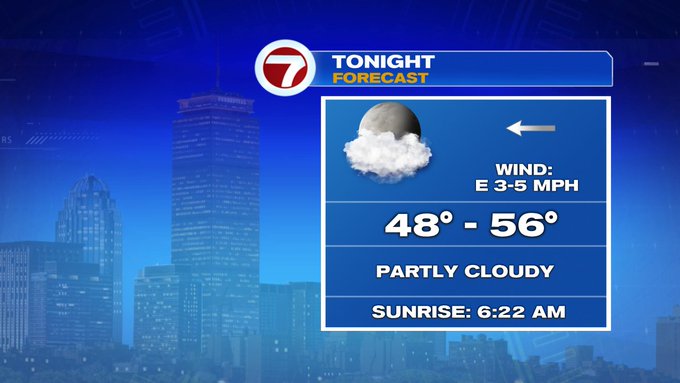
Tonight, we’ll see increasing clouds and temperatures will be cool, but not nearly as chilly a last night. Lows tonight dip into the upper 40s to mid 50s.
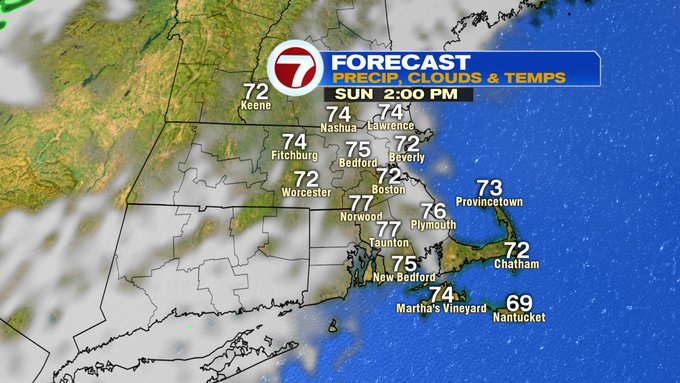
Tomorrow, we’ll see partly cloudy skies and slightly higher dewpoints as well as warmer temperatures.
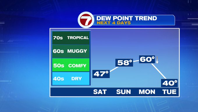
Highs will stretch into the mid to upper 70s with dewpoints in the upper 50s (which is still comfortable).

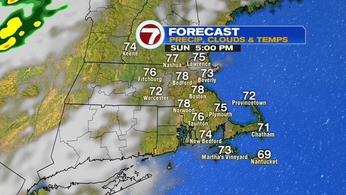
A passing shower is possible Sunday night, but the amount of rain looks paltry as the cold front takes it’s time sliding into southern New England.
The next work week is also mainly dry, with highs in the upper 70s Monday before diving towards a fall feel Tuesday with highs into the upper 60s.