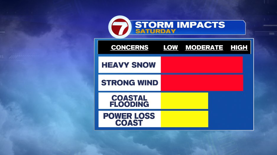
Confidence has greatly increased on a major winter storm hitting southern New England through the day on Saturday. It’s bringing heavy snow, strong wind, and coastal concerns. The breakdown of each one at a time below:
COASTAL CONCERNS
If you’re on the coast, this is one to prepare for. Tides are astronomically high as we head toward the end of the month so it doesn’t take much to see splash over, let alone minor or moderate coastal flooding. The high tides on Saturday occur roughly at 8am and 9pm. Give yourself a two hour window for concern on either side of that so 6-10am and 7-11pm.
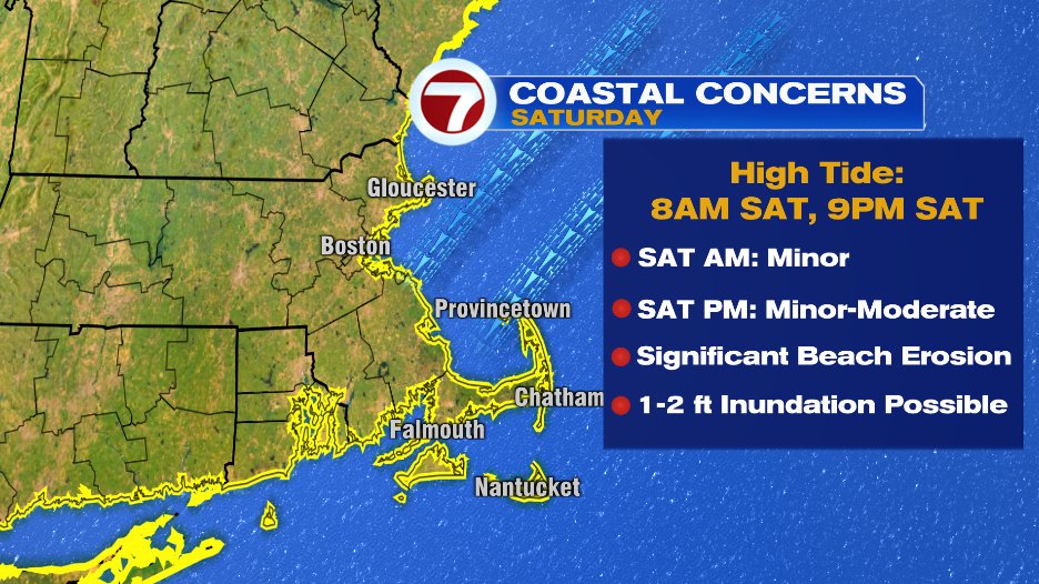
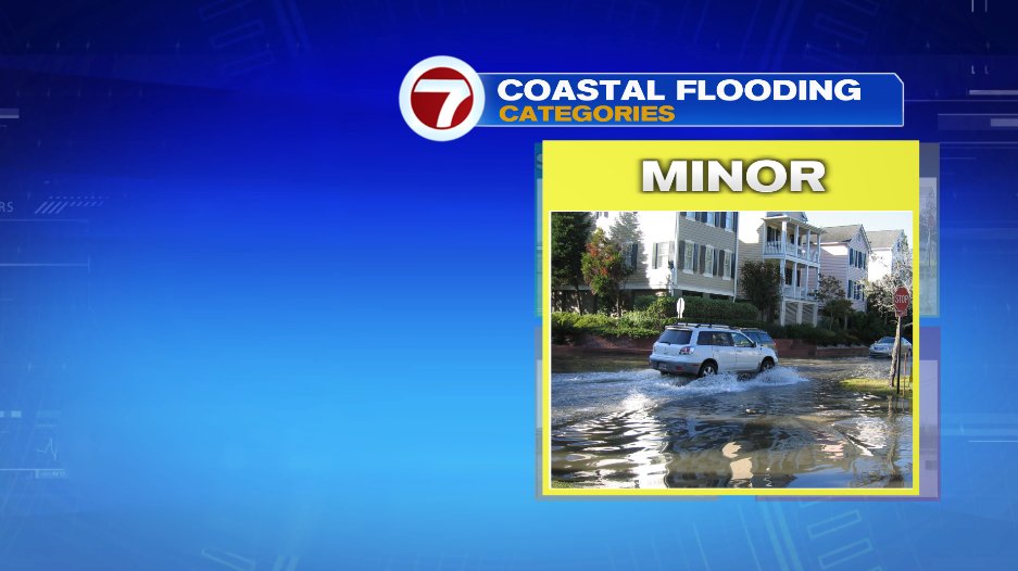
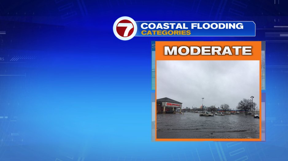
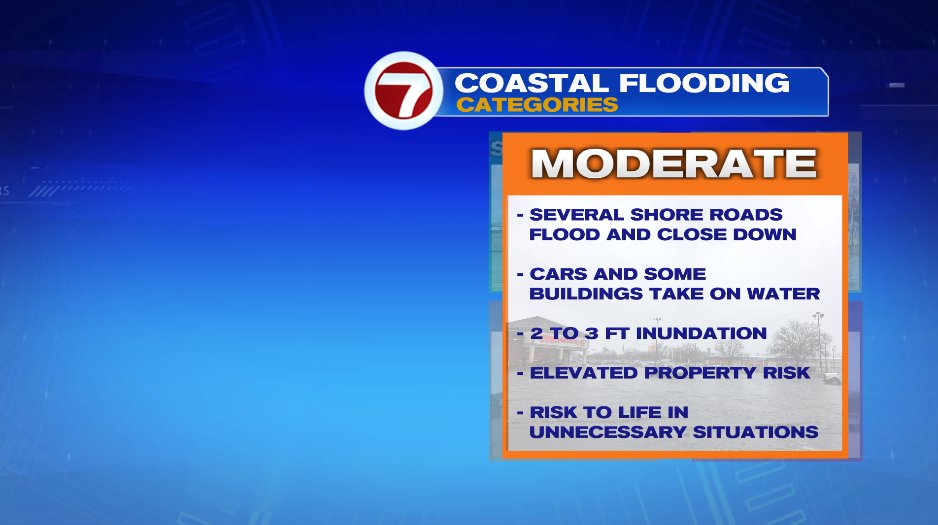
For the most part we’re looking at minor coastal flooding with pockets of moderate. If you think back to the storm we had on MLK day, that was minor with pockets of moderate coastal flooding. Minor will be most common. Here’s what that looks like and what it means:
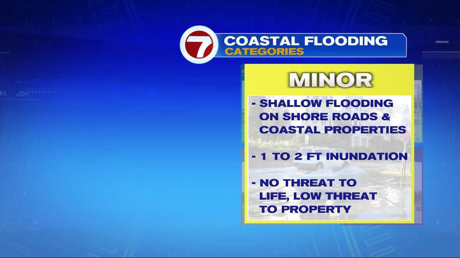
Moderate coastal flooding is a little more concerning. Here’s what that looks like and means:
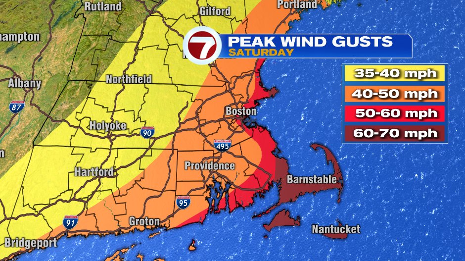
WIND
Wind will be gusty and possibly damaging on the coast. Most east of 95 north of Boston and east of Route 3 south of Boston will see 50-70 mph gusts. The good news is for most of us this will be a light fluffy snow. It’s not going to be cement on the Cape, but the consistency will be a little wetter. So a weighted down tree limb or power line with a 60+ mph wind gust will not only lead do damage but also power outages.
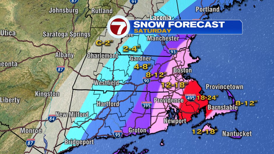
SNOW
Ok best for last. I left this last for a reason. After we talk about snow totals, we’ll talk about the word blizzard and what that is and is not. So without any more delay, here’s the snow map. Just about everyone is in line for significant snow and there will be tweaks to this forecast between now and Saturday. Right now it seems the most likely (not for sure) tweaks would be expanding the red blow north toward Boston and pulling the pink and purple bands farther west. We’ll see.
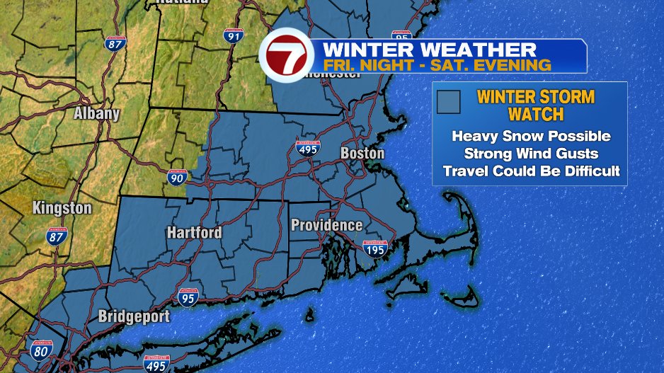
Between the heavy snow and strong wind/blowing snow, a winter storm watch is in effect for Saturday because travel will be EXTREMELY difficult.
Ok so to address the “blizzard” chatter. The term has been thrown around (a little recklessly) a lot in the past few years. But not just any storm that brings snow is a blizzard. In fact the term blizzard has nothing to do with the amount of snow that falls. You could have 50″ of snow and that doesn’t make it a blizzard.
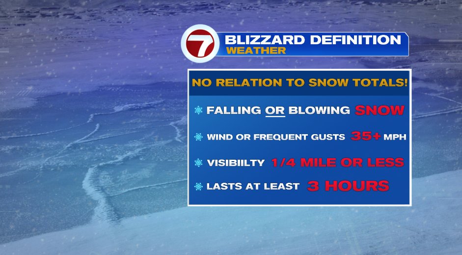
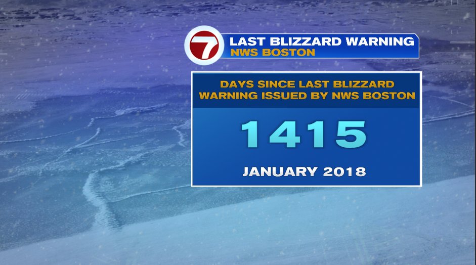
To officially be a blizzard you need falling OR blowing snow. So snow from a few days ago with blue skies over head would work! Sustained winds of 35 mph or more (or frequent gusts) which create visibilities of 1/4 mile or less. All of this has to last for AT LEAST three hours. It’s been a while since this has occurred. In fact the last time was 1,415 days ago — January 2018. This one has the potential to do it again so it really is a serious travel concern.
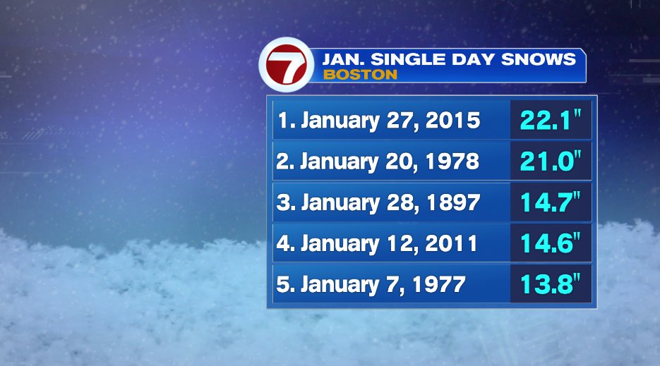
We’ll see how much snow falls in Boston but this storm has the potential to be one of the snowiest January days in Boston history.