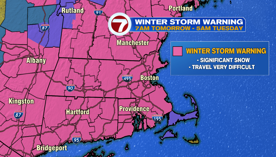
7Weather- Most of the area is under a Winter Storm Warning from 7AM Monday – 5AM Tuesday. Travel will be very difficult for the afternoon/evening commute on Monday, and travel will remain poor Monday night.
This winter storm will be around Monday morning through very early Tuesday morning. The heaviest snow will fall from 1 PM Monday – 1 AM Tuesday.
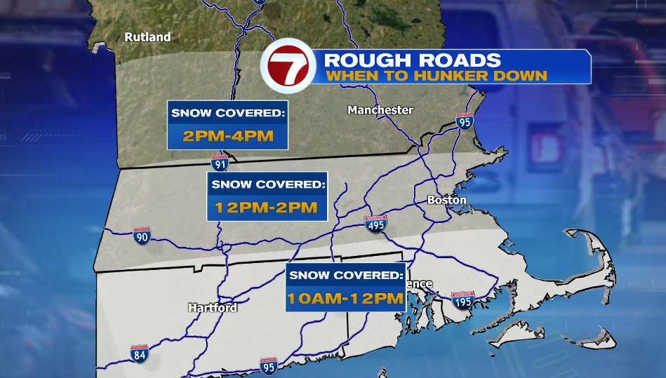
There will be flurries throughout the Monday morning commute, but we won’t see snow covered roads until the late morning/mid-day. Southeast Massachusetts will see snow covered roads between 10 AM – 12 PM. You’ll want to hunker down by 12-2 PM if you’re in Worcester County and inside of I-95. Roads will be snow covered between this time. If you’re in southern New Hampshire it looks like roads will be snow covered by 2-4 PM.
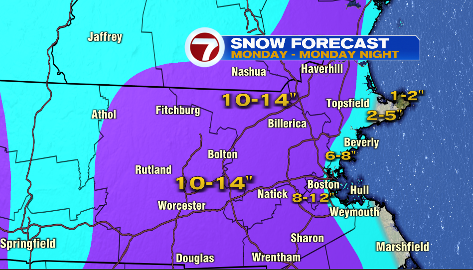
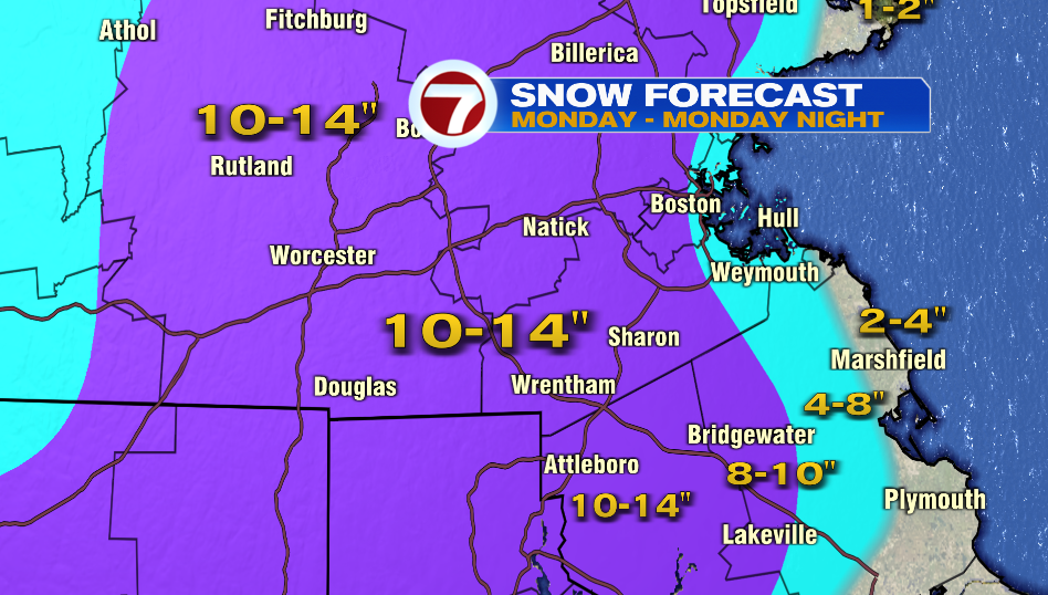
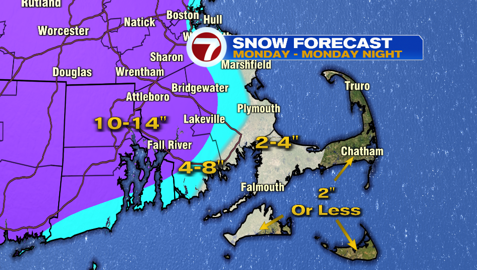
Snow Forecast:
- Boston (Logan): 6-8″
- Jamaica Plain/ Dorchester: 10-12″
- Norwood: 12-14″
- Plymouth: 4-6″
- New Bedford: 6-8″
- Worcester: 12-14″
- Fitchburg: 10-12″
- Nashua: 10-12″
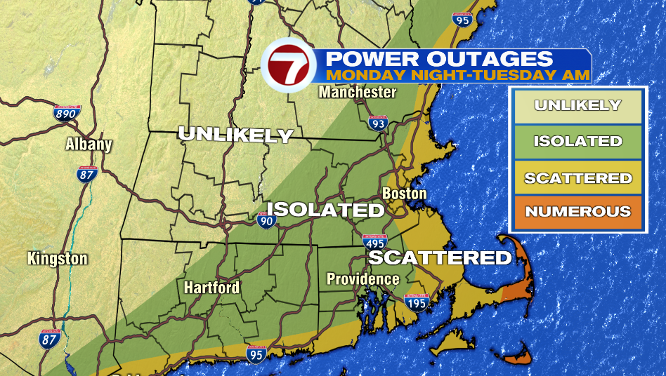
We will have gusty winds along the coast. That along with the possibility of 4″+ of wet/heavy snow at immediate coastline could lead to scattered power outages.
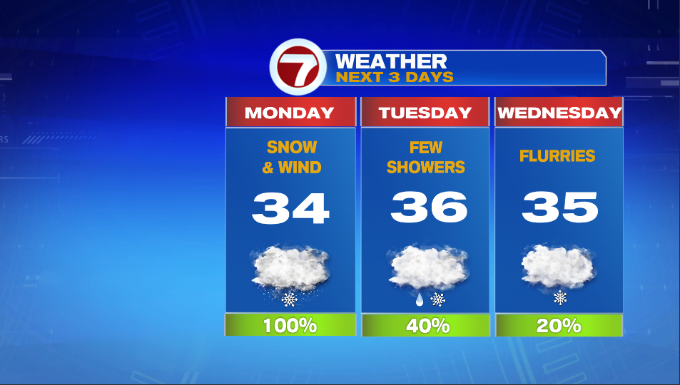
The main event is done by 2-3 AM. After that, we are left with a few rain/snow showers throughout the day on Tuesday.
The Tuesday morning commute will have slick pots, but we’re we think crews will be able to clear main roads.
Wednesday has a flurries here and there with highs in the mid 30s.