First off… I hope all you moms had a great weekend. While it was a damp and dreary day yesterday, at least Saturday was about as good as it gets with temps near 70 and abundant sunshine.
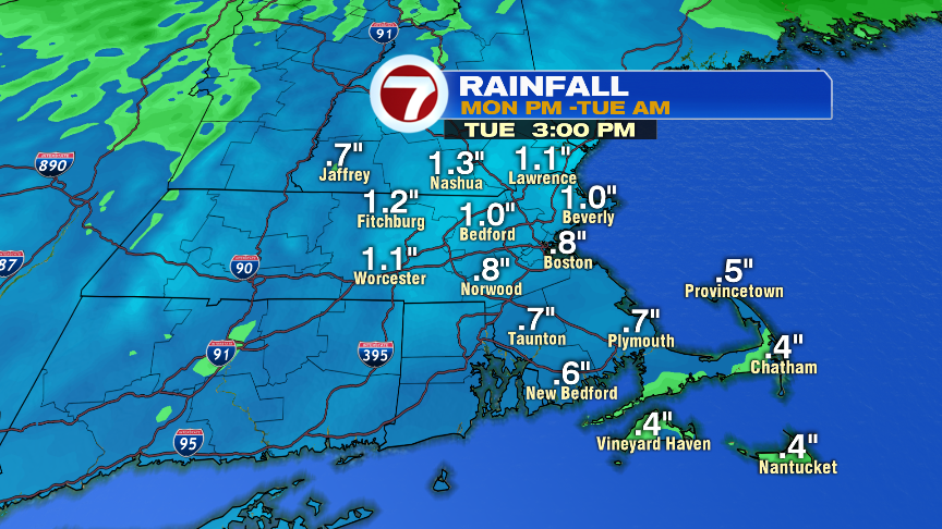
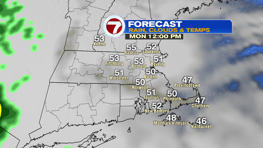
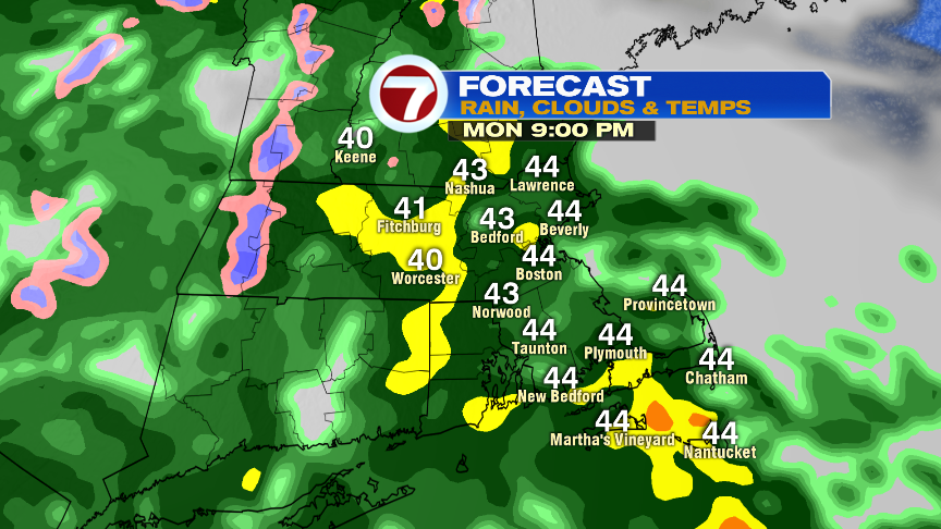
That sunny and 70 degree weather seems like a distant memory now and we won’t be having any repeats of it over the next few days. In fact, the weather goes downhill later today and won’t start to recover until Wednesday. Highs today run in the low to mid 50s with thickening clouds and scattered showers breaking out between 3-5pm. By 7pm, a soaking rain starts to settle in and that rain will be heavy at times tonight. Many locations pick up 0.50-1.00″ of water.
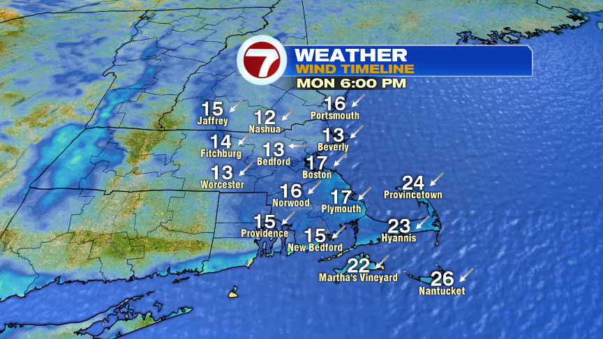
The wind from the northeast increases today, into tonight, gusting to 25mph inland and to 35mph at the coast. With the onshore breeze strong and consistent enough, there may be some minor coastal flooding/splashover around tomorrow morning’s high tide.
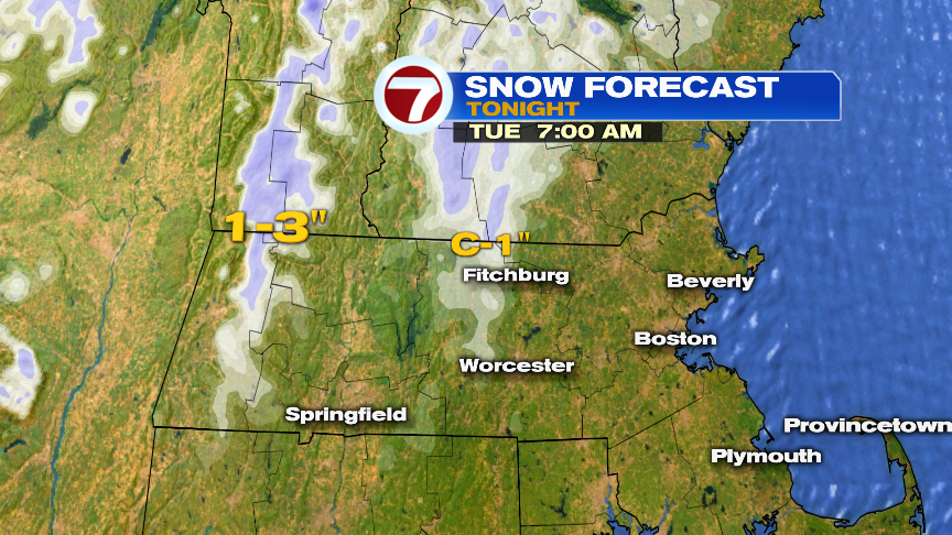
Above 1000 feet in the central and northern Worcester Hills, wet snow likely mixes in tonight as temps cool into the mid 30s. From Hubbardston to Westminster to Ashburnham, slushy coatings of snow are possible overnight. In the Berkshires, above 1500 feet, 1-3″ of snow is possible with even more likely above 2000 feet in elevation across VT and NH.
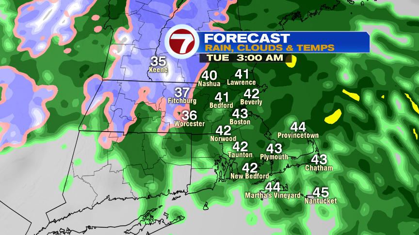
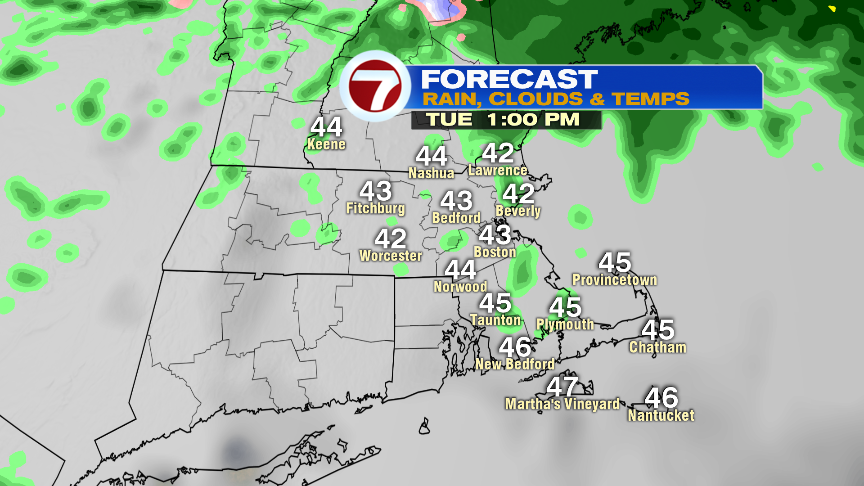
By tomorrow morning, the steadiest rain tapers to scattered showers and drizzle. It’ll be a damp and dreary day with highs only in the 40s.