Today was a gorgeous January day across southern New England! This morning featured a ton of sunshine and with the sun, temperatures climbed to near 50° today! Clouds did increase this afternoon, but hard to complain when we had a day like this. Unfortunately most of the snow in the area was torched by these warmer temperatures. Any snow that did survive, will melt away tomorrow as we climb back to near 50° once again.
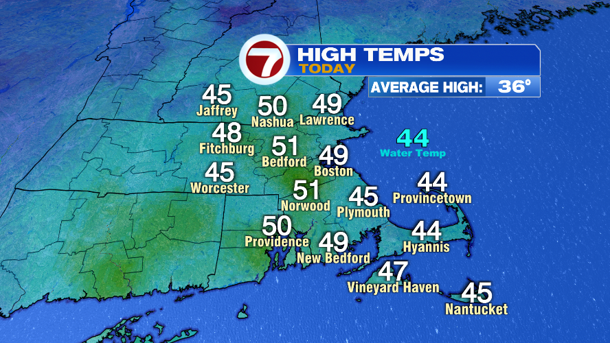
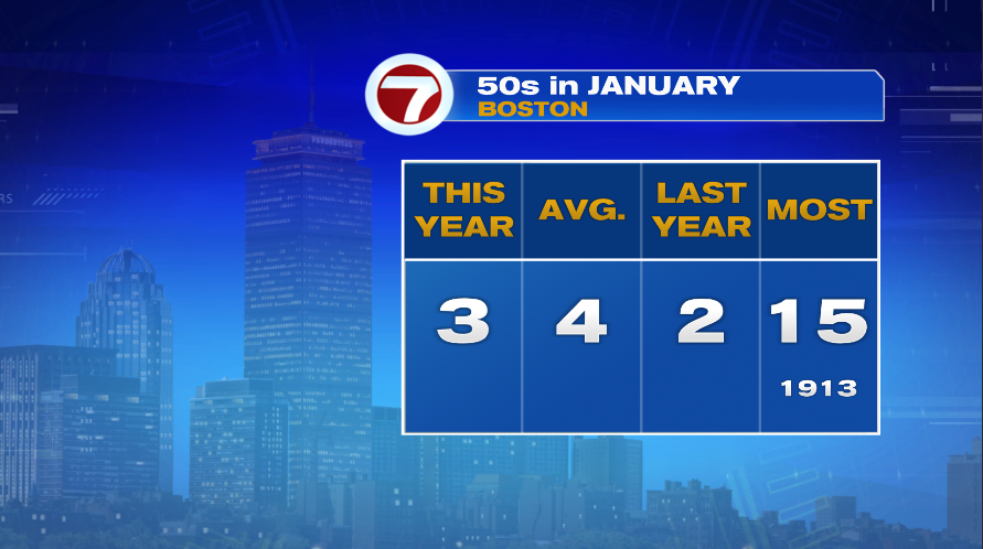
Now 50° in January isn’t totally out of the ordinary. In fact, on average, Boston hits 50° four times each January. So far this year we’ve done it three times. Obviously as you see above, we didn’t do it today, but we’ll be close again tomorrow with many of us back in the upper 40s.
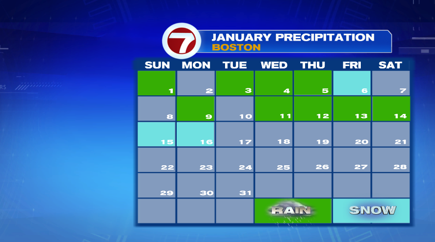
While many of us like the 50s in January, snow lovers probably do not. It hasn’t been a great winter for snow lovers in southern New England. As we turned the page into 2023 we did see a more active weather pattern set up with a majority of days this month recording some type of precipitation, whether rain or snow. As we go forward the next week to week and a half the active pattern will continue with a parade of storms heading to New England.
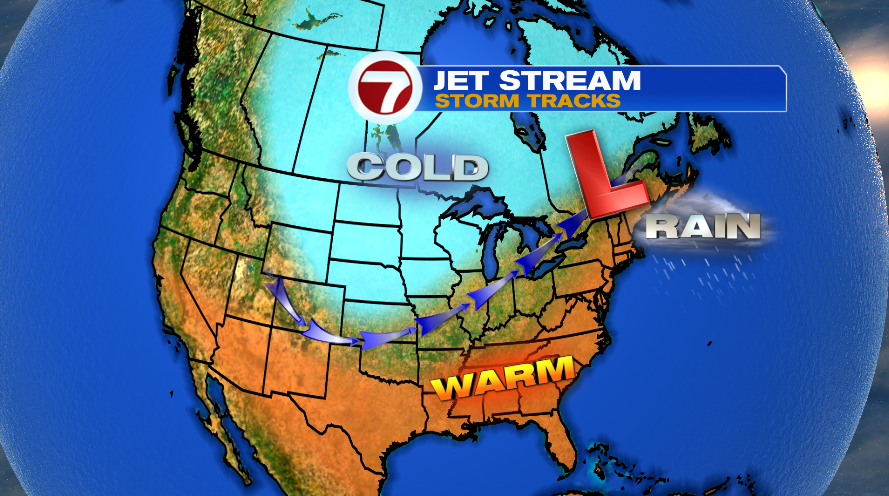
The problem is the location of the storm track. Storm systems follow the jet stream, which is the dividing line between the warm and cold air. When the jet stream is north of us, storm systems go north of us and we pull warmer air into the storm which gives us rain storms in southern New England.
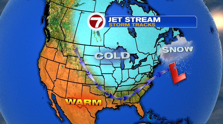
Snow lovers, you want a storm track that is south of southern New England. That allows the cold air to set up shop so when the storm system crashes into it, it falls as snow. That’s the set up it takes for the blockbuster snow storms we get in southern New England.
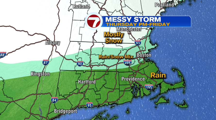
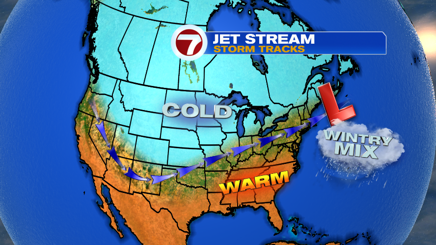
Then there’s the situation where the storm track is right over top of us. And while our pattern going forward is more active, the storm track is not quite far enough south for big snow storms in southern New England. When the storm track is right over top of us, we get the messy mix systems of rain and snow. And that’s what we’ll deal with for the next few storms that roll through. This though, could be good news for Ski Country… finally!
Our next storm up in our parade of systems will be Thursday afternoon into Friday. It looks like it comes in as rain for most of us, ends as snow for most of us, but it’s what happens in between that will determine snow numbers. We’ll have a lot of back and forth between rain and snow and maybe even some sleet which will cut back on numbers. Where that band sets up will determine our snow accumulation forecast. We’ll have a better look at that in tomorrow’s blog. Right now, just plan on a messy end to the week with rain and snow. Our next system, by the way, looks to be Sunday night into Monday and again around the next Thursday time frame (with some wiggle room of course being 10 days out at this point).
