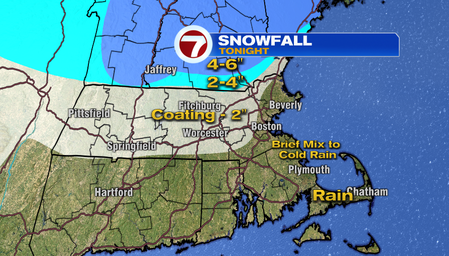
7Weather- If you already switched to a wintry mix, that’s it for you for this system. The rain/snow line continues to push north and so our updated snow map reflects that. As of right now it looks like we’ll end up on the lower end of each range with the higher snow amounts near Manchester, NH and north.
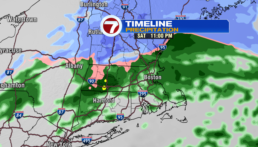
Temperatures will be around freezing for areas along and outside of I-495 tonight so you’ll still want to watch for slick spots. If you’ll be out late for a Christmas gathering or just going out to dinner make sure you take it slow even if roads aren’t snow covered.
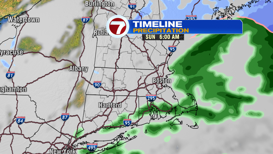
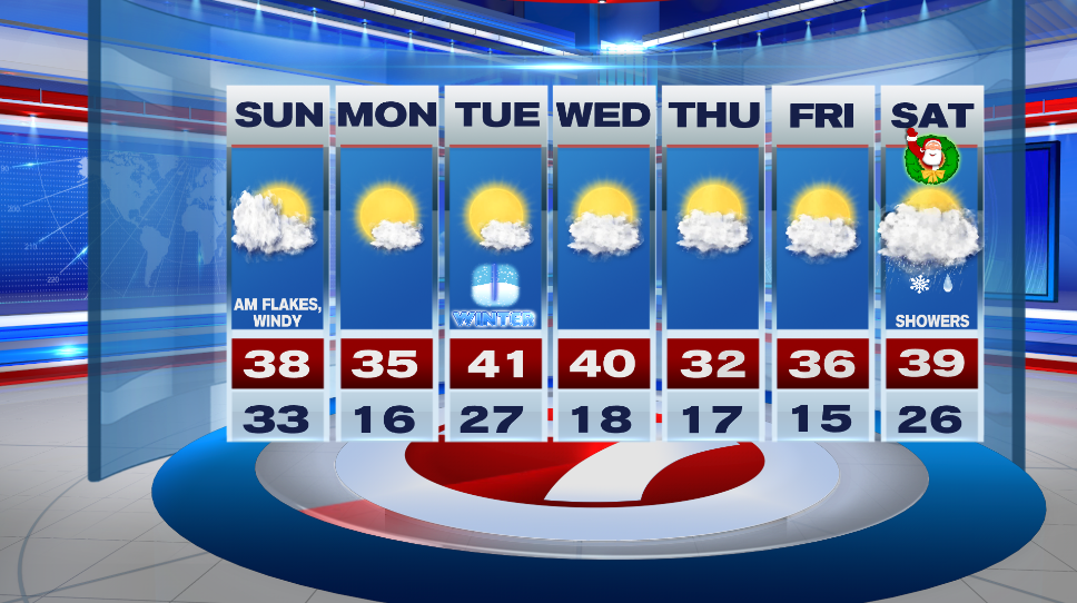
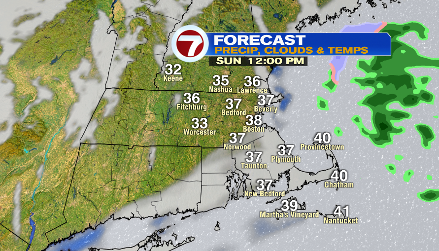
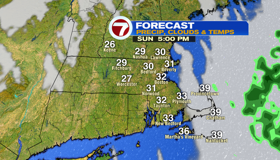
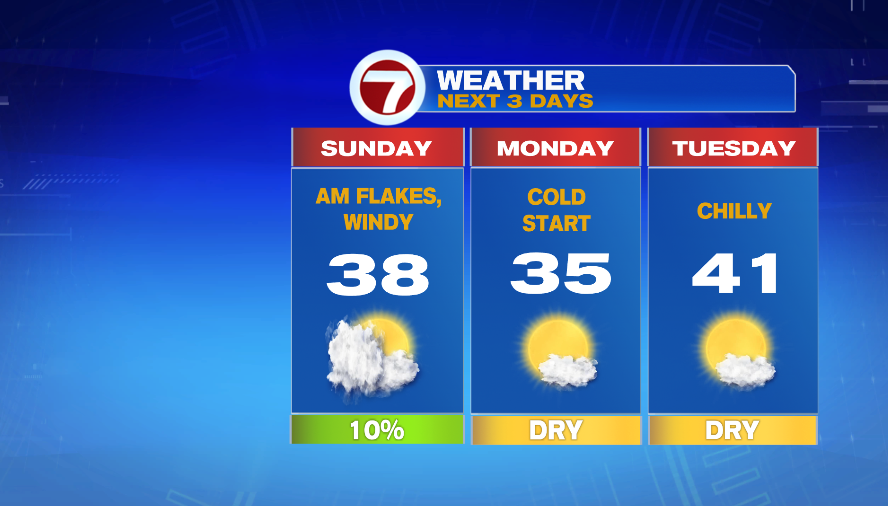
There could be a few lingering sprinkles/flurries early Sunday morning, and then we gradually clear up. Some locations will see sun by lunch time and this is when we hit highs in the mid and upper 30s. We all eventually see clearing and it is chilly in the evening with temps in the upper 20s.
Monday morning will be cold with lows in the teens. It’s overall a cold day with highs several degrees below average in the mid 30s. We go back to normal, December temps on Tuesday and there will be plenty of sun.
Wednesday also has highs in the low 40s and it is partly sunny. Thursday and Christmas Eve are chilly with morning temps in the teens and afternoon highs in the 30s. There’s a warm front lifting through the area on Christmas Day. This could bring in a few showers. If they come in early enough, we could see a wintry mix in the morning. If it comes in later in the day then it will all be rain.