Before we break down the mess that arrives around midnight tonight, let’s talk about today. It’s another cold start with temperatures this morning falling to near if not below zero.
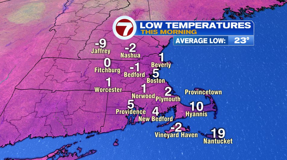
In fact, this was our second coldest morning this entire winter. Probably not surprising is what is 1st place… yesterday morning. It’s been a pretty chilly first few weeks of January with all of our top six cold mornings happening in the last 2 weeks.

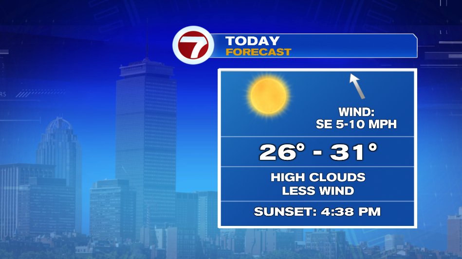
That said, we’ll have a decent afternoon on the way. Temperatures will be about 10 degrees below average — in the upper 20s, but with light wind and full sun it really will be a decent afternoon to be outside. Especially with what’s on the way later tonight and Monday.
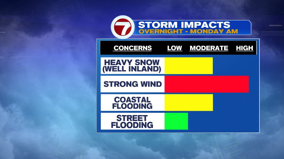
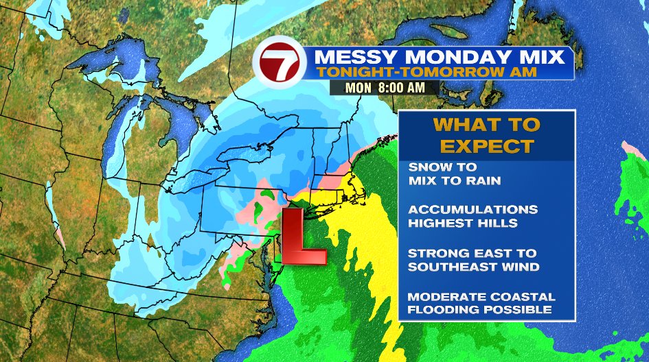
The storm on the way will bring all of our typical powerful storm threats: heavy snow, strong winds, and coastal flooding. I’ll break it down one threat at a time below.
SNOW
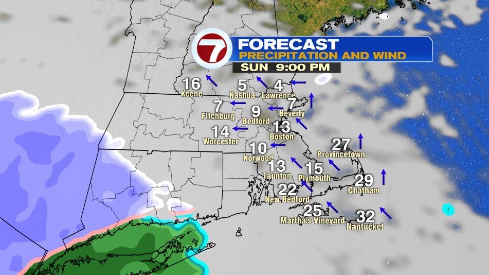
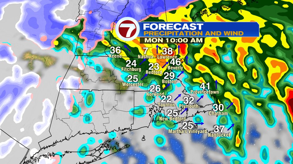
For most of us this IS NOT a snow storm. The storm will arrive around midnight and it is BRIEFLY snow for everyone. Strong southeast winds off the warm ocean will quickly change the snow to rain for most of us within just a few hours. It really is going to be an elevation snow, where the cold air will hold on a lot longer. Keep in mind, the snow map below is what will fall overnight while we sleep. By the time you walk outside tomorrow this will be rain (and heavy rain) for a majority of us and will wash a lot of, if not most of the snow accumulations away.
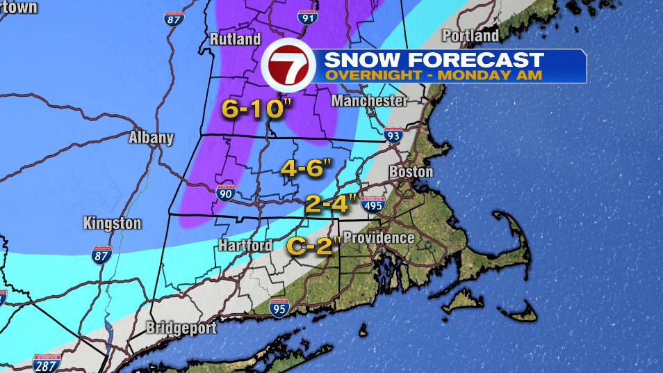
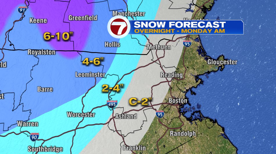
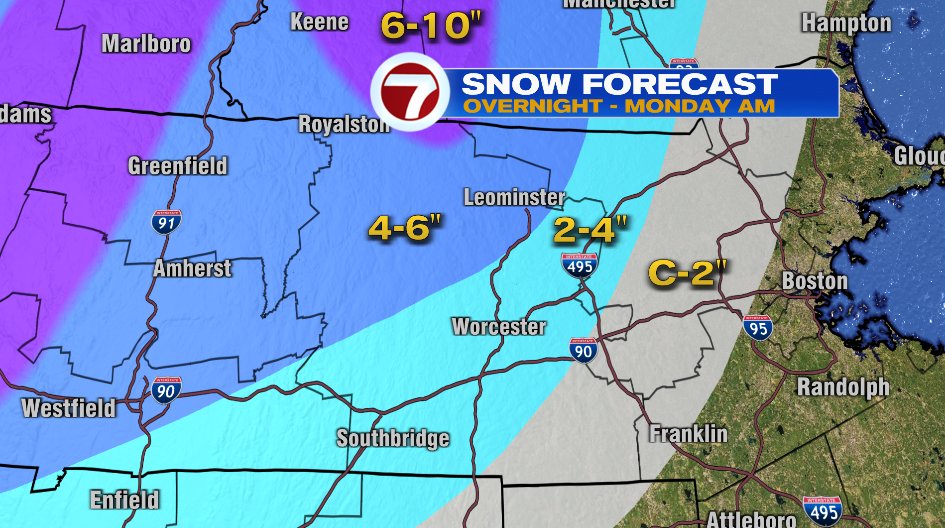
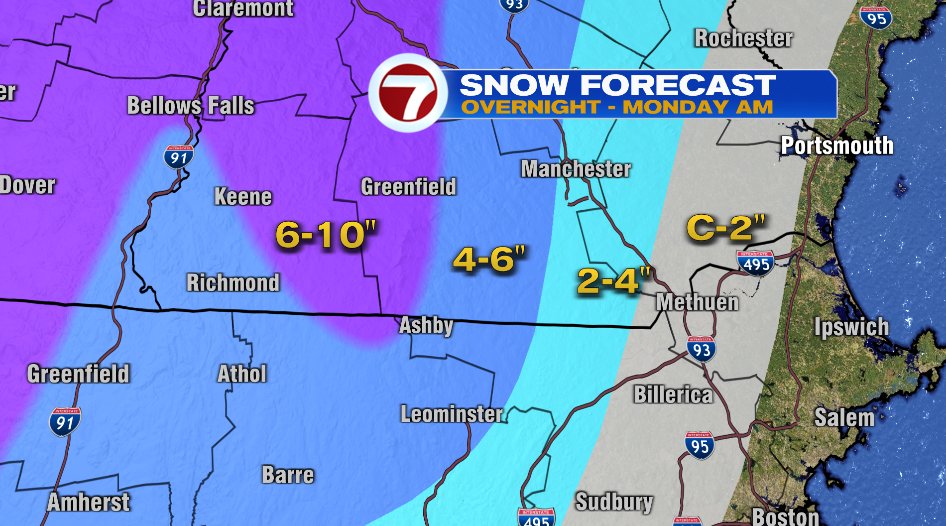
Where snow amounts are highest and where snow will hang on a bit longer, there is a winter storm warning in effect. Snow will accumulate on roads and travel will be slow/difficult overnight and Monday morning. Most of us between 495 and 128 are under a winter weather advisory. That is less for the snow and more for the “mess”. Travel will be slick and slippery as we see a mix of snow to sleet to rain tomorrow morning.

WIND
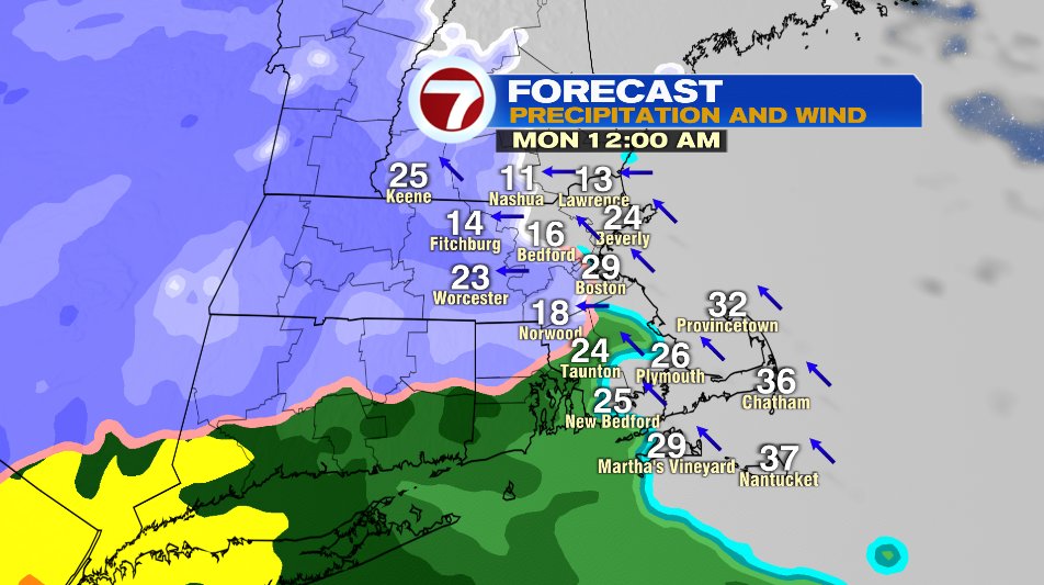
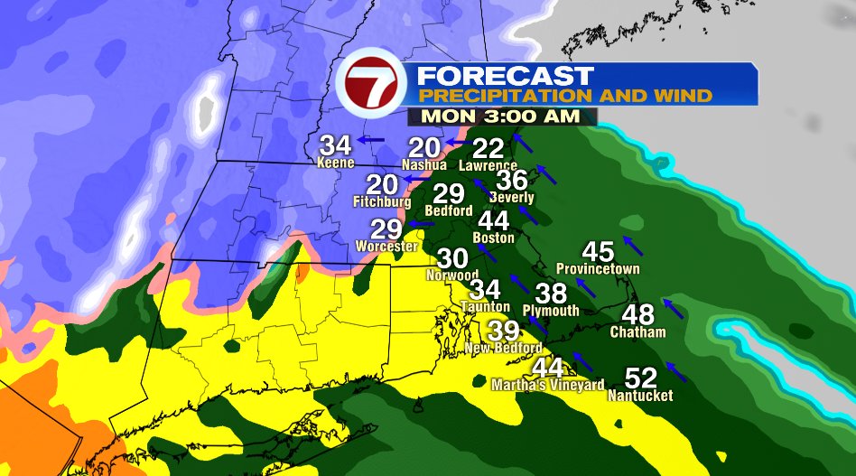
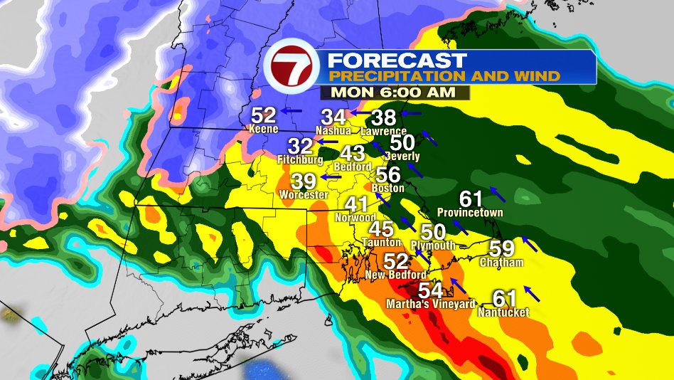
For a lot of us wind is the big story with this storm. Strong east to southeast winds could gust to 60-65 mph on the coastline overnight and Monday morning.
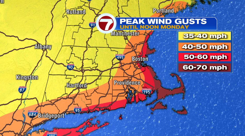
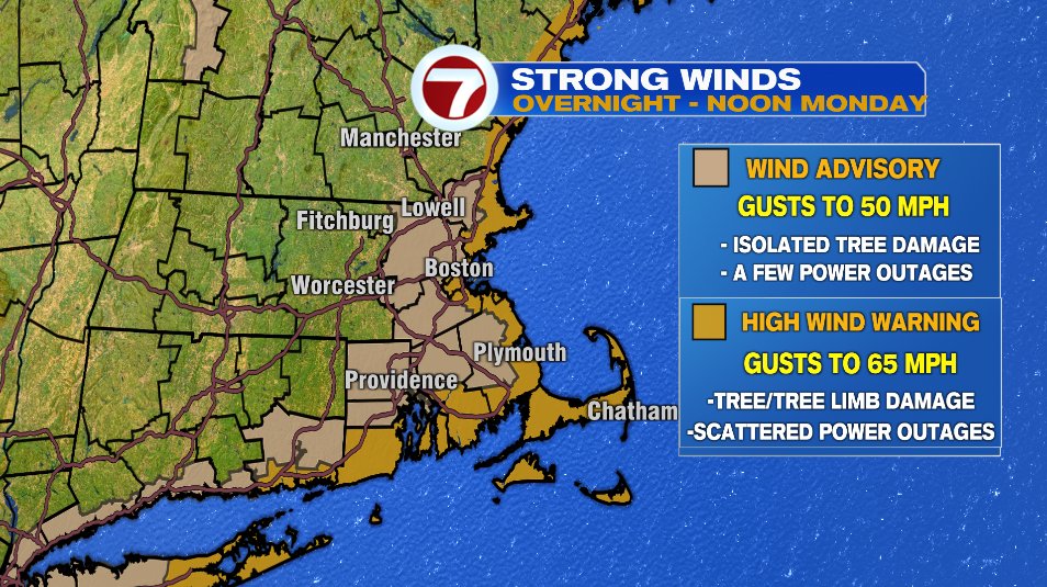
A high wind warning is in effect for the entire New England coastline from Maine to Massachusetts. Those wind gusts to 60 or 65 mph could lead to scattered power outages and scattered damage. The wind advisory continues from there out to 495. Wind will still gust 50-55 mph here and could lead to isolated damage and isolated power outages. If you have a generator, might be worth getting that out and running today and have on standby for tonight and tomorrow.
FLOODING
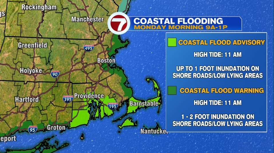
We’ll have to watch for two types of flooding with this storm. “Regular” flooding and coastal flooding. The coastal flooding is the bigger threat but with heavy rain through the morning, street flooding and ponding are likely. There is no watch out for flooding, however there are warnings for coastal flooding. We’ll have to watch the 11am high tide and a few hours on either side of it Monday morning (so 9am- 1pm). Water could pile up one to two feet on shore roads and low lying areas. That’s for the entire coastline of Massachusetts.
TIMING
Finally, timing. Snow will move in around midnight tonight. It is briefly snow for everyone. By 2-3am it changes to rain to 495. The cold air and snow will hold on for a few hours in the higher elevations of Worcester county and the Monadnock Region. That’s where our highest totals are. By 9am it is rain for everyone and by noon we’re dry.