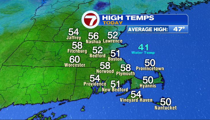
7Weather – It was another nice day for Southern New England- especially if you were farther inland! Two of our spots that have been cooler lately, were some of our mild areas today- Worcester and Fitchburg. An onshore wind coming off the 42° ocean water kept it cooler in Boston.
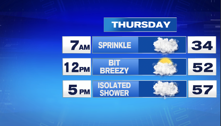
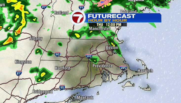
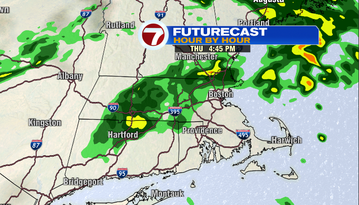
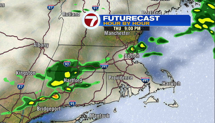
The filtered sunshine we saw today will give way to more clouds overnight into tomorrow. The thickening cloud cover will keep temperatures mild in the low/mid 40s to start tomorrow morning. Grab the umbrella before you head out. A sprinkle is possible in the morning, with some isolated showers later in the day. Any amounts will stay light. There will be a lot of clouds around tomorrow. After the mild start, it won’t be hard to get temperatures to the upper 50s/near 60° with a breezy southwest wind. That wind direction coming off the chilly ocean water will keep the Cape cooler near 50° once again.
Here’s what the timing of the showers looks like for tomorrow…
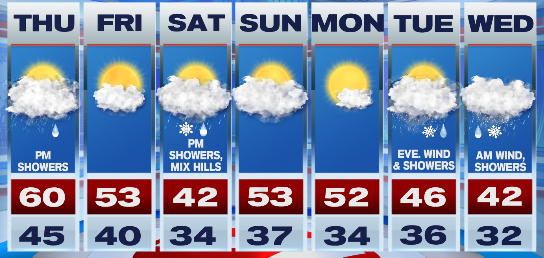
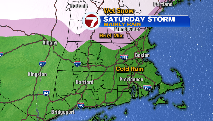
Looking ahead, Friday is our dry day in between systems. Saturday evening turns wet. A low pressure system will track through the Great Lakes and stay to our north and west. That track means the snow stays to our north. There will be a brief mix for areas north of Route 2 and far northwest Mass. For most of it, we’ll get a cold rain as high temperatures will be near 40°, but feel like the low 30s with a steady onshore wind.
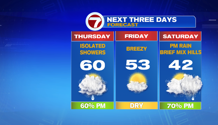
Sunday and Monday are quiet and mild in the 50s. Monday will be your brightest day of the extended period. Right now, it looks like a coastal storm will bring us rain/snow showers and wind.
-Meteorologist Melanie Black