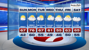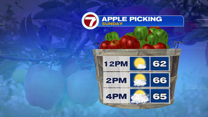
It was another chilly start this morning with quite a few locations starting off in the 30s. The good news is that temperatures quickly recovered by late morning and will continue to rise into the afternoon. Overall, another great fall day with a few more clouds. High temperatures are expected into the mid to upper 60s with winds out of the SW at 10-15 mph.


Tonight, not quite as cold the past two nights, as clouds continue to thicken. Lows are expected to only dip into the 50s for most locations. A warm front lifts northward into our area into Monday, ahead of a cold front to our northwest.
These battling airmasses will bring a chance for rain showers especially into Monday afternoon. The leading edge could bring a few raindrops into northern Worcester Co. by late Monday morning.

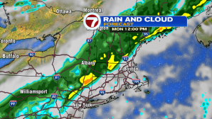

Not the best timing for the Monday evening commute with the leading edge of rain approaching the 495-corridor by 5PM and continuing to expand in coverage south and eastward.

The front starts to move out by Tuesday morning with just a few rain showers lingering at the coast, otherwise drier conditions prevail for Tuesday afternoon.
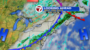
We’re keeping an eye on the end of the next work week for some more rain, breezy conditions, and cloud cover Friday and into next weekend associated with a system that could form just off the mid-Atlantic coast.