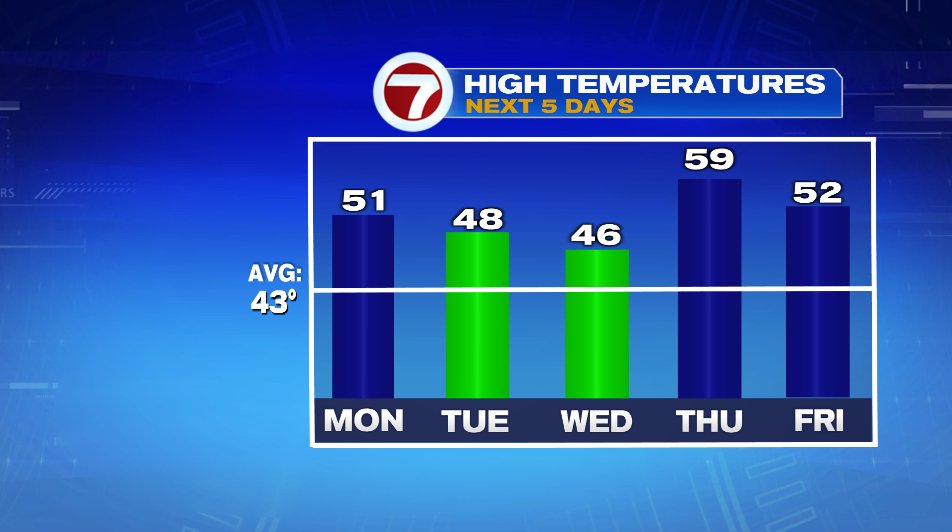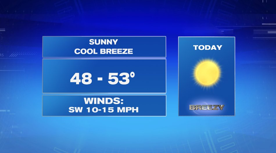
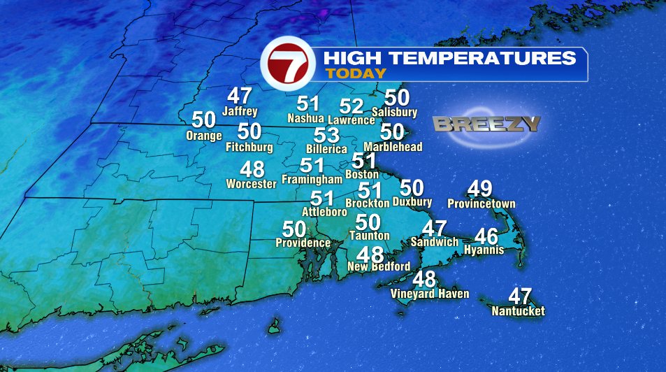
It’s a little chilly out there this morning but not for the air temperatures! Many of us woke up to temps near 40°, our typical high temperature for today is 43°! This morning, the issue is the wind. Winds up to 20 mph are making it feel like the 20s and 30s this morning. That said, the wind will be our friend this afternoon as it helps send temperatures to the low 50s — nearly 10° above average!
And tomorrow will be more of the same. A very weak cold front will slide through, but it’ll only drop us by about 5° and still leave us with sunshine and above average temperatures for tomorrow.

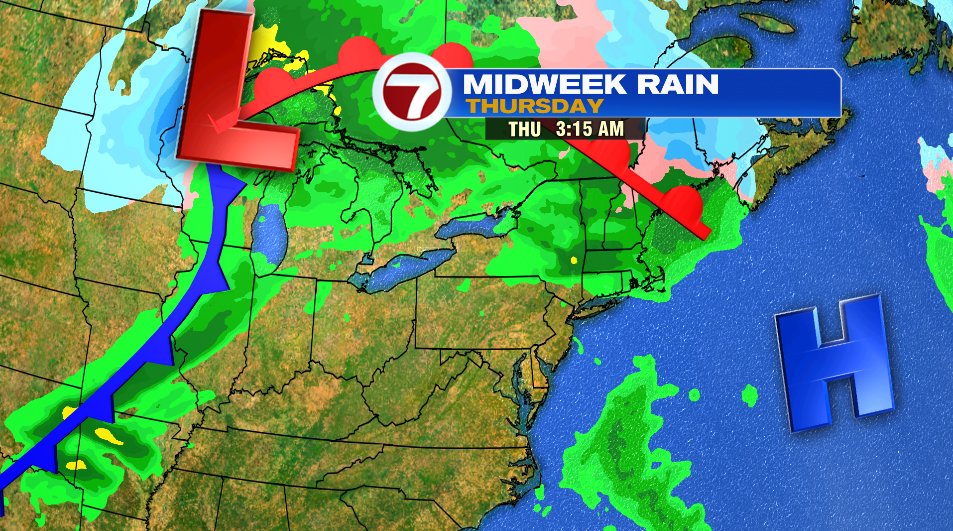
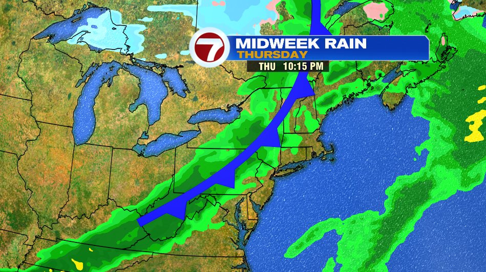
We’ll keep sunshine around until Wednesday as clouds start to increase ahead of a few showers Wednesday night and early Thursday. Like the last few storms have been, we’ll bookend the day with rain chances. So if you need to get outside on Thursday it will be totally doable. The first round (with the warm front) will come in overnight Wednesday into Thursday and may linger until about 7am Thursday. We’ll then dry out until the second round (cold front) moves in after 8pm.
And we’re not expecting any cold weather over the next several days. Even the cold fronts we talk about will be pretty weak and high temperatures will stay above average the entire work week.