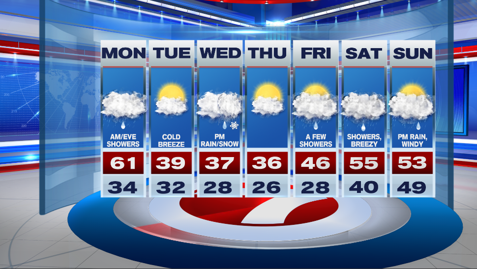
7Weather- Monday will be warm, windy, and we’ll have some wet weather around.
A warm front lifts through the area early tomorrow morning, and then a cold front arrives in the evening. Those are our two rounds of rain.
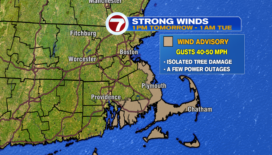
This system also comes with some wind energy. It will windy for everyone with gusts up to 40mph. That’s enough to bring down Christmas decorations that aren’t secure. There could be an occasional higher gust to 50 mph along the South Shore, South Coast, and the Cape & the Islands where a Wind Advisory is in effect from 1 PM tomorrow to 1 AM Tuesday. Isolated tree damage is possible.
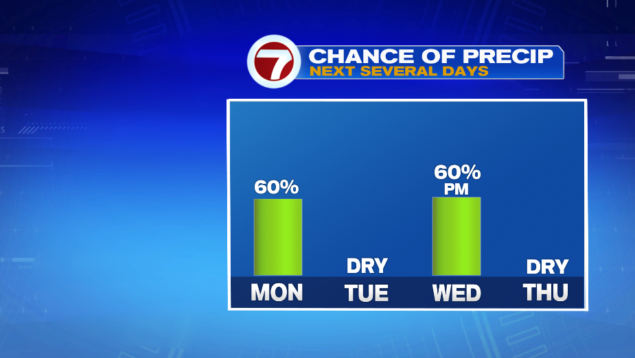
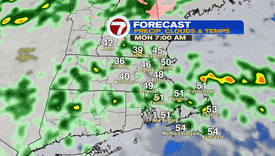
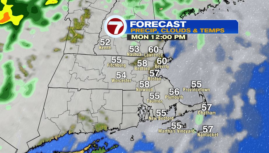
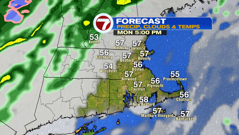
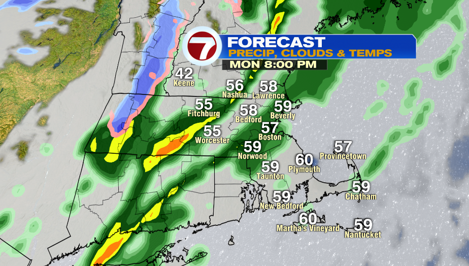
Most areas will be in the 40s by 7AM tomorrow. Expect a few showers around between 5-11 AM. There will be a dry period throughout the afternoon from 12 PM-5PM. This will allow our highs to jump into the low 60s. Another round of showers moves in between 5-7 PM and will be around until about midnight. Even with two rounds of wet weather, we only get about 0.2″ of rain from this system.
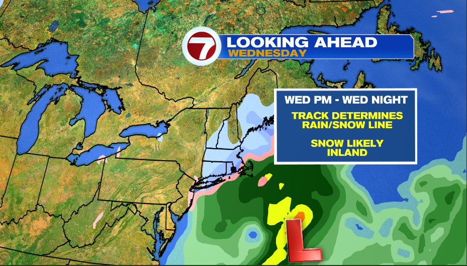
Back to reality on Tuesday. Expect a mix of clouds and sun with highs in the upper 30s. A cold breeze will make it feel about 7-10º colder than the actual temperature. Wednesday morning looks dry and cold, and then rain/snow moves in throughout the afternoon.
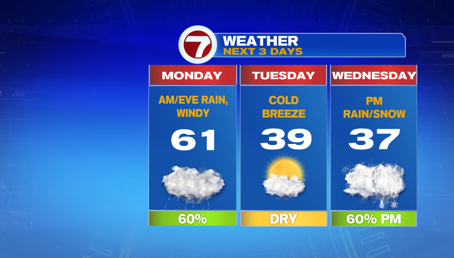
We’re still watching a low pressure system on Wednesday, but it’s looking less impressive. It is now further away from us, which puts the main area of precipitation offshore. Snow accumulation inlands is likely minor.
Thursday starts cloudy and then skies gradually clear up. It is chilly in the mid 30s. The week ends with a few showers on Friday and temps in the 40s. Next weekend has wet and mild weather.