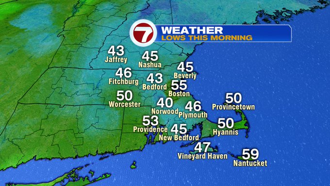
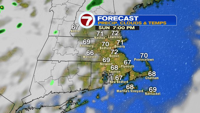
It was another chilly start across with region with lows in the 40s for most.
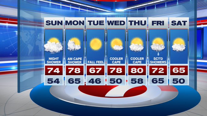
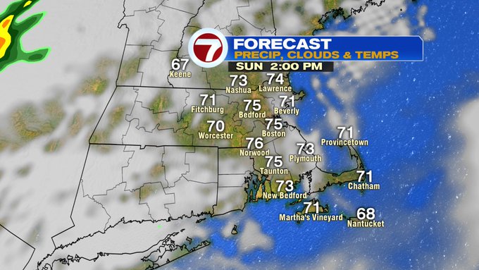
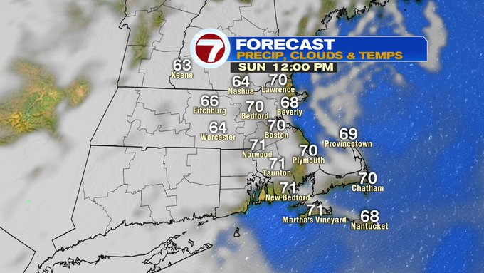
Temperatures this afternoon will warm up into the low to mid 70s, which is seasonable for this time of the year. We’ll also see increasing clouds through the day with a spot sprinkle chance after sunset, but overall, most locations will remain dry.

If you’re heading to the beach today, there is a moderate to high rip current risk for a good portion of the southern New England coastline.
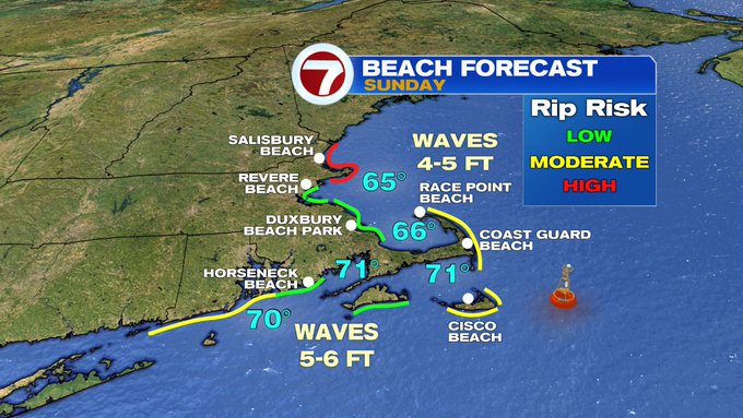
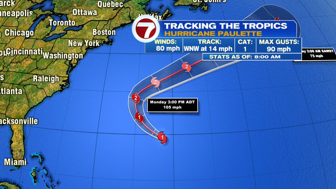
The taller waves and the rough surf are swells from Hurricane Paulette which will remain well offshore.
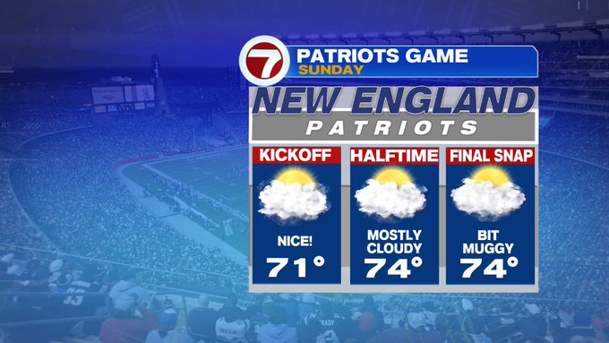
For the Pats Home Opener, there are no weather issues for the players this afternoon.
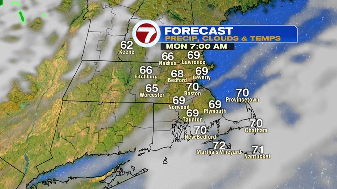
Tonight temperatures don’t plummet after sunset like the last two nights. Lows tonight will only slip into the 60s.
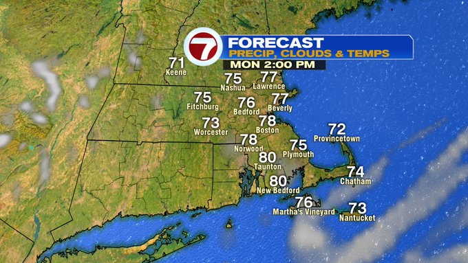
Monday afternoon features a gradual clearing of the skies and highs into the upper 70s.
Tuesday temperatures only rise into the upper 60s under clear skies and low humidity, making it feel like fall.
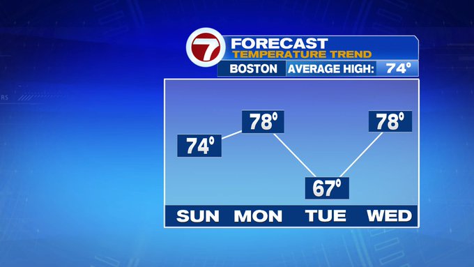
That fall feel is short-lived as we approach 80 by Thursday. The next chance for showers in the extended forecast is Friday with scattered showers.