
Scattered showers and thunderstorms are moving through the area this morning. In fact about 3:15 this morning we had a severe thunderstorm that moved through Essex County with some damage reports coming in out of Danvers. That storm is now well out to see, but here’s what the radar looked like this morning in that area (lightning was plenty, but turned off here to make for easy viewing).

There’s more storms and downpours extending back toward Albany, so we’ll keep scattered activity in the forecast this morning for areas north of the Mass Pike. The storms are moving due east, so communities south of the Mass Pike will stay dry this morning while towns north of the Mass Pike deal with downpours and wet roads for the commute.
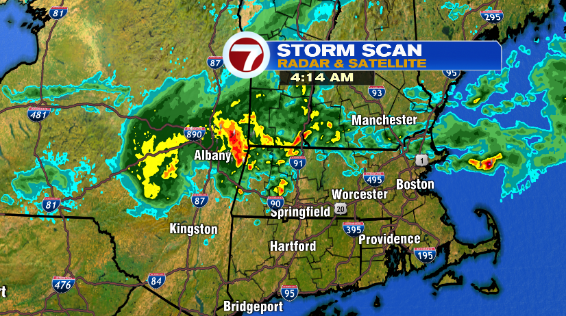
The timeline below shows storms and downpours still moving through until about 6 or 7 this morning. After that we’ll dry things out and we’ll be back into the sunshine by late morning. In fact, despite the damp start, the afternoon and evening looks fantastic!


Temperatures today will end up in the upper 70s to near 80 for highs this afternoon. And despite the humid start to the day, the dew points will fall off this afternoon. So not only does the sun come back and temperatures climb, the humidity will be trending down.

We’re also watching the tropics and newly formed Tropical Storm Nicholas.

Nicholas will head toward the Texas coastline later tonight and it will bring strong wind and it will drop a ton of rain. Some areas are expecting over a foot of rain!