
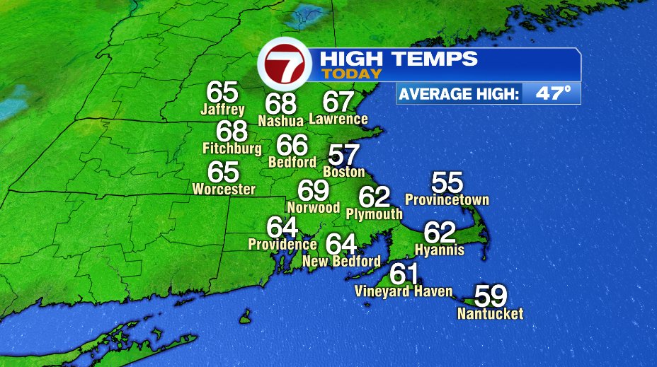
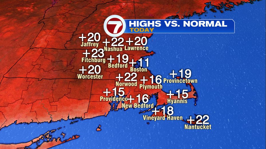
Another warm day out there today! Many towns soaring 15-20 degrees above the average leaving some areas with highs near 70 degrees this afternoon!
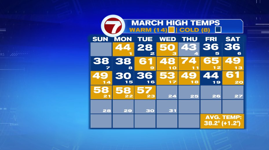
We’ve now strung together a stretch of pretty warm days (outside of the little road bump on Friday) and that won’t change any time soon. That said, we’ll lose the sunrise to sunset bright blue skies.
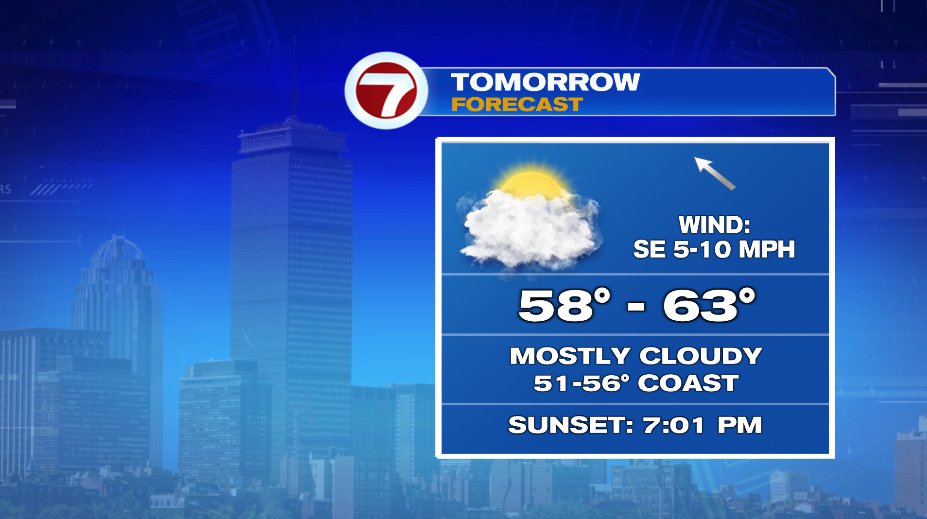
Tomorrow is a prime example. It’s still nice. It’s still warm. But there will be a lot more clouds than we’ve had this week. Temperatures will climb to near 60 inland and low to mid 50s on the coast. We’ll wake up to a partly cloudy sky and it will be full on cloudy by lunch time and that will last for the rest of the day.
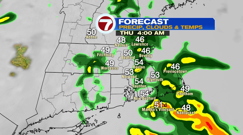
The clouds tomorrow are ahead of rain that will come in tomorrow night — it’s good news because we need the rain. Showers should hold off until close to midnight. A few light showers may linger to sunrise on Thursday but unless you’re up super early on Thursday, you’ll likely just wake up to wet pavement.

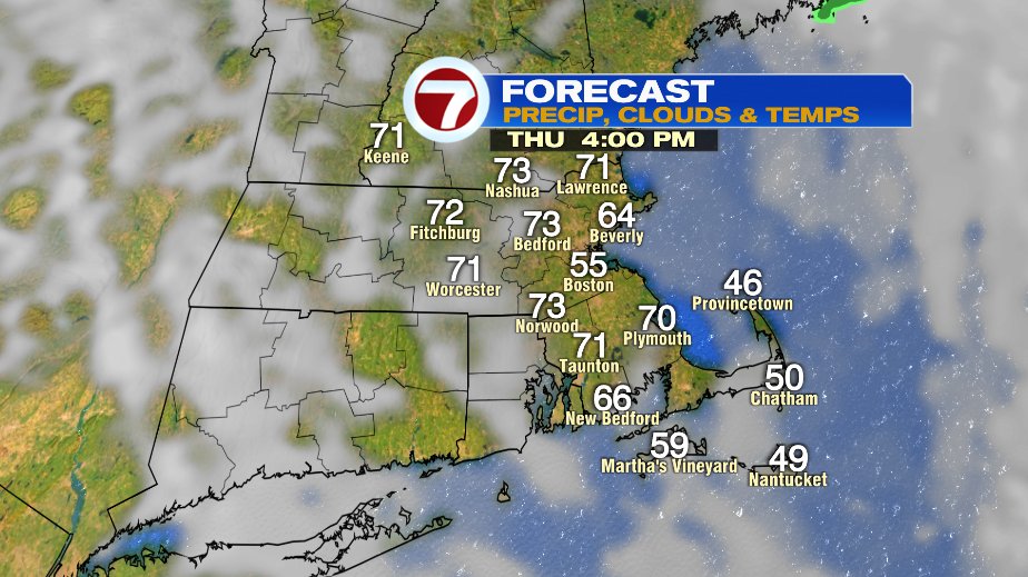
So while Thursday will start with clouds, we’ll break into sunshine in the afternoon. With that sunshine temperatures will rapidly shoot to the 70s!
While the few rain drops Wednesday night are better than nothing, we really do need more. Since the beginning of the year, we’re pushing 4″ below average in the rainfall department and over 2″ below average for March alone!
