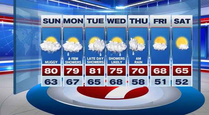
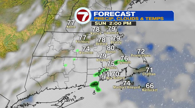
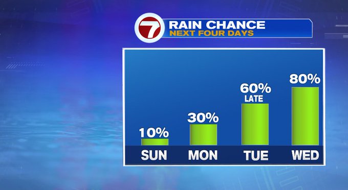
We started off our Sunday with some patchy dense fog and the low clouds. The clouds will linger into this afternoon, with more clouds than sunshine for our Sunday. Highs will stretch into the upper 70s to low 80s with the dewpoints into the mid to upper 60s, a spot sprinkle cannot be ruled out.

Tonight, we’ll see a few showers after midnight with some patchy fog developing. It will be muggy with lows into the 60s.

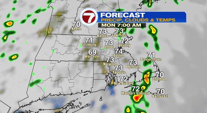
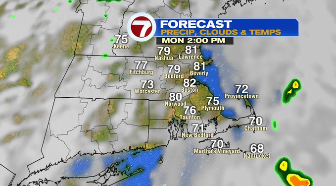
Monday morning starts off with the fog and clouds, along with a few showers along the eastern coastline and the Cape. Drier by midday with some peeks of sun, highs will be near 80 again tomorrow afternoon.
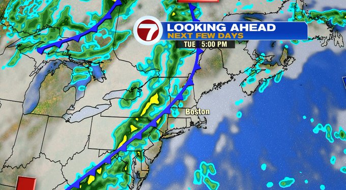
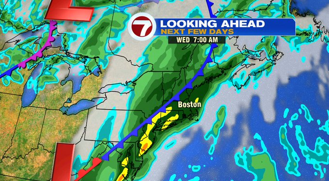
Tuesday starts off partly sunny before clouds and showers slide in after the evening commute. These showers will become widespread and linger through Tuesday night into Wednesday. Wednesday will be the wettest day out of the work week, with some downpours possible in central and western MA.
The unsettled pattern with the much-needed rainfall is associated with a cold front to our west that slows it’s approach through Wednesday, allowing for rain to linger into early Thursday, too.
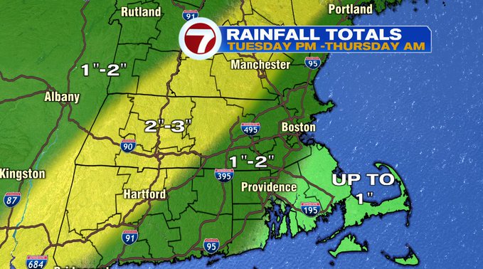
Just how much rain are we looking at from Tuesday through Thursday morning? Widespread inch, to close to 2 inch north and west (over a three day timeframe as shown below).
Turning dry and seasonable by late week and that pattern continues into next weekend with highs into the mid to upper 60s (much more fall-like compared to this weekend).