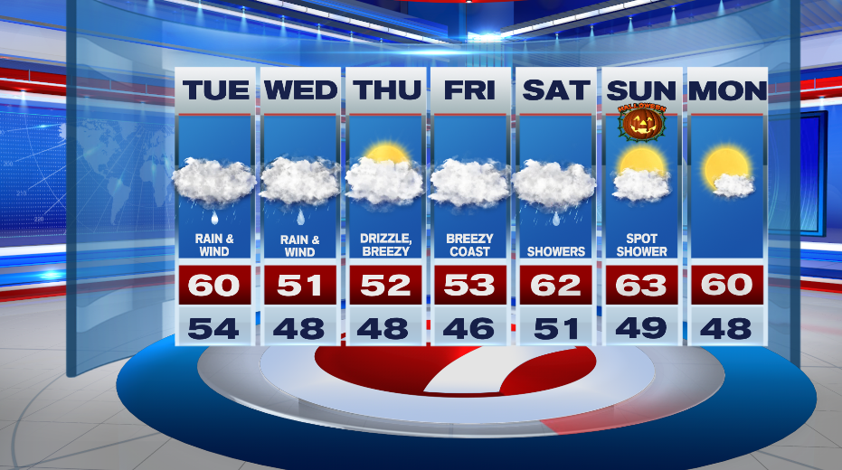
Our nor’easter has arrived. We’ll have periods of rain today and tomorrow, but we’re most concerned with the wind with the peak of the storm this evening and tonight.
WIND:
DARK RED- The highest gusts will be felt along the South Shore and down to the Cape and the Islands where gusts could be as high as 65-70mph. Tree damage is likely here with scattered to numerous power outages this evening and into tonight.
BRIGHT RED- The North Shore down to Boston and into parts of Bristol and Plymouth Counties will likely see gusts between 55-65 mph. That is enough to break down big tree branches and bring down trees as well. Scattered power outages are possible.
ORANGE- Parts of Norfolk and Middlesex Counties will see gusts between 45-55mph. This is enough to break tree branches. Isolated power outages are possible.
YELLOW- It will be windy in these locations with some tree damage possible, but little to no damage is expected. You’ll want to secure patio furniture if you still have it out.
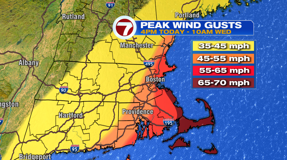
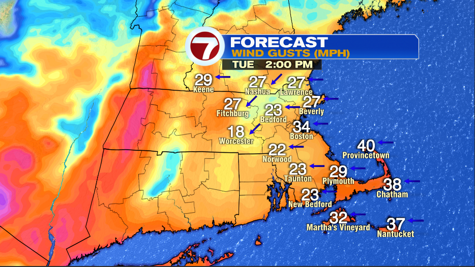
We’ll call it breezy early this afternoon, windy around dinner time, and then very windy this evening and tonight. Gusts are at about 25-35mph around 2 PM, 35-45mph, by dinner time, and then between 50-70mph around 10-11PM.
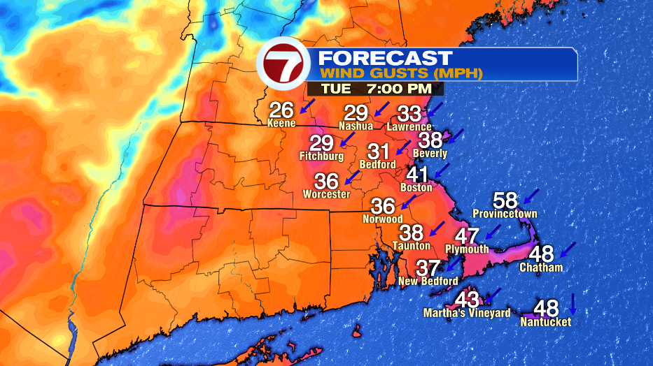
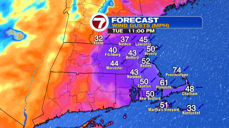
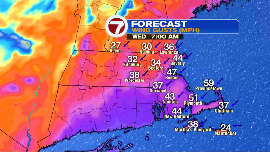
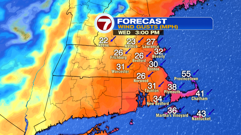
It will still be very windy early tomorrow morning with gusts still between 45-55mph along the coast. Winds start to die down a bit as we approach lunch time, and more so by late afternoon.
RAIN:
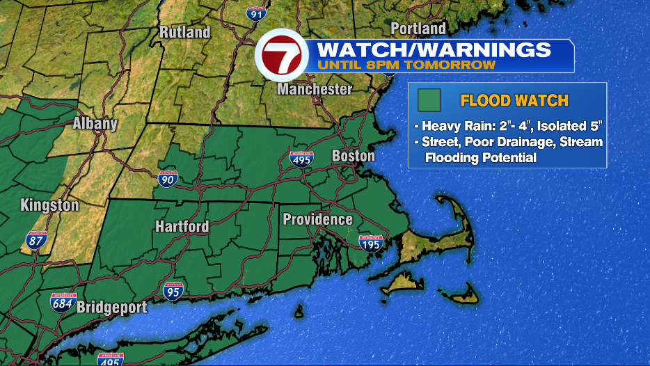
There is a Flood Watch in effect for almost the entire area until 8PM tomorrow. There will be pockets of heavy rain today-tomorrow that could lead to pockets of flooding. Expect street flooding since leaves are likely clogging storm drains.
We’ll get a break from the heavy rain around lunch time today, but the rain picks back up just in time for the afternoon commute. Expect poor driving conditions with rain and wind around for the PM commute.
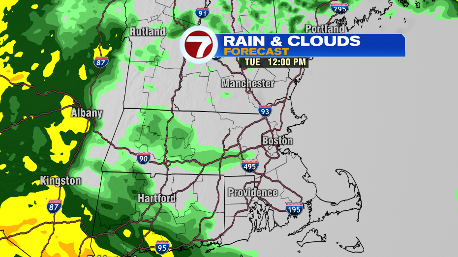
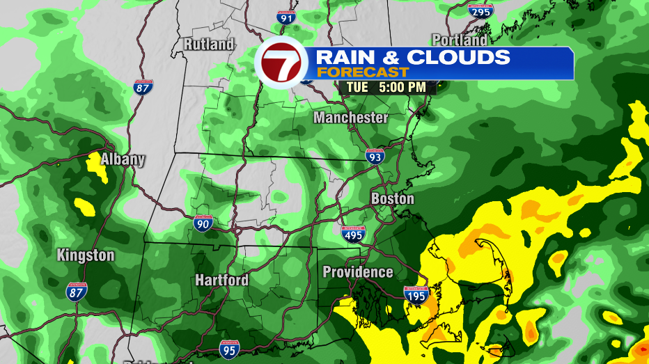
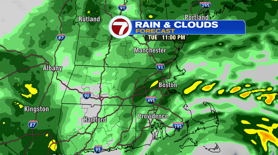
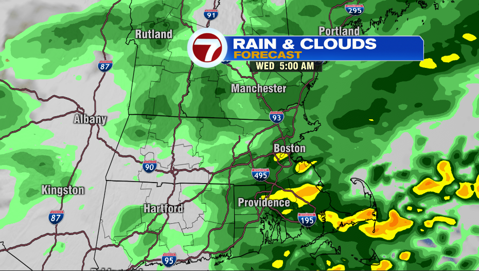
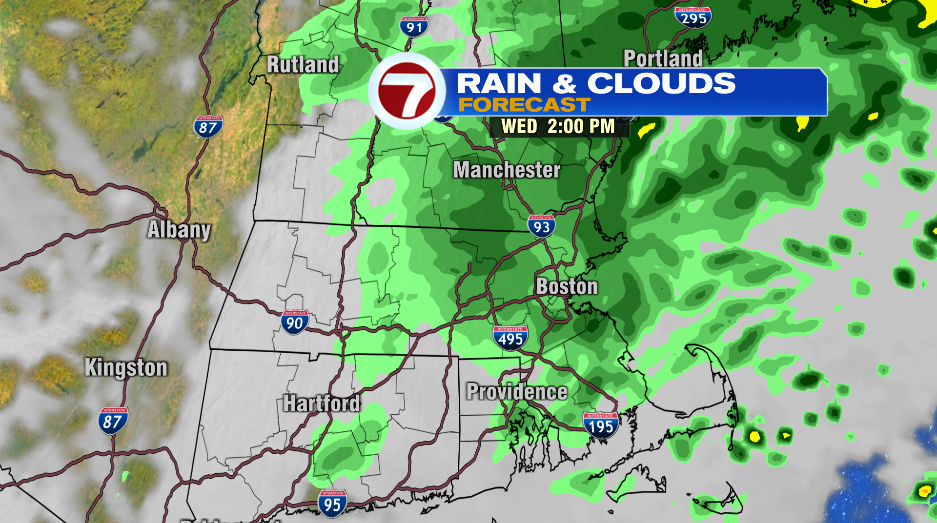
Rain will be heavy at times Tuesday night into early Wednesday morning. The Wednesday morning commute will have wet weather and windy conditions. We’re left with light showers the rest of Wednesday that will eventually turn into patchy drizzle.
COASTAL CONCERNS:
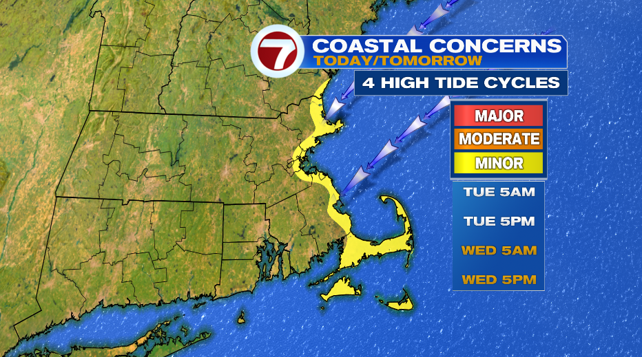
Thankfully we have low astronomical tides as this nor’easter moves by. We’ll still deal with a constant onshore wind for 4 high tide cycles. This will lead to minor coastal flooding in typical spots, especially for high tide Wednesday afternoon around 5PM. Beach erosion is likely.
We’ll have patchy drizzle Thursday and it is breezy. Another system moves in late on Friday. This one will bring breezy conditions Friday evening and into Friday night. Showers will be on and off on Saturday. It looks like the weather improves for Halloween! There could be a spot shower with temps in the 60s.
