It’s been a while, but we certainly have a winter’s mess on our hands as we go through Saturday night into Sunday as snow, ice, rain, flash freezes and coastal flooding are all in the forecast. Sounds pleasant huh?
Snow starts patchy and lightly after 7pm Saturday and becomes steadier by 10pm and heavy by midnight. From midnight, to 7am, many towns see snow rates of 1-2″/hr as roads become treacherous.
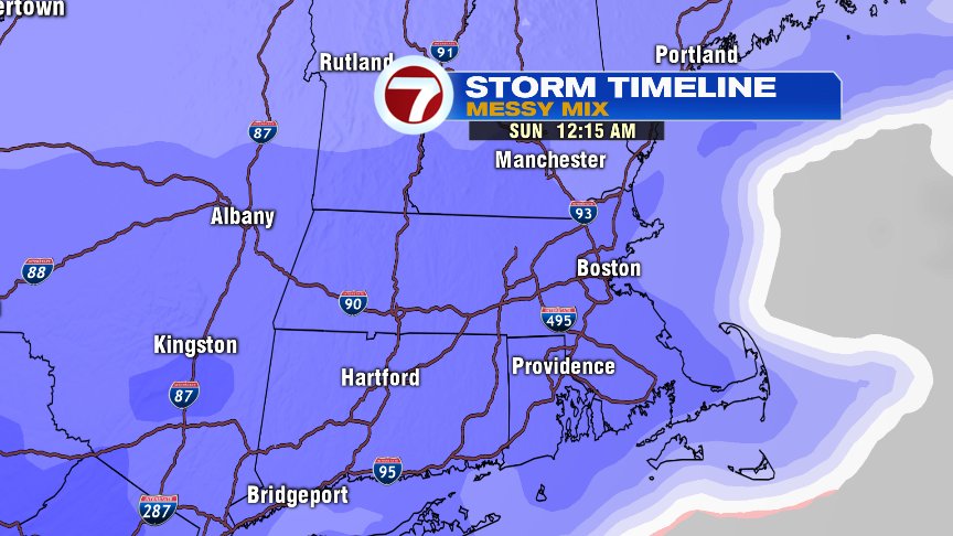
Sleet/freezing rain/rain starts mixing in near the south coast by 4am.
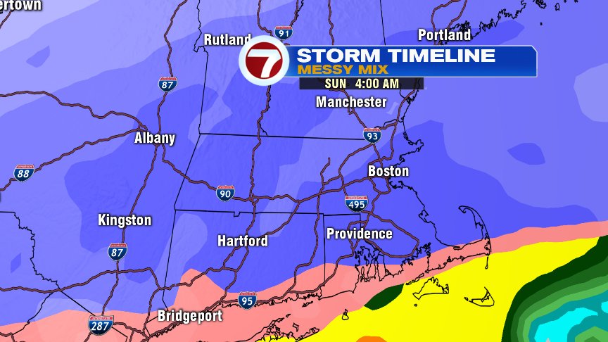
That sleet line makes it into Boston and nearby towns and cities between 5-7am.

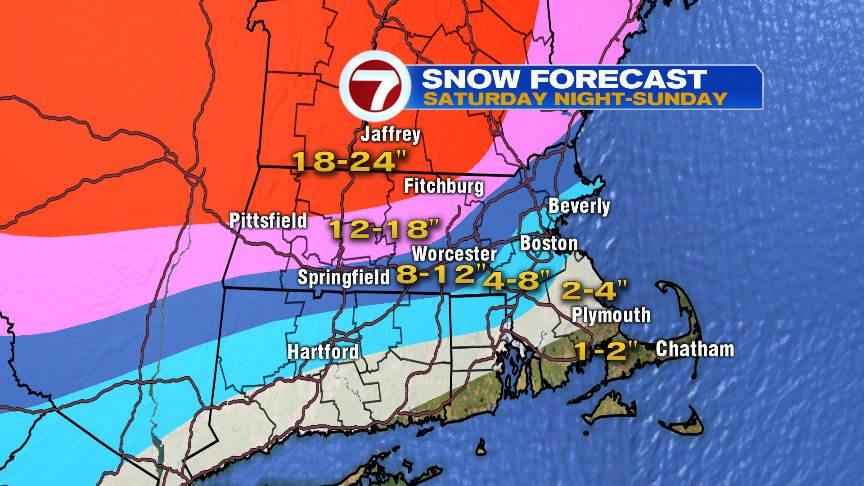
Sleet and freezing rain are widespread Sunday morning, which will compact/cut down on snow totals, but continue to provide for treacherous travel through the day.

Where the dark and light blues are on the map below is where the most sleet falls on top of the snow. If less sleet mixes in, snow totals are a bit higher and vice versa.
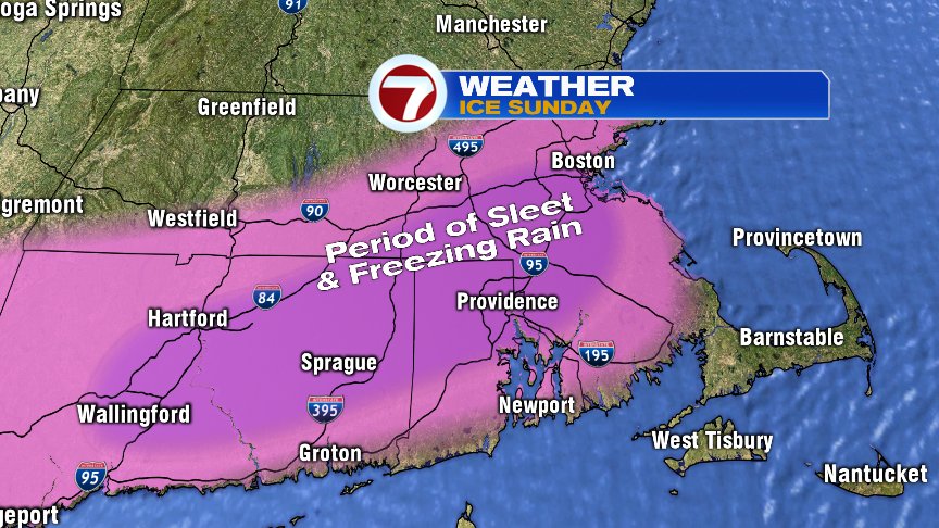
Areas most likely to see prolonged freezing rain (drops that freeze on contact) are across interior Southeast Mass and around the Boston to Providence to Hartford corridor. If we start taking a quarter inch or more of ice accretion, then the potential of down trees branches and power lines yielding to power outages will go up.
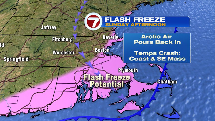
Where temps briefly go above freezing tomorrow morning, we’ll see a flash freeze by the afternoon as any wet surfaces rapidly freeze back up with temps crashing into the teens and low 20s.
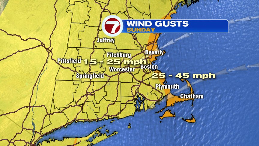
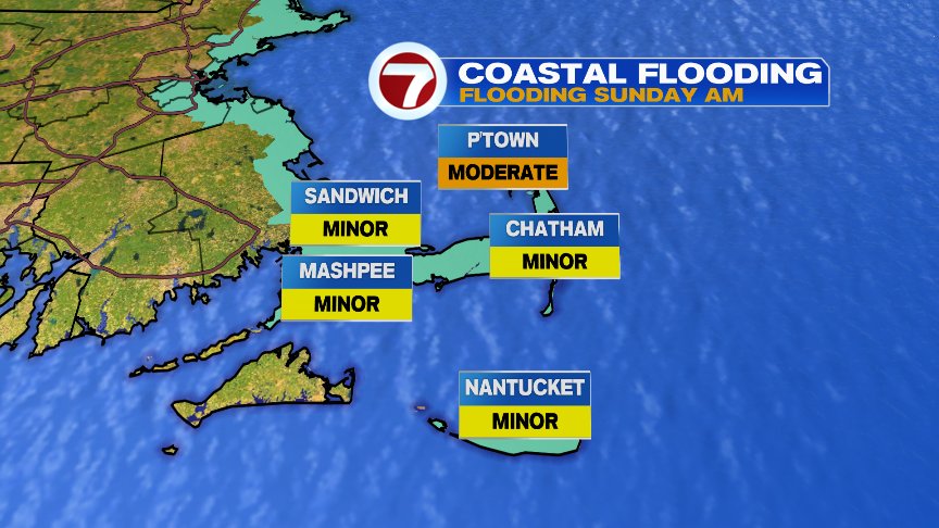
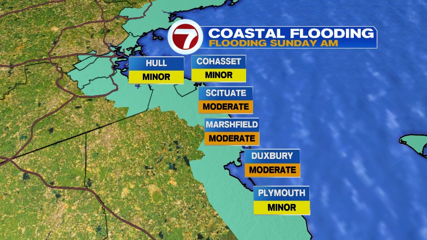
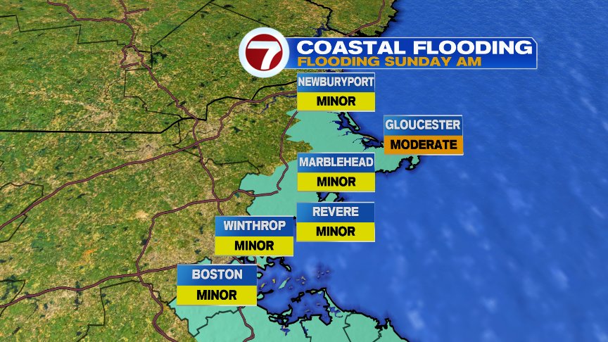
Winds with this storm are strongest at the coast. Tides are astronomically on the high side, so minor to pockets of moderate coastal flooding is possible near the 10am high tide Sunday morning.
Sunday night into Monday, wind chills go well below 0 with air temps crashing into the single digits.
They will be plenty to track through the weekend so stay with 7News. I’ll also share updated maps on twitter https://twitter.com/clamberton7?lang=en
Go Pats!