It’s a milder start to this Taco Tuesday as warmer air has slide into Southern New England from our southeast. To accompany that milder air, a few showers will be with us at times today too as highs head for near 60 degrees. Most locations outside I-95 pick up less than a 0.25″ of rain, although across Southeast Mass, locally 0.5-1.0″ of rain will fall in heavier pockets of rain. Rain tapers off tonight, yielding to clearing skies and a much brighter day tomorrow.

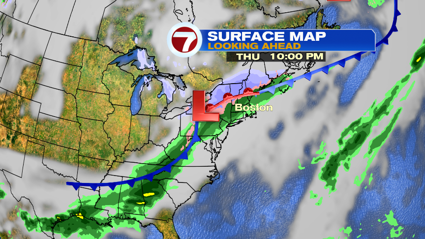
A storm, along a cold front, still has to slide on through New England Thursday night. This storm looks to move quickly, and that means the coldest air won’t have a chance to settle in here before the steadiest precipitation falls. This type of set-up produces mainly rain for many of us vs. snow, with the highest snow chance across the northern Berkshires and up across central and northern New England.
Rain many end as a bit of wet snow across the higher terrain of Worcester County, but even there accumulations would be limited. The storm would have to track farther south and be a bit slower to bring more widespread snow across central and eastern Mass, which does not look likely at this point.
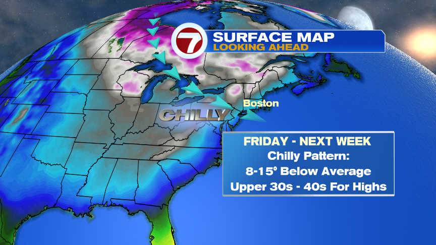
What is likely is that once the precip tapers off early Friday morning, a gusty wind and the coldest air of the season works in Friday afternoon and Friday night.
In fact, starting Friday, through much of next week, the pattern favors below average temps with most of that stretch running 5-15 degrees below the average high of the lower 50s.