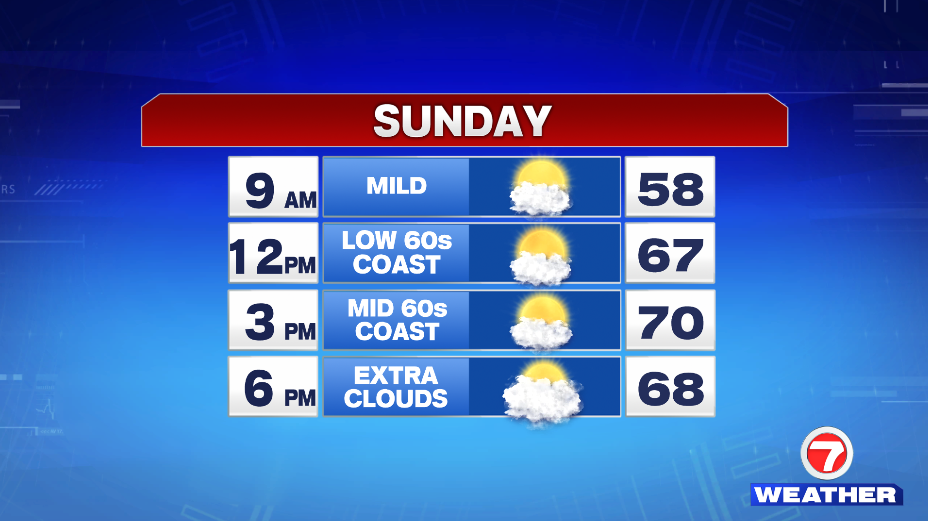
7Weather- We’re looking at another great day Sunday with temperatures near 70, but then it cools down to start the week.
There might be some extra cloud cover by sunrise (5:20 AM), but then it clears up by 9 AM. Temperatures will be in the mid and upper 60s inland by lunch time, and in the low 60s at the coast. We hit close to 70º by 3 PM, with the coast staying a bit cooler. Clouds gradually move in late in the day, and it remains mild in the 60s.
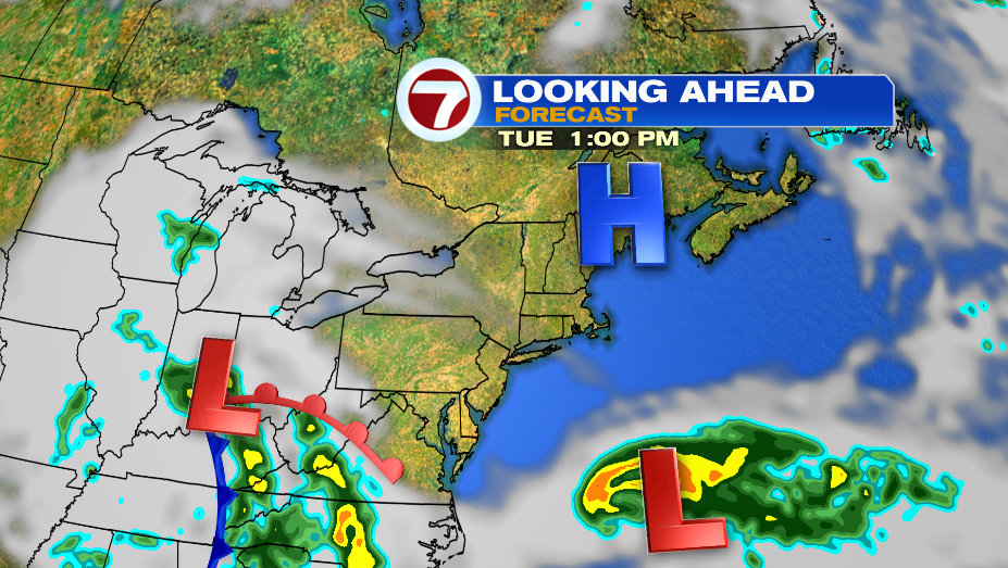
There are two systems that could impact our weather to start the week. A low pressure system to the west, and a tropical system to the south.
Monday and Tuesday, as of now, look mainly dry. The best chance for a shower on Monday is early in the morning. The rest of the day is cloudy and cool. A northeast wind will keep temperatures between 54-58º. These two systems look to stay pretty far from us on Tuesday as well. If the pattern continues as is, a high pressure system will block any rain from moving in. Highs will be in the mid 50s.


Tropical Depression One formed Saturday afternoon, and is expected to become a tropical storm by Sunday.
The closest it gets to land is off the coast of North Carolina on Monday afternoon. It then takes a turn east, and continues to weaken.
