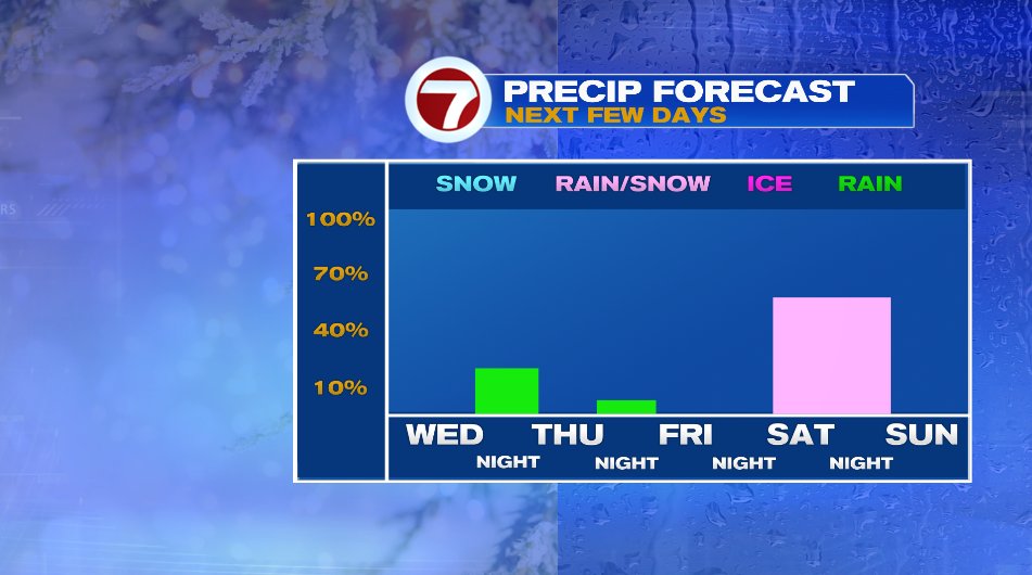
A large area of low pressure is affecting the weather from Colorado to Massachusetts this afternoon. Unfortunately, another severe weather outbreak is ongoing in the Midwest this evening and we’ll again see devastating damage from this system tomorrow. We’ll talk about that in a second, but for us, we are talking tame, light rain showers developing this evening and continuing on and off overnight. They’re gone by tomorrow morning so your commute will be A-OK.


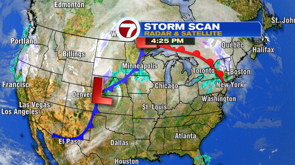
The other part of the storm will unfortunately be not as low-impact as ours. The snapshot below shows the entire weather set up across the country. Notice how our warm front is actually tied to the same area of low pressure all the way back near Denver. Areas in the Midwest and High Plains had the warmth we’re getting tomorrow, today. And that is fueling another severe weather outbreak tonight.
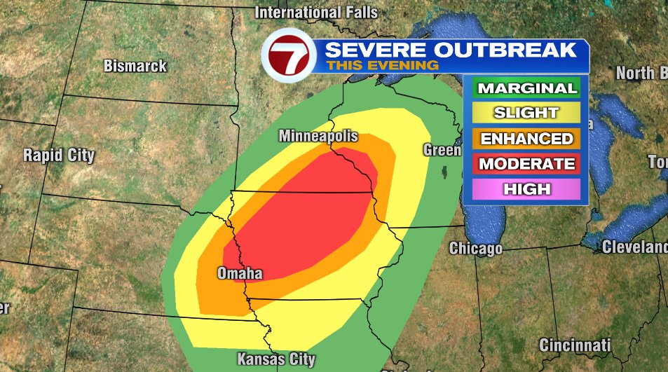
As of the writing of this blog (4:30 pm ET), severe thunderstorm warnings take up the entire length of Nebraska and half of Kansas. Embedded in that line are five tornado warnings. And while this is only a snapshot in time, the line of severe storms has held together since western Nebraska/Kansas and has continuously had several tornado warnings within it. The yellow box is a tornado watch that may be expanded even farther east to the Mississippi River (Minnesota/Wisconsin/Iowa borders).
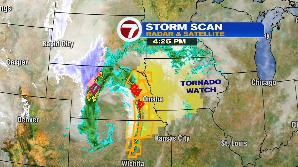
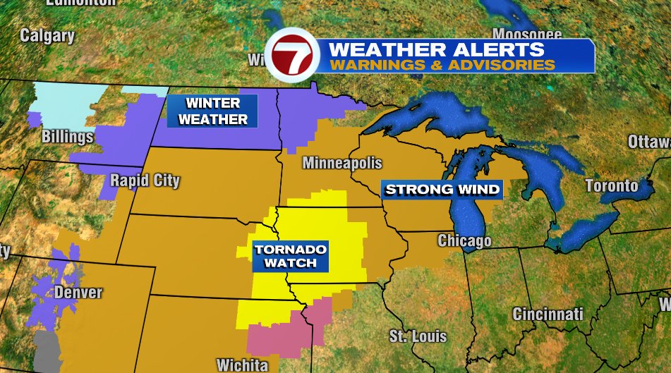
While the tornadoes grab the headlines (and rightfully so) there will be damage that extends far beyond the tornado warnings. Take a look at all the headlines issued for that area!
- Purple: Winter Weather Advisory for snow on the cold side of the storm
- Light Blue: Wind Chill Advisory
- Tan: High Wind Warning for wind gusts up 75-80 mph. That’s not even in a thunderstorm. That’s the general wind gust potential!
- Pink: Severe Thunderstorm Warning
The Storm Prediction Center has a Moderate Risk area for North Iowa and Southern Minnesota. For perspective, that is a level 4 of 5 on the severe weather scale. Last week, Kentucky was under the same moderate risk. There will unfortunately be plenty of news headlines coming from that area tomorrow.
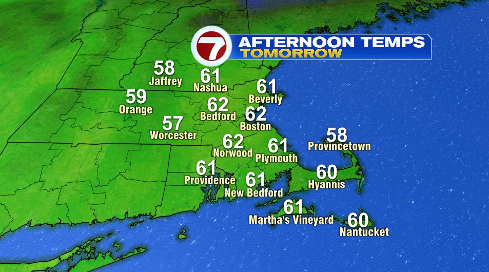
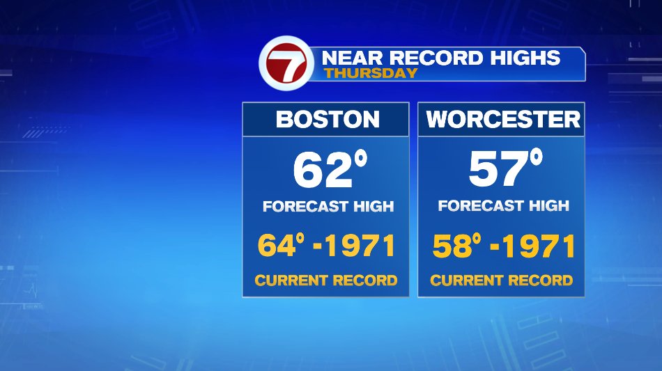
That storm is heading to the northeast and is NOT heading to us here in New England. But we WILL tap into the warm air tomorrow underneath that warm front. Temperatures for many of us will crack 60° and challenge records in both Boston and Worcester.
The cold front will slide through Thursday night but will produce little to no rain for us. A sprinkle or spot shower is possible overnight but nothing more. The bigger system to watch is the weekend. Timing looks to be Saturday afternoon/evening and overnight. Right now it looks like it will be a messy mix and it’s gone by Sunday. We’ll fine tune that over the next couple of days.