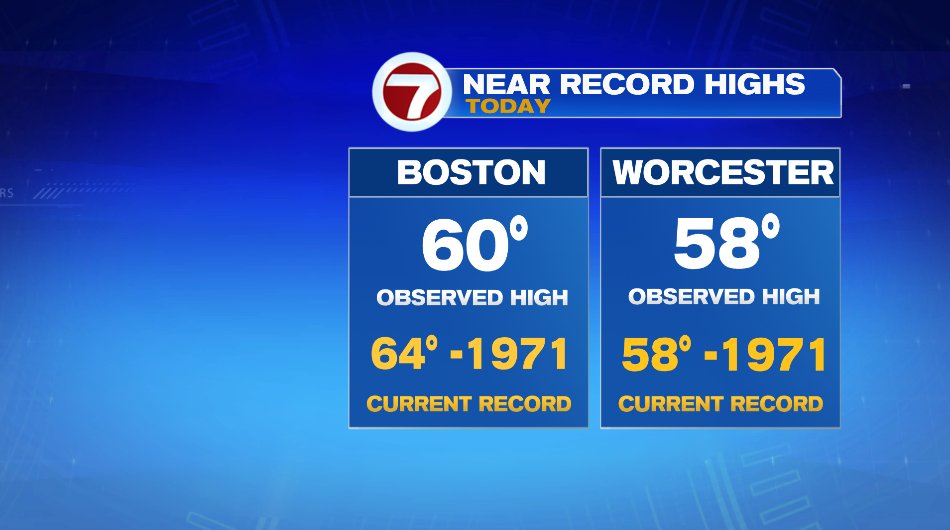
Temperatures near record levels today. Worcester tied their record of 58° and Boston was just shy of the 64° record, both set back in 1971. It’s hard to believe we’ll be going from these temperatures to snow in just 48 hours!
Tomorrow (Friday) will be a bit cooler but still well above average. A weak cold front will slide through tonight and drop temperatures by about 10 degrees for Friday. That said, 10 degrees off of 60 still leaves us at 50° for tomorrow. In fact, I think many of us will hang out near 52 or 53° Friday afternoon. There will be plenty of sunshine and a bit of a breeze, but overall a nice December day. As the cold front comes through tonight, it may touch off a sprinkle but it’s like a 5% chance and it’s overnight so don’t worry about that.
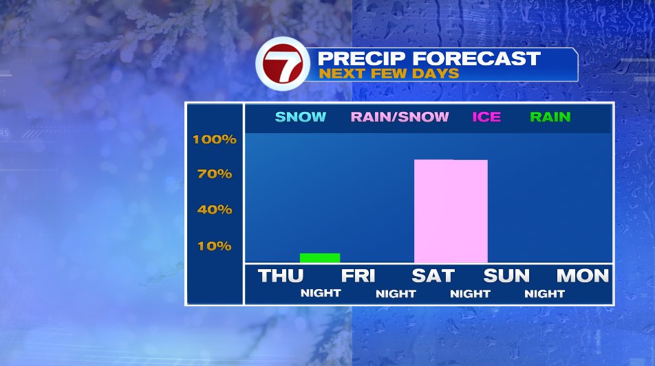
The bigger system and bigger headline arrives this weekend as we watch a rain/snow mix arrive on Saturday. Before we dive into that forecast, let’s back up to that cold front I was just talking about. That is the cold front that moved through the Midwest last night and produced a severe weather outbreak. Yes, that makes two in less than a week… IN DECEMBER!
The storm started as an strong area of low pressure in Colorado that produced wind gusts (not even associated with thunderstorms) of over 100 mph! That caused dust storms and damage in the high plains. For perspective, an EF-1 tornado has winds up to 110 mph. So while not a tornado, producing the same sort of damage that an EF-1 tornado could cause.
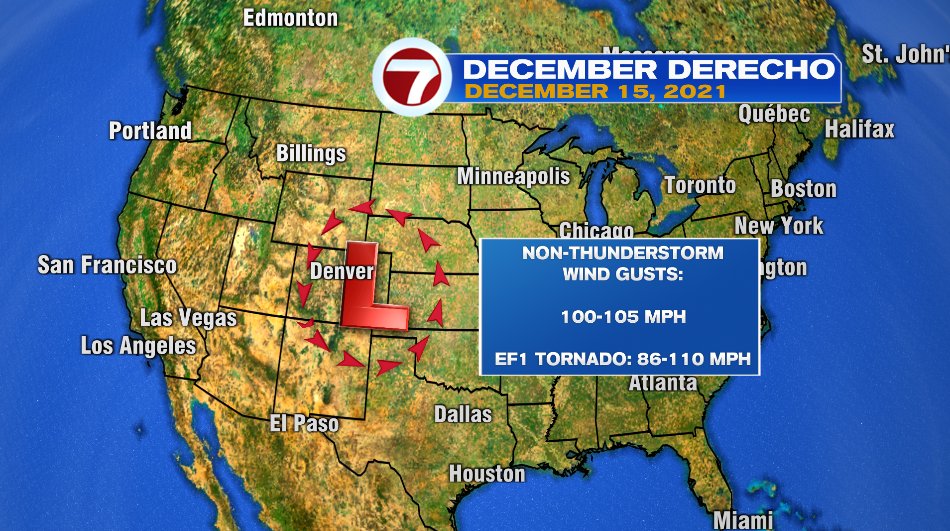
From there, the storm moved into the Midwest and it produced A TON of severe weather. The squall line started in Kansas and made it all the way to Wisconsin. At times the line of storms was moving to the northeast at 100 mph! When everything was said and done, there were reports of 23 tornadoes. The National Weather Service will go out and survey the damage over the next couple of days and see how many actually were. Last night the National Weather Service issued 71 tornado warnings and 118 severe thunderstorm warnings! There were 54 automated reporting stations that clocked winds over 75 mph and nearly 600 reports of damage. That number is likely to grow as more reports come in with today’s daylight and damage surveys are being done.
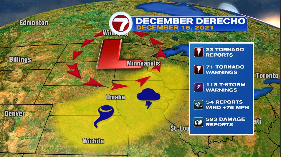
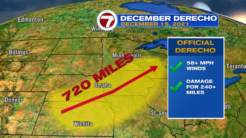
The storm will officially get the title of derecho. A derecho is just a long-lived line of thunderstorms that produces a lot of damage. The line of damage needs to extend for 240 miles and the entire length of that line needs to either show damage that would correspond to a severe wind gust (58+ mph) or weather reporting stations that capture that wind speed. That was an easy accomplishment with this one as it traveled and produced damage for over 700 miles last night.
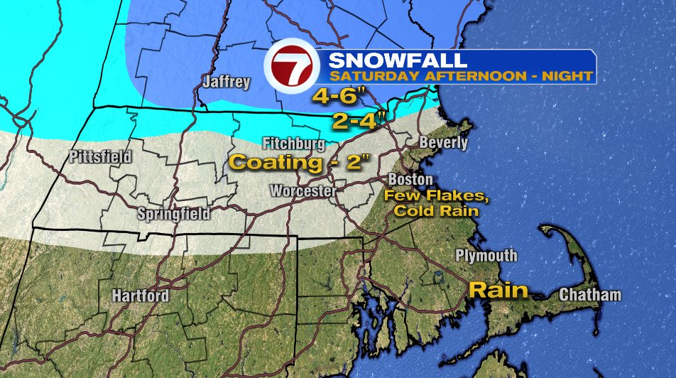
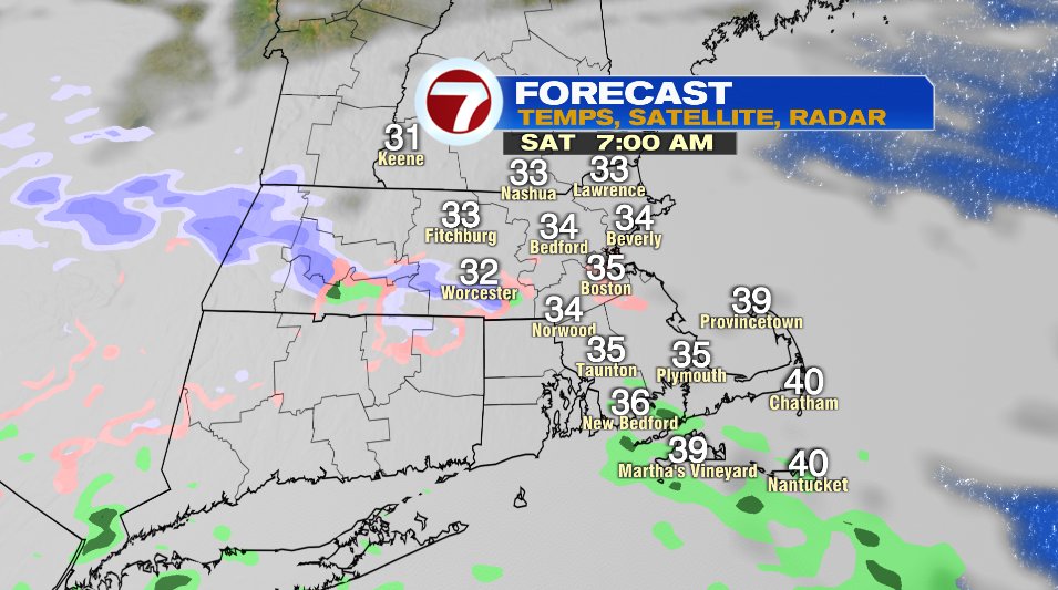
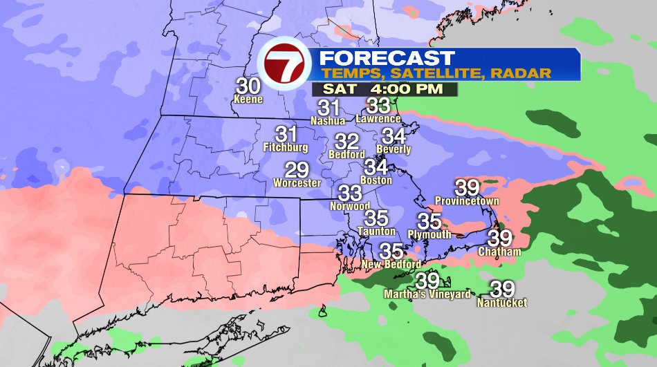
Ok now back locally to our snow. We’ll start off dry on Saturday morning, cloudy but dry. Snow will arrive during the midday hours.
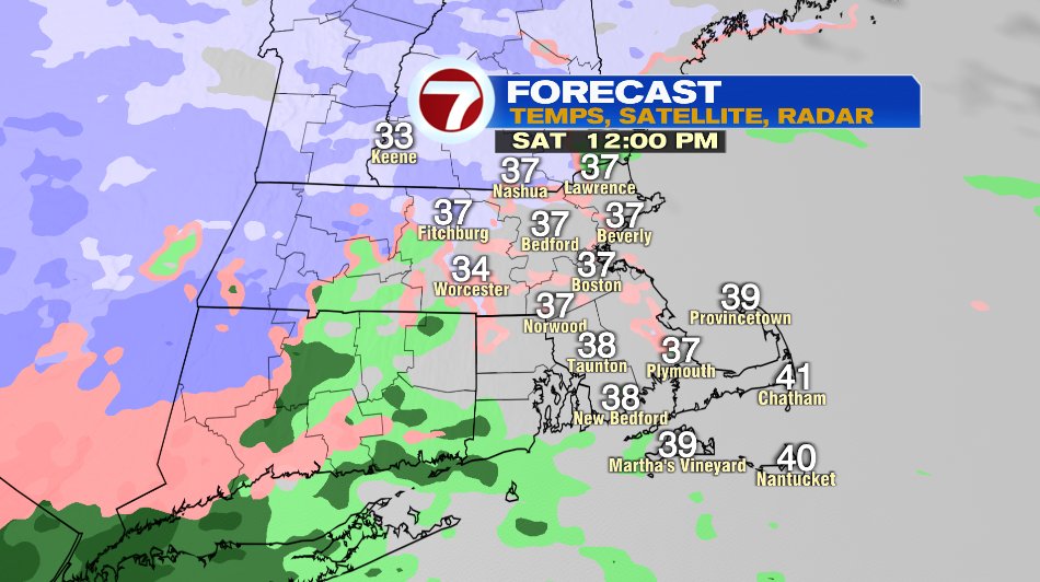
By mid to late afternoon the snow will really fill in and for most of us it will be snowing.
The storm will wrap in warmer air and push the rain/snow line northward. So a lot of us will see the snow transition to sleet, a rain/snow mix, or even just plain old rain.
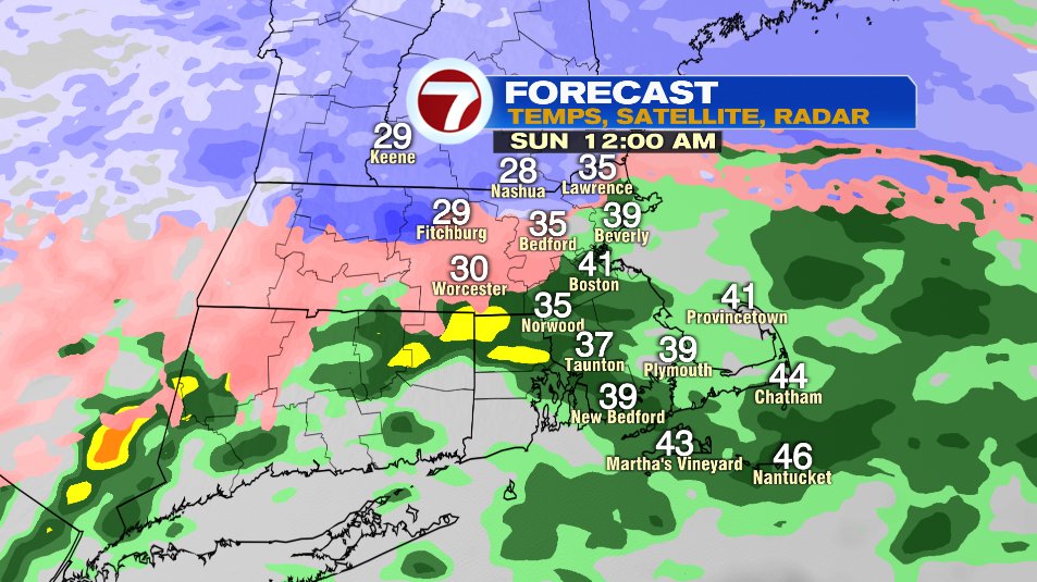
Snowfall amounts will have a sharp cut off as you go north and west of Boston. North of Route 2 will likely stay as snow the entire time so accumulations will be higher and it will taper off as you head south. Notice even areas that may see snow during that mid afternoon window don’t have anything for accumulation. It is very possible that the coastline north of Boston (Gloucester, Lynn, Salem, Marblehead, etc.) get a little coating of snow initially but as it switches back to rain will all get washed away.