
A Flash Flood Watch remains in effect until 11 PM tonight for Worcester County. Downpours could pop-up along a boundary this evening. This could lead to an additional 0.50″-1.00″ of rain.
Monday is not a washout, but there will still be a few showers around. There will be spotty, light showers for the morning commute with temperatures in the mid 60s. Cloudy skies are still around for lunch time, but it looks mainly dry. Skies clear up a bit late in the afternoon, and this energy from the sun could trigger a few downpours from 4-8 PM.


Tuesday looks mainly dry and mainly sunny! Tuesday morning is mild in the mid and upper 60s, and then highs reach into the mid and upper 80s in the afternoon. It will still be humid, but at least it’s mainly dry. If we see a thunderstorm, it will be late and northwest of I-495.


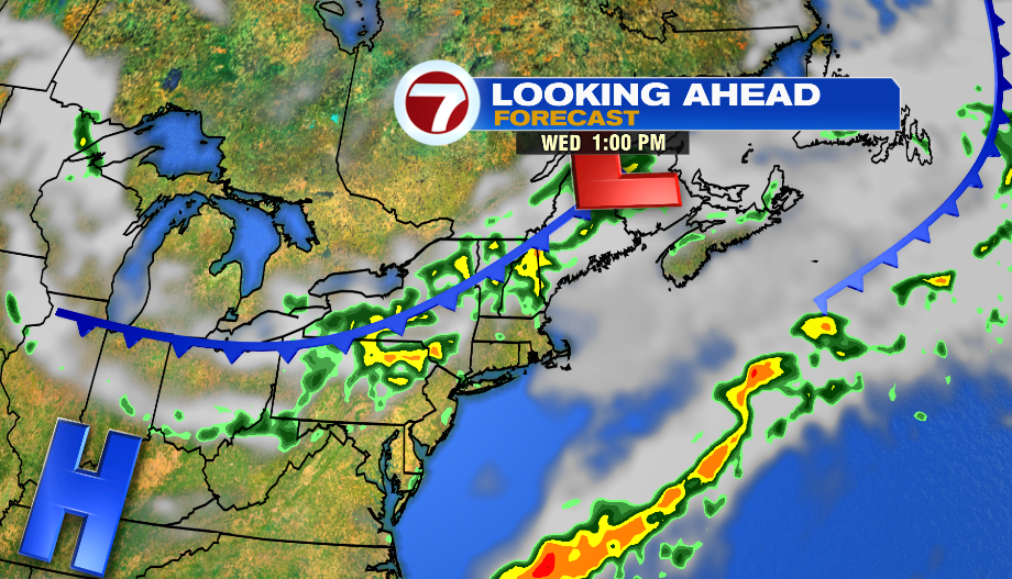
Here comes another low pressure system on Wednesday. This means we again see afternoon scattered thunderstorms. As of now, it looks like the best chance of strong to severe storms is along and south of the Pike. Some of these thunderstorms could drop 1-2″ of rain, leading to localized flooding.
Thursday is the pick of the week! Highs will be between 76-82º, and it will be less humid. The week ends with a chance of on and off rain again, but as of now, next weekend looks dry.